MyTopo
Plainfield Wisconsin US Topo Map
Couldn't load pickup availability
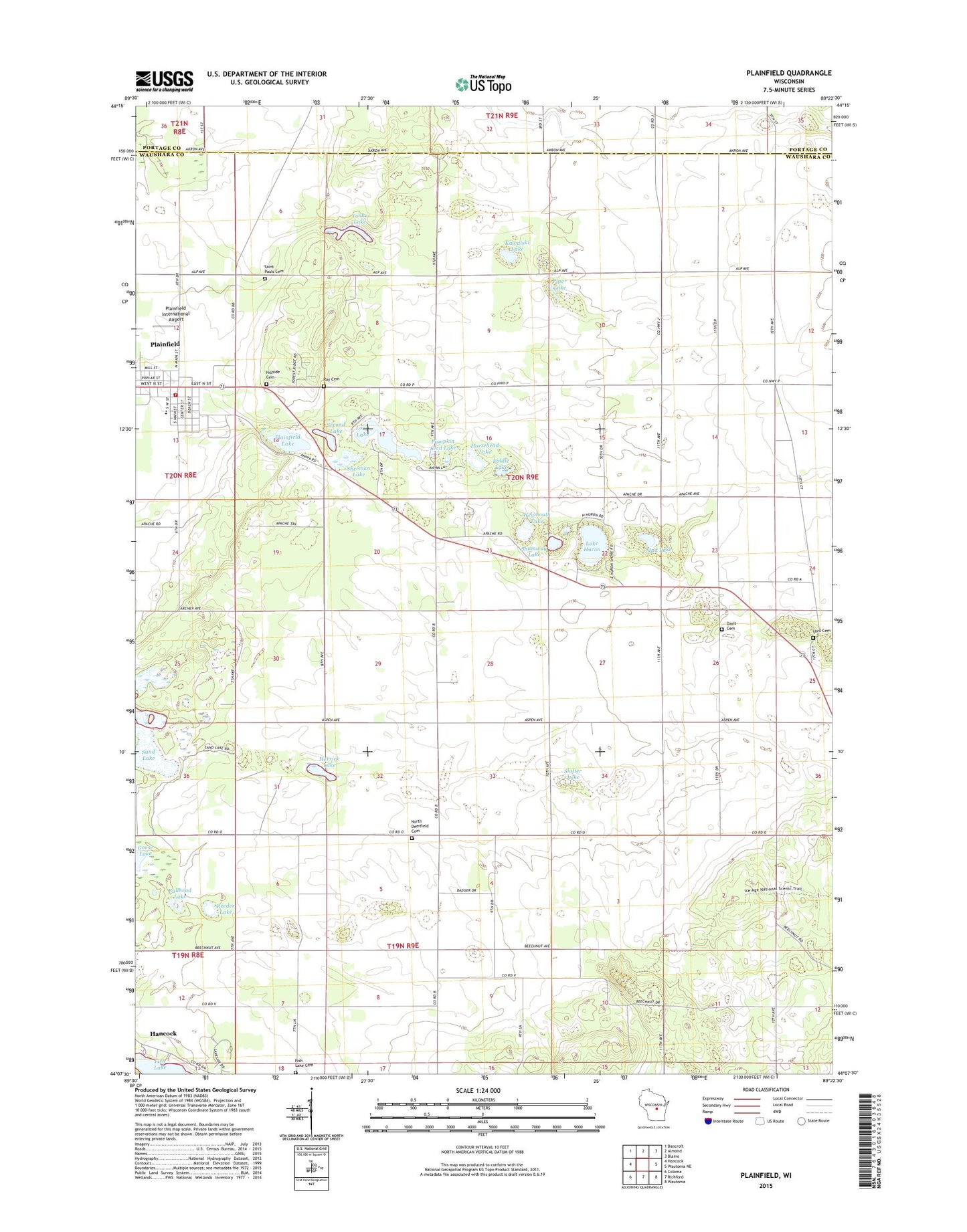
2022 topographic map quadrangle Plainfield in the state of Wisconsin. Scale: 1:24000. Based on the newly updated USGS 7.5' US Topo map series, this map is in the following counties: Waushara, Portage. The map contains contour data, water features, and other items you are used to seeing on USGS maps, but also has updated roads and other features. This is the next generation of topographic maps. Printed on high-quality waterproof paper with UV fade-resistant inks.
Quads adjacent to this one:
West: Hancock
Northwest: Bancroft
North: Almond
Northeast: Blaine
East: Wautoma NE
Southeast: Wautoma
South: Richford
Southwest: Coloma
This map covers the same area as the classic USGS quad with code o44089b4.
Contains the following named places: Bullhead Lake, Camp Chapel, Fiddle Lake, Fish Lake Cemetery, Hancock Park, Herrick Lake, Hillside Cemetery, Horsehead Lake, Kawalski Lake, Lake Huron, Long Lake, Lord Cemetery, Mud Lake, North Deerfield Cemetery, Oasis Cemetery, Piper Lake, Plainfield, Plainfield Baptist Church, Plainfield Fire Department, Plainfield International Airport, Plainfield Lake, Plainfield Police Department, Plainfield Post Office, Plainfield Tunnel Channel Lakes State Natural Area, Pumpkin Seed Lake, Ray Cemetery, Reeder Lake, Saint Pauls Catholic Church, Saint Pauls Cemetery, Sand Lake, Second Lake, Sherman Lake, Shumway Lake, Slafter Lake, Town of Oasis, Tri - County Elementary School, Tri - County High School, Tri - County Middle School, Village of Plainfield, Walters Lake, Weymouth Lake, Yonke Lake