MyTopo
Bradley Wisconsin US Topo Map
Couldn't load pickup availability
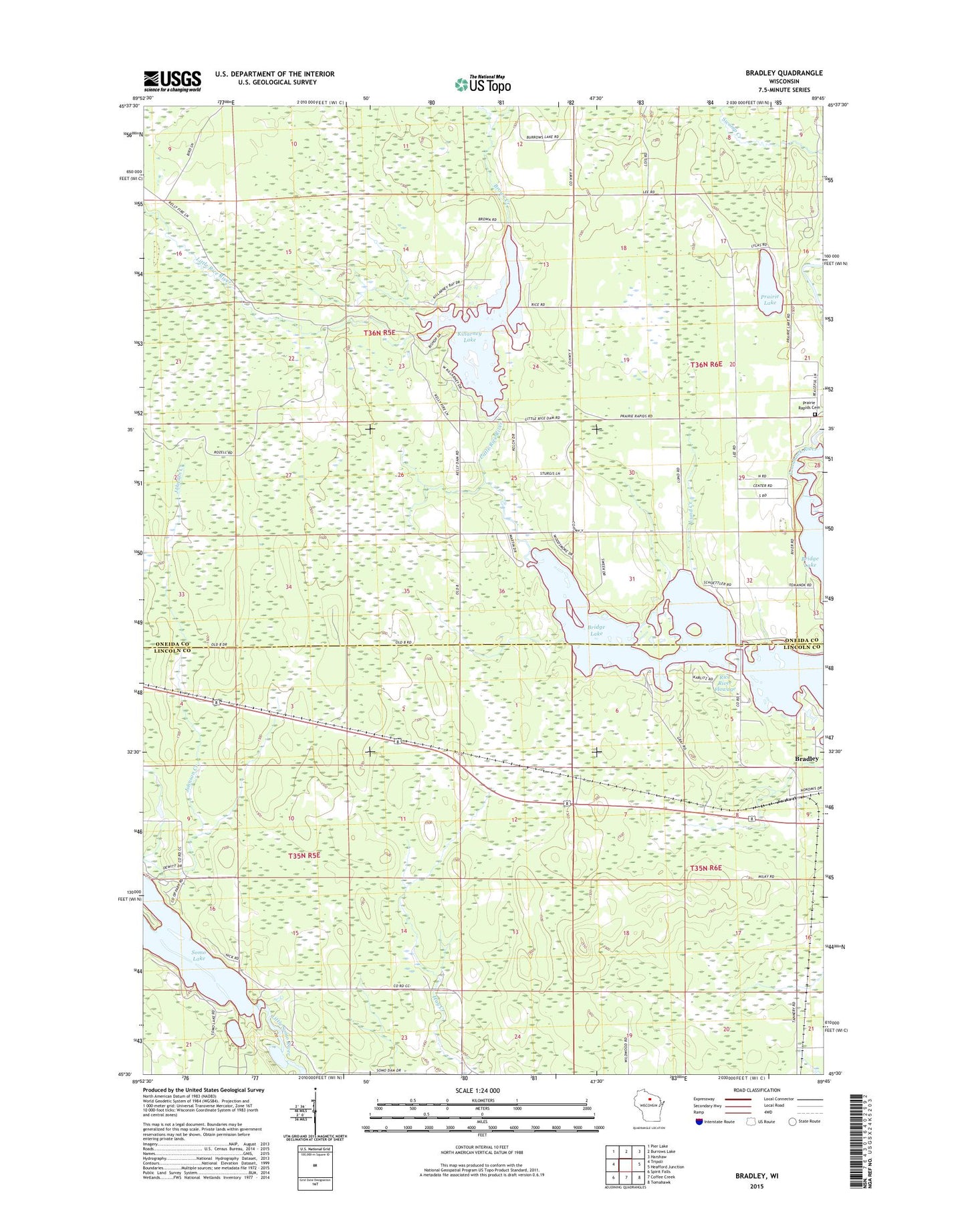
2022 topographic map quadrangle Bradley in the state of Wisconsin. Scale: 1:24000. Based on the newly updated USGS 7.5' US Topo map series, this map is in the following counties: Oneida, Lincoln. The map contains contour data, water features, and other items you are used to seeing on USGS maps, but also has updated roads and other features. This is the next generation of topographic maps. Printed on high-quality waterproof paper with UV fade-resistant inks.
Quads adjacent to this one:
West: Tripoli
Northwest: Pier Lake
North: Burrows Lake
Northeast: Harshaw
East: Heafford Junction
Southeast: Tomahawk
South: Coffee Creek
Southwest: Spirit Falls
This map covers the same area as the classic USGS quad with code o45089e7.
Contains the following named places: Bradley, Brown Creek, Clukey Creek, Hay Creek School, Kelly School, Killarney Lake, Killarney Lake 32, Little Rice River, Little Rice River 2WP1331 Dam, Little Rice Townhall, Lund Creek, Lund School, Prairie Lake, Prairie Lake School, Prairie Rapids Cemetery, Prairie Rapids Church, Rice River Flowage, Somo Lake, Town of Wilson, Wilson Townhall, ZIP Code: 54487