MyTopo
Heafford Junction Wisconsin US Topo Map
Couldn't load pickup availability
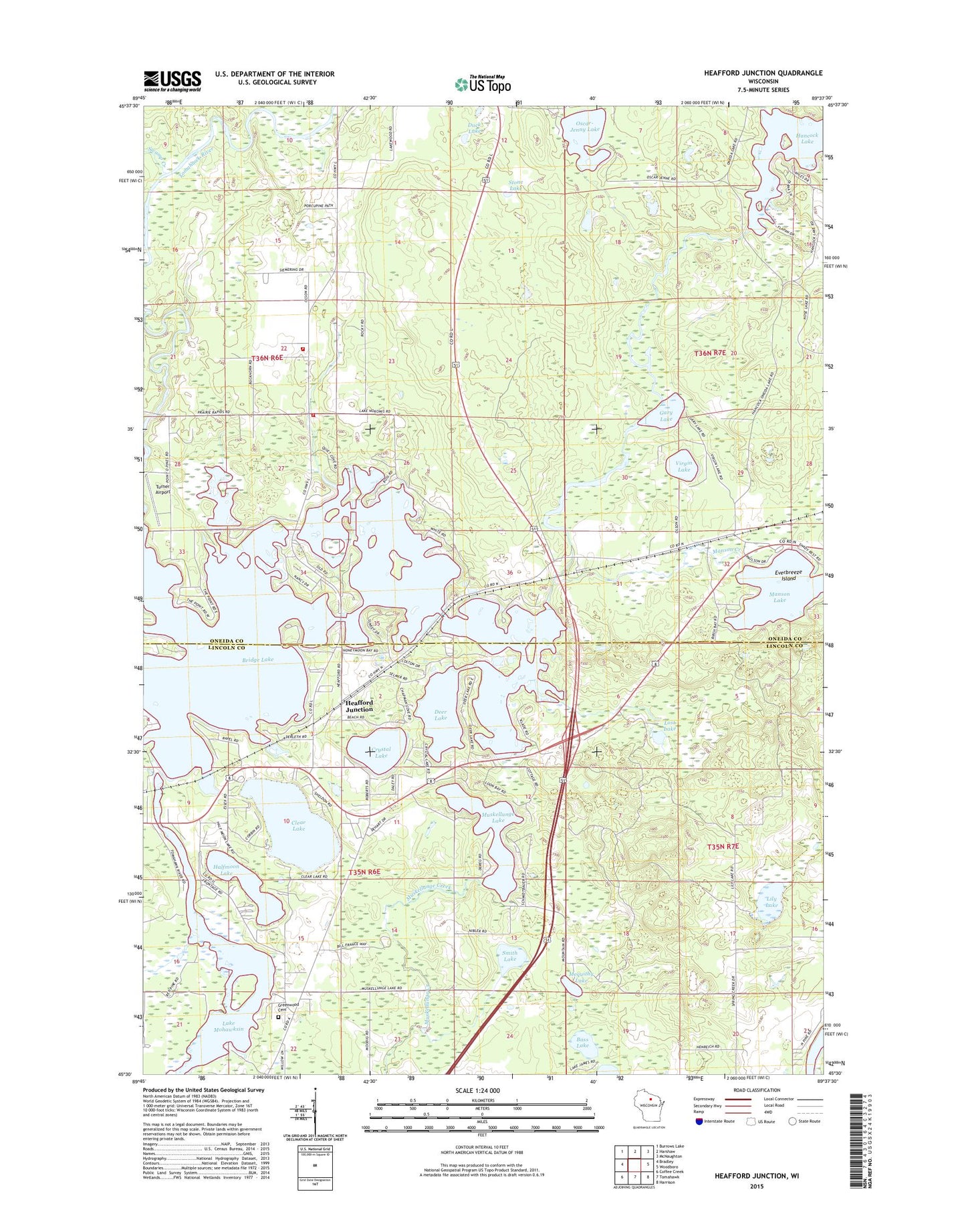
2022 topographic map quadrangle Heafford Junction in the state of Wisconsin. Scale: 1:24000. Based on the newly updated USGS 7.5' US Topo map series, this map is in the following counties: Oneida, Lincoln. The map contains contour data, water features, and other items you are used to seeing on USGS maps, but also has updated roads and other features. This is the next generation of topographic maps. Printed on high-quality waterproof paper with UV fade-resistant inks.
Quads adjacent to this one:
West: Bradley
Northwest: Burrows Lake
North: Harshaw
Northeast: McNaughton
East: Woodboro
Southeast: Harrison
South: Tomahawk
Southwest: Coffee Creek
This map covers the same area as the classic USGS quad with code o45089e6.
Contains the following named places: Bass Lake, Bridge Lake, Clear Lake, Crystal Lake, Deer Lake, Deer Trail, Duck Lake, Everbreeze Island, Gary Lake, Greenwood Cemetery, Halfmoon Lake, Hancock Lake, Hancock Lake 22, Hancock Lake Dam, Heafford Junction, Hiawatha School, Inshalla Country Club, Jersey City Flowage, Lake Nokomis, Lily Lake, Lily Lake School, Lost Lake, Manson, Manson Creek, Manson Lake, Mequithy Lake, Muskellunge Lake, Nokomis School, Nokomis Townhall, Nokomis Volunteer Fire Department, Nokomis Volunteer Fire Department Station 2, Oscar-Jenny Lake, Pinewood School, Rice 1907C335 Dam, Rice Creek, Smith Lake, Stone Lake, Swamp Creek, Town of Nokomis, Turner Airport, Virgin Lake