MyTopo
Breed Wisconsin US Topo Map
Couldn't load pickup availability
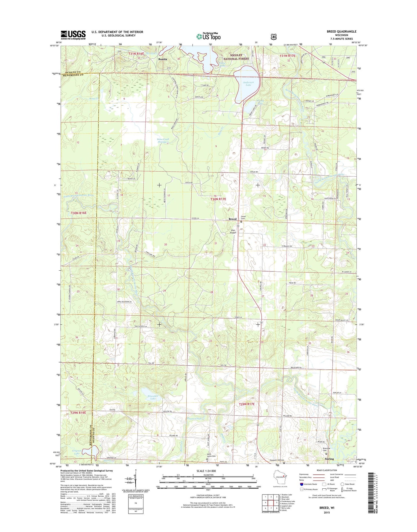
2018 topographic map quadrangle Breed in the state of Wisconsin. Scale: 1:24000. Based on the newly updated USGS 7.5' US Topo map series, this map is in the following counties: Oconto, Menominee. The map contains contour data, water features, and other items you are used to seeing on USGS maps, but also has updated roads and other features. This is the next generation of topographic maps. Printed on high-quality waterproof paper with UV fade-resistant inks.
Quads adjacent to this one:
West: Fredenberg Lake
Northwest: Shadow Lake
North: Mountain
Northeast: Shay Lake
East: Hickory Corners
Southeast: Gillett
South: Berry Lake
Southwest: Legend Lake
Contains the following named places: Anderson Lake, Bonita, Bonita Creek, Breed, Breed School, Grignon Lake, Hayes Creek, Logan, Moody Lake, North Branch Oconto River, Pecore Creek, Peshtigo Brook, Piso Airport, Riverside Cemetery, Saint John Lutheran Church and School, Saint Johns Cemetery, Saint Johns Lutheran Church, South Branch Oconto River, South Branch Oconto River State Wildlife Area, Suring Elementary School, Suring High School, Town Line School, Town of Breed, U-Nah-Li-Ya Camp, Union Cemetery, Weso Creek, Weso Creek 2WP1431 Dam, Weso Creek Flowage 5, Wiscobee Lake, ZIP Code: 54174