MyTopo
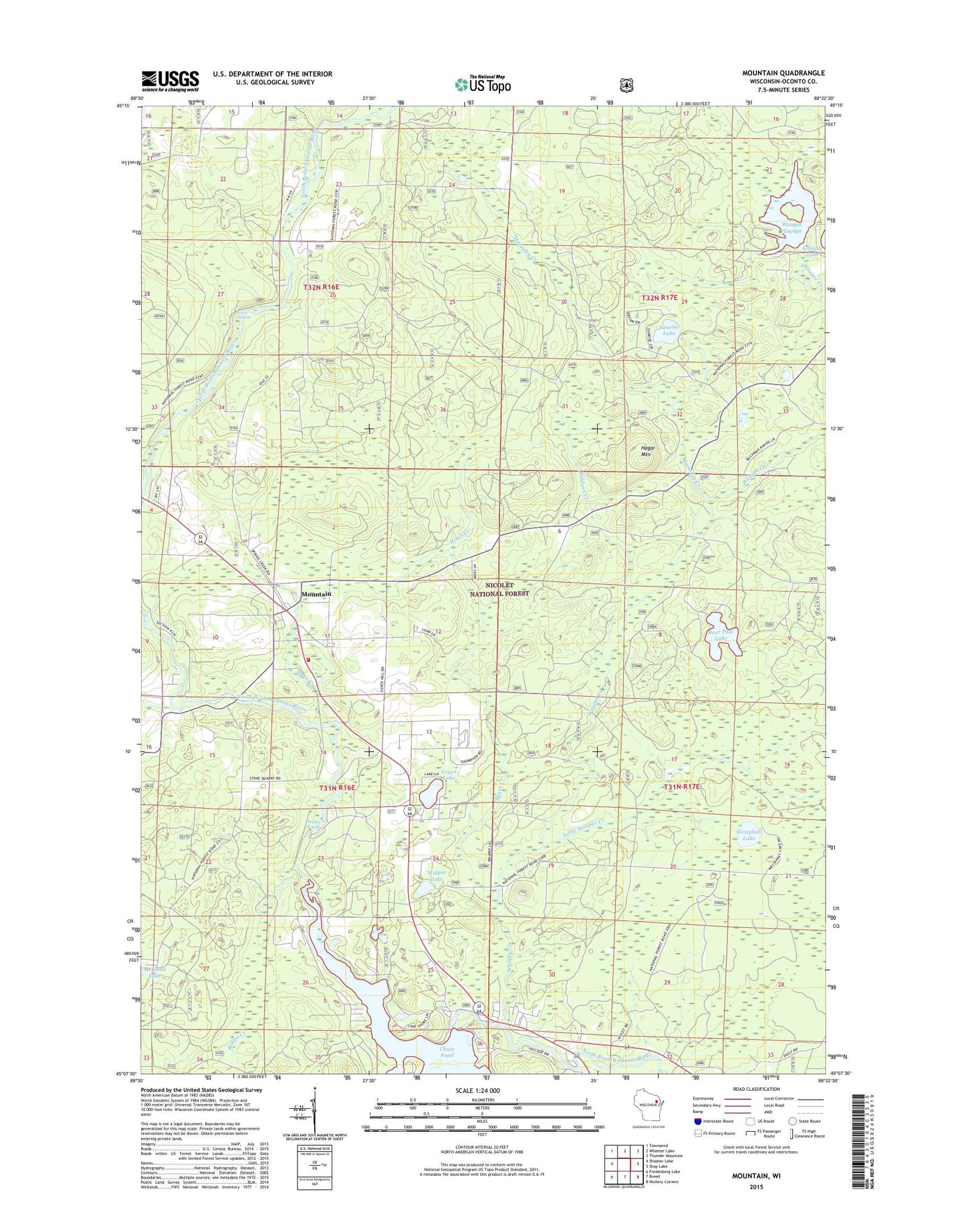
Mountain Wisconsin US Topo Map
Couldn't load pickup availability
Also explore the Mountain Forest Service Topo of this same quad for updated USFS data
2022 topographic map quadrangle Mountain in the state of Wisconsin. Scale: 1:24000. Based on the newly updated USGS 7.5' US Topo map series, this map is in the following counties: Oconto. The map contains contour data, water features, and other items you are used to seeing on USGS maps, but also has updated roads and other features. This is the next generation of topographic maps. Printed on high-quality waterproof paper with UV fade-resistant inks.
Quads adjacent to this one:
West: Shadow Lake
Northwest: Townsend
North: Wheeler Lake
Northeast: Thunder Mountain
East: Shay Lake
Southeast: Hickory Corners
South: Breed
Southwest: Fredenberg Lake
This map covers the same area as the classic USGS quad with code o45088b4.
Contains the following named places: Bagley Rapids, Bagley Rapids Campground, Baldwin Creek, Bear Paw Camp, Bear Paw Lake, Bowman Airport, Chute 1865c371 Dam, Chute Pond, Green Lake, Green Lake Picnic Area, Grindle Dam, Hagar Mountain, Hagar Mountain State Natural Area, Hines Creek, Little Waupee Creek, Loon Rapids, Macauley Creek, Midget Lake, Mountain, Mountain Ambulance Service, Mountain Census Designated Place, Mountain Fire Department, Mountain Lookout Tower, Mountain Post Office, Oconton County Park Campground, Riverview Townhall, Saint Michael Chapel, Sunrise Lake, Town Creek, Town of Mountain, Town of Riverview, Waupee Creek, Waupee Flowage, Waupee Flowage 8, Westphall Lake, ZIP Code: 54149