MyTopo
Legend Lake Wisconsin US Topo Map
Couldn't load pickup availability
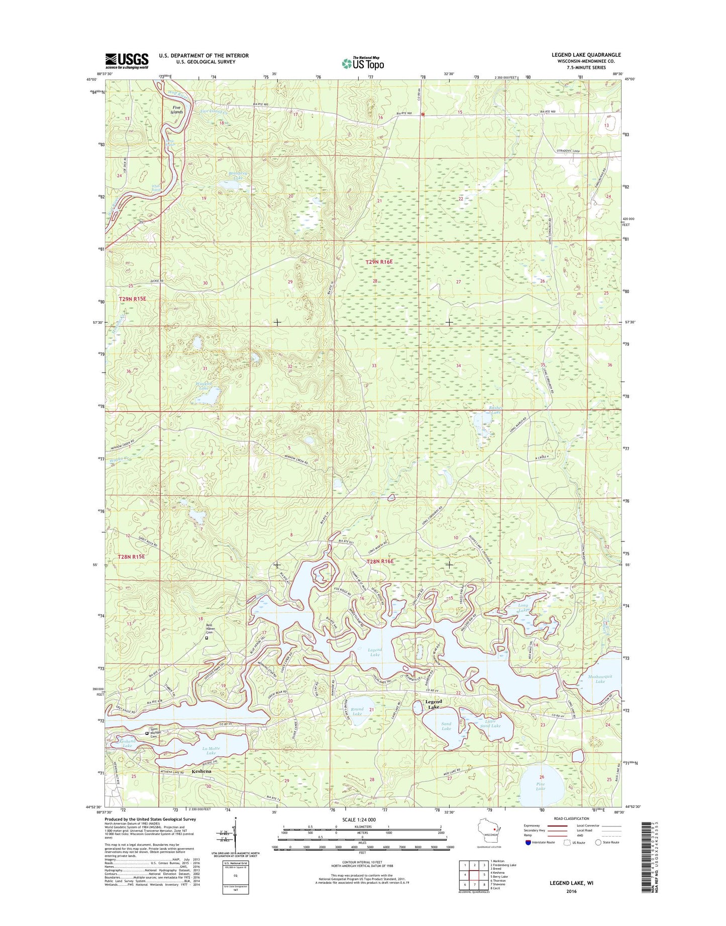
2022 topographic map quadrangle Legend Lake in the state of Wisconsin. Scale: 1:24000. Based on the newly updated USGS 7.5' US Topo map series, this map is in the following counties: Menominee. The map contains contour data, water features, and other items you are used to seeing on USGS maps, but also has updated roads and other features. This is the next generation of topographic maps. Printed on high-quality waterproof paper with UV fade-resistant inks.
Quads adjacent to this one:
West: Keshena
Northwest: Markton
North: Fredenberg Lake
Northeast: Breed
East: Berry Lake
Southeast: Cecil
South: Shawano
Southwest: Thornton
This map covers the same area as the classic USGS quad with code o44088h5.
Contains the following named places: Beauprey Lake, Blacksmith Lake, Elm Creek, Five Island Creek, Five Islands, Keshena Lake, La Motte Lake, Legend Lake, Legend Lake Census Designated Place, Legend Lake Number Three 3 WR 543 Dam, Little Blacksmith Lake, Little Sand Lake, Long Lake, Moshawquit Lake, Pestiga Lake, Pine Lake, Pywaosit Lake, Rest Haven Cemetery, Round Lake, Rushes Lake, Saint Michael Cemetery, Sand Lake, Sand Lake Lookout Tower, Sapokesick Lake, Skice Lake, South Branch Fire Department, Spring Lake, Turtle Rapids, Waukau Lake, White Rapids, ZIP Code: 54135