MyTopo
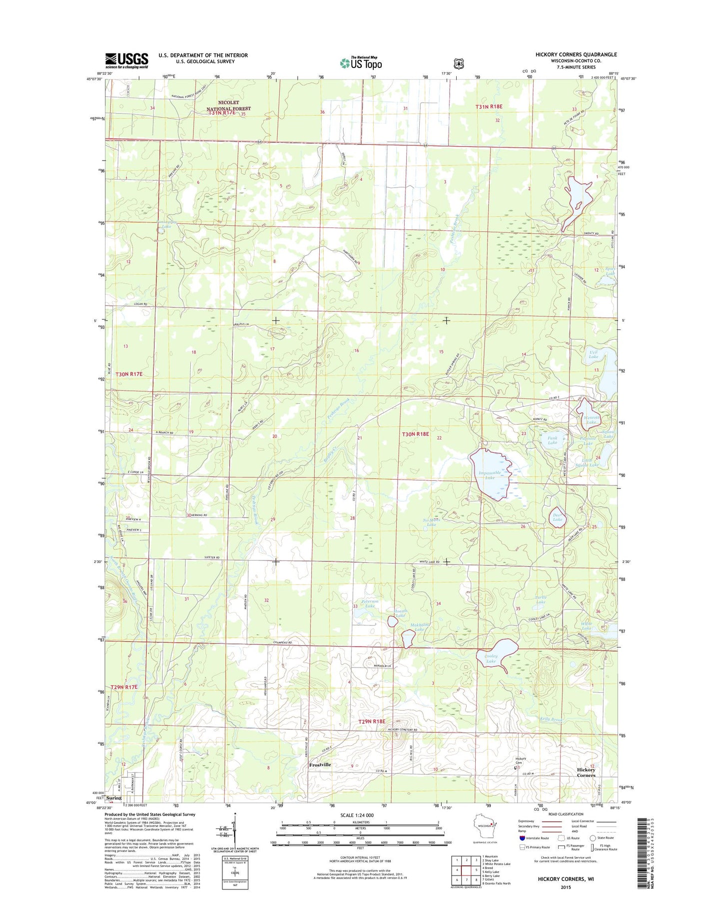
Hickory Corners Wisconsin US Topo Map
Couldn't load pickup availability
Also explore the Hickory Corners Forest Service Topo of this same quad for updated USFS data
2023 topographic map quadrangle Hickory Corners in the state of Wisconsin. Scale: 1:24000. Based on the newly updated USGS 7.5' US Topo map series, this map is in the following counties: Oconto. The map contains contour data, water features, and other items you are used to seeing on USGS maps, but also has updated roads and other features. This is the next generation of topographic maps. Printed on high-quality waterproof paper with UV fade-resistant inks.
Quads adjacent to this one:
West: Breed
Northwest: Mountain
North: Shay Lake
Northeast: White Potato Lake
East: Kelly Lake
Southeast: Oconto Falls North
South: Gillett
Southwest: Berry Lake
This map covers the same area as the classic USGS quad with code o45088a3.
Contains the following named places: Bagley Creek, Bagley Lookout Tower, Community Church, Cooley Lake, Deer Lake, Frostville, Funk Lake, Hickory Cemetery, Hickory Corners, Hoerth Lake, Impassable Lake, Little Squaw Lake, Makholm Lake, No Mans Lake, Our Redeemers Church, Papoose Lake, Peshtigo Brook School, Peshtigo Brook State Wildlife Area, Peterson Lake, Ponsegrau Lake, Spies Lake, Suring Volunteer Fire Department, Town of Bagley, Turtle Lake, Ucil Lake, Village of Suring, Wescott Lake