MyTopo
Fireside Lakes Wisconsin US Topo Map
Couldn't load pickup availability
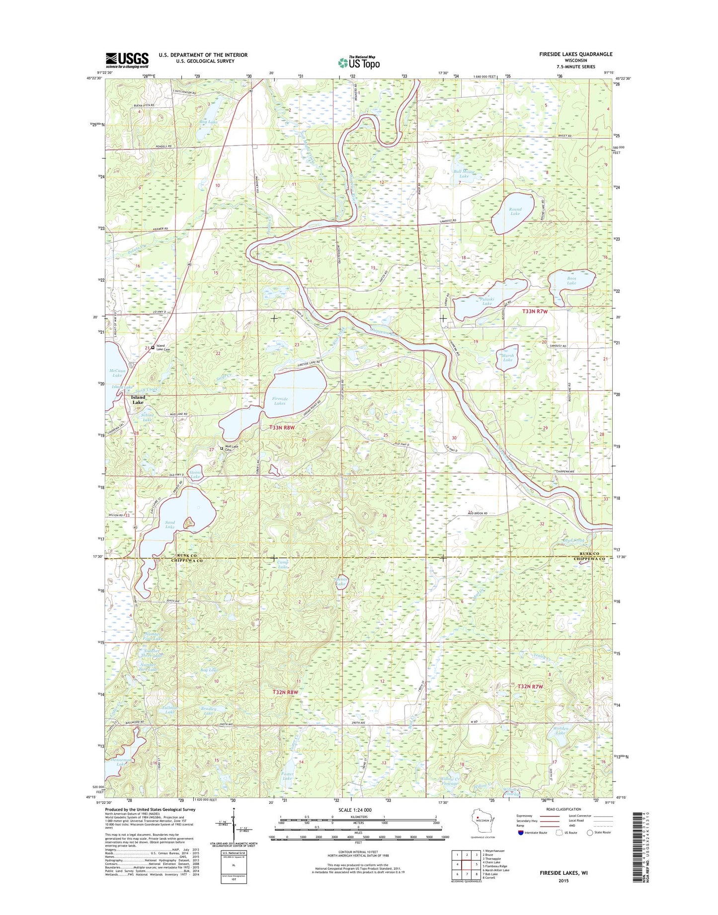
2022 topographic map quadrangle Fireside Lakes in the state of Wisconsin. Scale: 1:24000. Based on the newly updated USGS 7.5' US Topo map series, this map is in the following counties: Rusk, Chippewa. The map contains contour data, water features, and other items you are used to seeing on USGS maps, but also has updated roads and other features. This is the next generation of topographic maps. Printed on high-quality waterproof paper with UV fade-resistant inks.
Quads adjacent to this one:
West: Chain Lake
Northwest: Weyerhaeuser
North: Bruce
Northeast: Thornapple
East: Flambeau Ridge
Southeast: Cornell
South: Bob Lake
Southwest: Marsh-Miller Lake
This map covers the same area as the classic USGS quad with code o45091c3.
Contains the following named places: Big Bend Townhall, Bog Lake, Boot Lake, Bradley Lake, Bull Moose Lake, Camp Lake, Cedar Lake, Fireside Lakes, Foster Creek, Foster Lake, Goose Lake, Hatch Landing, Henneman Lake, High Bank Church, High Bank School, Island Lake, Island Lake Cemetery, Island Lake Church, Island Lake WP363 Dam, Marsh Lake, Mud Creek, Mud Lake Cemetery, North Washington School, Number Four Lake, Number One Lake, Number Three Lake, Number Two Lake, Potato Creek, Pulaski Lake, Rice Creek, Round Lake, Sand Lake, School Lake, Soft Maple Creek, Soft Maple School, Spence Lake, Sunfish Lake, Swift Creek, Tallman Lake, Taylorport Airport, Tealey Creek, Town of Big Bend, Willow Creek, Willow Creek Flowage Number 1 E12.52 Dam, Willow Creek Flowage Number 2 E12.52 Dam, Willow Creek Flowage Number One, Willow Creek Flowage Number Two, Worden Lake