
MyTopo
Brule Wisconsin US Topo Map
Couldn't load pickup availability
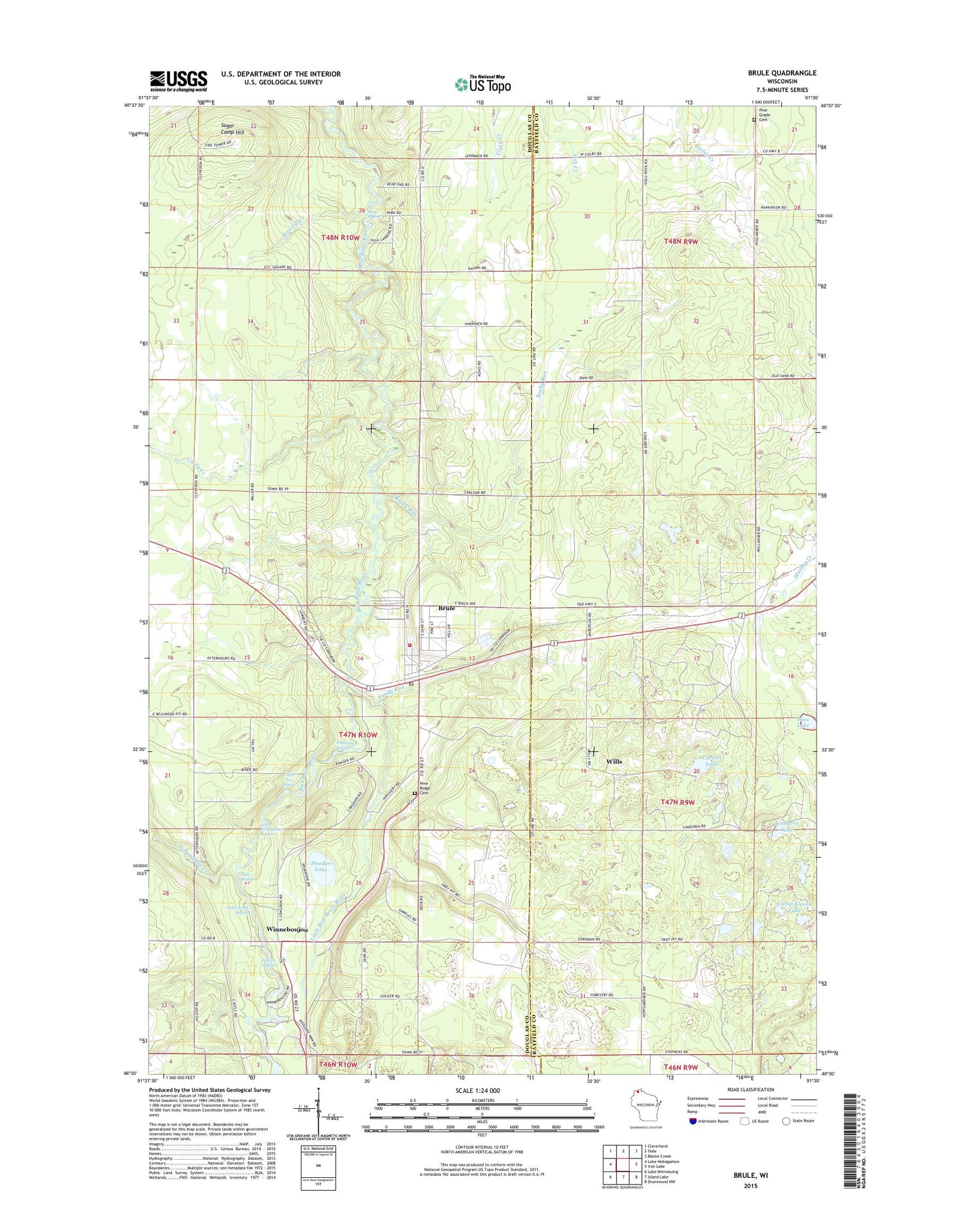
2018 topographic map quadrangle Brule in the state of Wisconsin. Scale: 1:24000. Based on the newly updated USGS 7.5' US Topo map series, this map is in the following counties: Douglas, Bayfield. The map contains contour data, water features, and other items you are used to seeing on USGS maps, but also has updated roads and other features. This is the next generation of topographic maps. Printed on high-quality waterproof paper with UV fade-resistant inks.
Quads adjacent to this one:
West: Lake Nebagamon
Northwest: Cloverland
North: Oulu
Northeast: Blaine Creek
East: Iron Lake
Southeast: Drummond NW
South: Island Lake
Southwest: Lake Minnesuing
Contains the following named places: Bass Lake, Brule, Brule Census Designated Place, Brule Post Office, Brule Volunteer Fire Department, Camp Eleven Lake, Carroll Lake, Casey Creek, Co-op Park Rapids, Copper Range Campground, Doodlebug Rapids, Hall Rapids, Hoodoo Lake, Lindgren Lake, Little Bois Brule River, Little Joe Rapids, Long Nebagamon Rapids, Nebagamon Creek, Oulu Townhall, Percival Creek, Pine Glade Cemetery, Pine Ridge Cemetery, Pine Tree Landing, Rocky Run, Sandy Run, Station Rapids, Sugar Camp Hill, Town of Brule, Williamson Rapids, Wills, Winneboujou, Wisconsin State Fish Hatchery, ZIP Code: 54820


