MyTopo
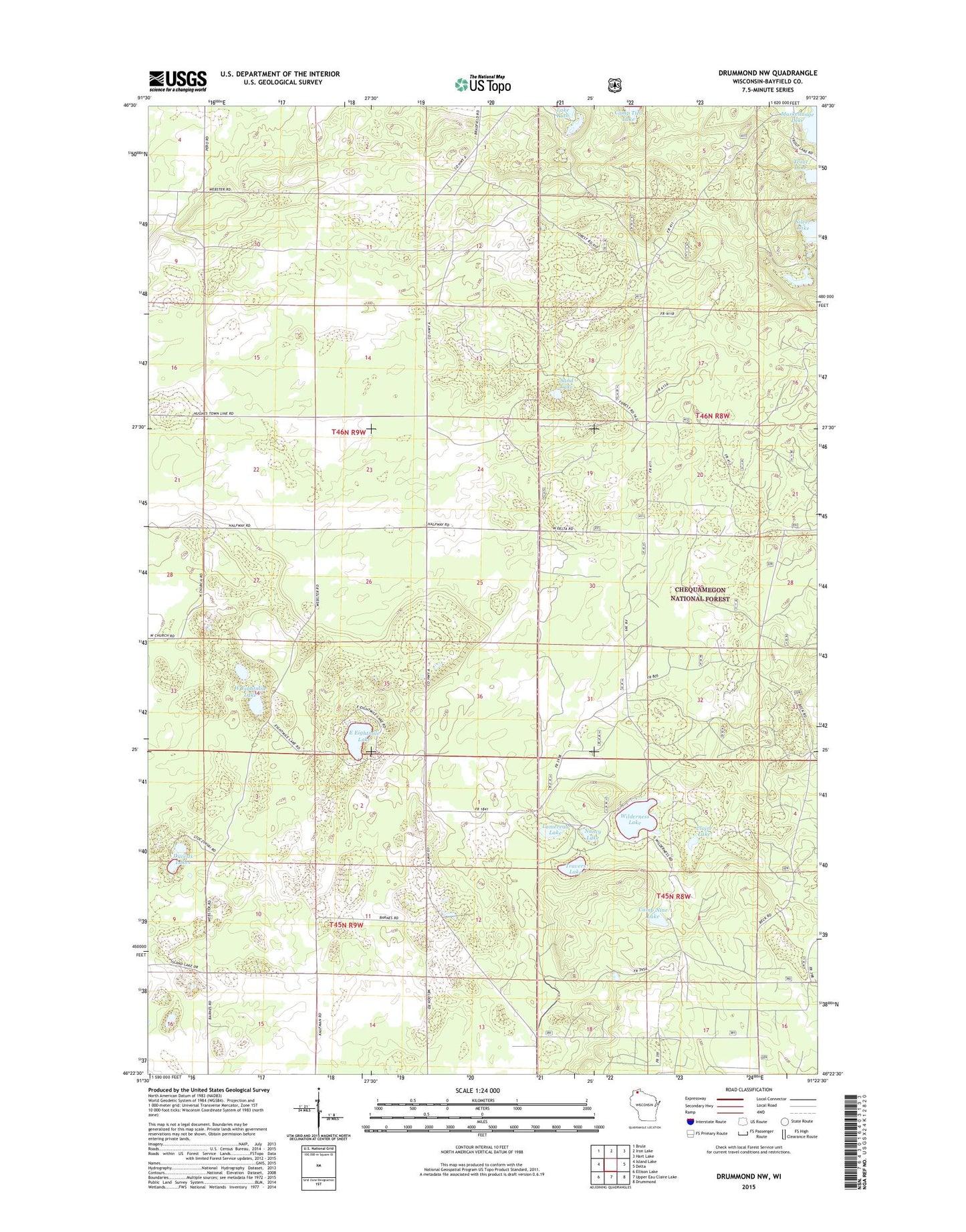
Drummond NW Wisconsin US Topo Map
Couldn't load pickup availability
Also explore the Drummond NW Forest Service Topo of this same quad for updated USFS data
2022 topographic map quadrangle Drummond NW in the state of Wisconsin. Scale: 1:24000. Based on the newly updated USGS 7.5' US Topo map series, this map is in the following counties: Bayfield. The map contains contour data, water features, and other items you are used to seeing on USGS maps, but also has updated roads and other features. This is the next generation of topographic maps. Printed on high-quality waterproof paper with UV fade-resistant inks.
Quads adjacent to this one:
West: Island Lake
Northwest: Brule
North: Iron Lake
Northeast: Hart Lake
East: Delta
Southeast: Drummond
South: Upper Eau Claire Lake
Southwest: Ellison Lake
This map covers the same area as the classic USGS quad with code o46091d4.
Contains the following named places: Camp Nine Lake, Claire Lake, Ducetts Lakes, East Eightmile Lake, Lamereau Lake, Nancy Lake, Sand Lake, Silver Lake, Travers Lake, Trout Lake, West Eightmile Lake, Wilderness Lake