MyTopo
Island Lake Wisconsin US Topo Map
Couldn't load pickup availability
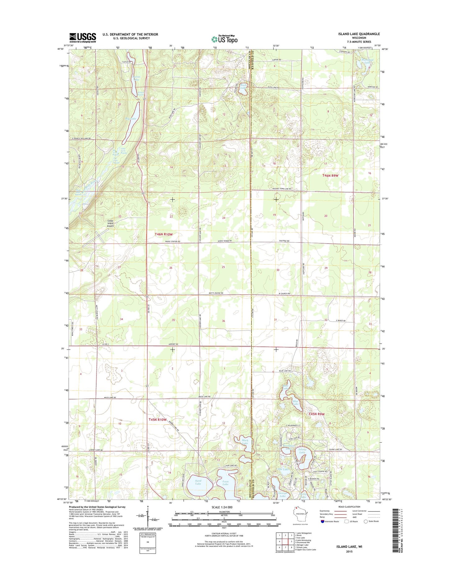
2022 topographic map quadrangle Island Lake in the state of Wisconsin. Scale: 1:24000. Based on the newly updated USGS 7.5' US Topo map series, this map is in the following counties: Douglas, Bayfield. The map contains contour data, water features, and other items you are used to seeing on USGS maps, but also has updated roads and other features. This is the next generation of topographic maps. Printed on high-quality waterproof paper with UV fade-resistant inks.
Quads adjacent to this one:
West: Lake Minnesuing
Northwest: Lake Nebagamon
North: Brule
Northeast: Iron Lake
East: Drummond NW
Southeast: Upper Eau Claire Lake
South: Ellison Lake
Southwest: Metzger Lake
This map covers the same area as the classic USGS quad with code o46091d5.
Contains the following named places: Bass Lake, Big Lake, Big Twin Rapids, Blue Lake, Breakfast Lake, Brule Lookout Tower, Brule Rush Lake State Natural Area, Cedar Island Airport, Cedar Island Estate, Cedar Island Ponds, George Lake, Hay Lake, Island Lake, Little Twin Rapids, Loon Lake, Lucius Lake, Mays Rips Rapids, Moreland Lake, Muck Lake, Ole Lake, Rush Lake, Sand Lake, Sucker Lake, The Falls Rapids, Town of Highland, Turtle Lake, WHSA-FM (Brule), Wildcat Rapids