MyTopo
Cleveland East Wisconsin US Topo Map
Couldn't load pickup availability
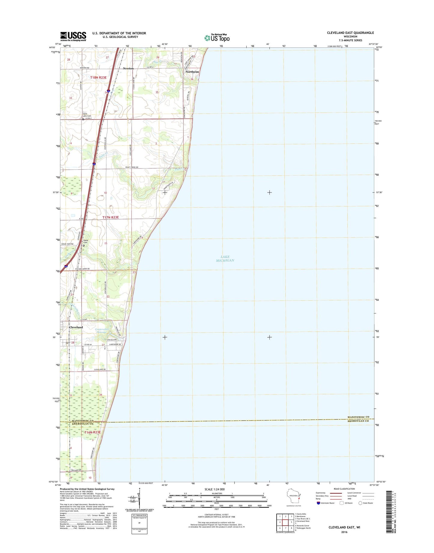
2022 topographic map quadrangle Cleveland East in the state of Wisconsin. Scale: 1:24000. Based on the newly updated USGS 7.5' US Topo map series, this map is in the following counties: Manitowoc, Sheboygan. The map contains contour data, water features, and other items you are used to seeing on USGS maps, but also has updated roads and other features. This is the next generation of topographic maps. Printed on high-quality waterproof paper with UV fade-resistant inks.
Quads adjacent to this one:
West: Cleveland West
Northwest: Clarks Mills
North: Manitowoc
Northeast: Two Rivers OE S
South: Sheboygan North
Southwest: Howards Grove
This map covers the same area as the classic USGS quad with code o43087h6.
Contains the following named places: Birchlawn Dairy, Centerville Creek, Centerville Dam, Centerville Flowage 10, Cleveland, Cleveland Elementary School, Cleveland Heights Mobile Home Park, Cleveland Post Office, Cleveland Wastewater Treatment Plant, Fischer Creek, Flowing Acres, Kassa Cemetery, Maple Leaf Dairy, Newton, Northeast Wisconsin Montessori School, Northeim, Pine Creek, Point Creek, Point River School, Saint John's Ebenezer Reformed Cemetery - East, Saint John's Ebenezer Reformed Cemetery - West, Shoreline Acres, Trackside Stock Farm, Village of Cleveland, White Trail School