MyTopo
Cleveland West Wisconsin US Topo Map
Couldn't load pickup availability
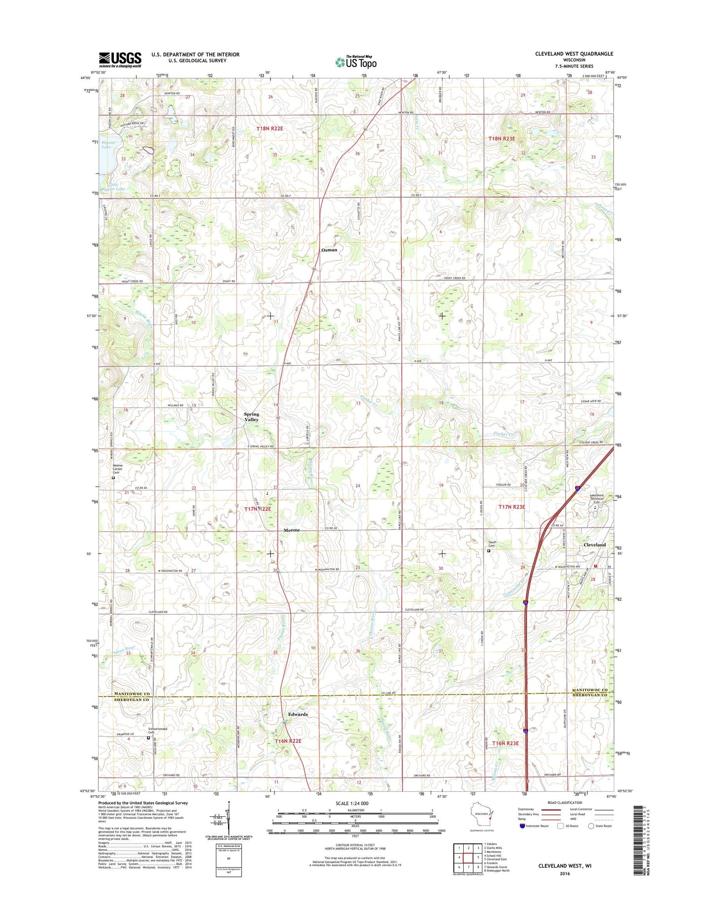
2022 topographic map quadrangle Cleveland West in the state of Wisconsin. Scale: 1:24000. Based on the newly updated USGS 7.5' US Topo map series, this map is in the following counties: Manitowoc, Sheboygan. The map contains contour data, water features, and other items you are used to seeing on USGS maps, but also has updated roads and other features. This is the next generation of topographic maps. Printed on high-quality waterproof paper with UV fade-resistant inks.
Quads adjacent to this one:
West: School Hill
Northwest: Valders
North: Clarks Mills
Northeast: Manitowoc
East: Cleveland East
Southeast: Sheboygan North
South: Howards Grove
Southwest: Franklin
This map covers the same area as the classic USGS quad with code o43087h7.
Contains the following named places: Bonde Acres, Brunmeier Dairy Farm, Circle B Bison Ranch, Cleveland Police Department, Cleveland Volunteer Fire Department, Driscoll Farms, Edwards, Fitz Pine Dairy Farm, Green Bay Road School, Grotegut Dairy Farm, Harvest Moon Dairy, Hidden Creek Farm, Jaeger Farms, La Follette School, Lakeshore Technical College, Liberty Bell School, Libertyland Farms, Lindeman Lake, Long View Dairy Farm, M V Farm, Meeme, Meeme Center Cemetery, Meeme Leads Charter School, Meeme River, Mineral Springs School, Mueller Range Line Dairy, North Creek Dairy Farm, Orth Farms, Osman, Pigeon Lake, Pleasant Hill School, Rof Lor Dairy Farm, Saint Johns Church, Saint Joseph's Catholic Cemetery, Saxon Cemetery, Saxon Homestead Farm, Schwartzwald School, Siemers Holstein Farms, Soaring Eagle Dairy, Spring Valley, Sunny Side Dairy Farm, Taylor School, Town of Centerville, Town of Meeme, Windemere Farm, WKTT-FM (Cleveland), Ziegler Dairy Farms, ZIP Codes: 53015, 53063