
MyTopo
Colfax South Wisconsin US Topo Map
Couldn't load pickup availability
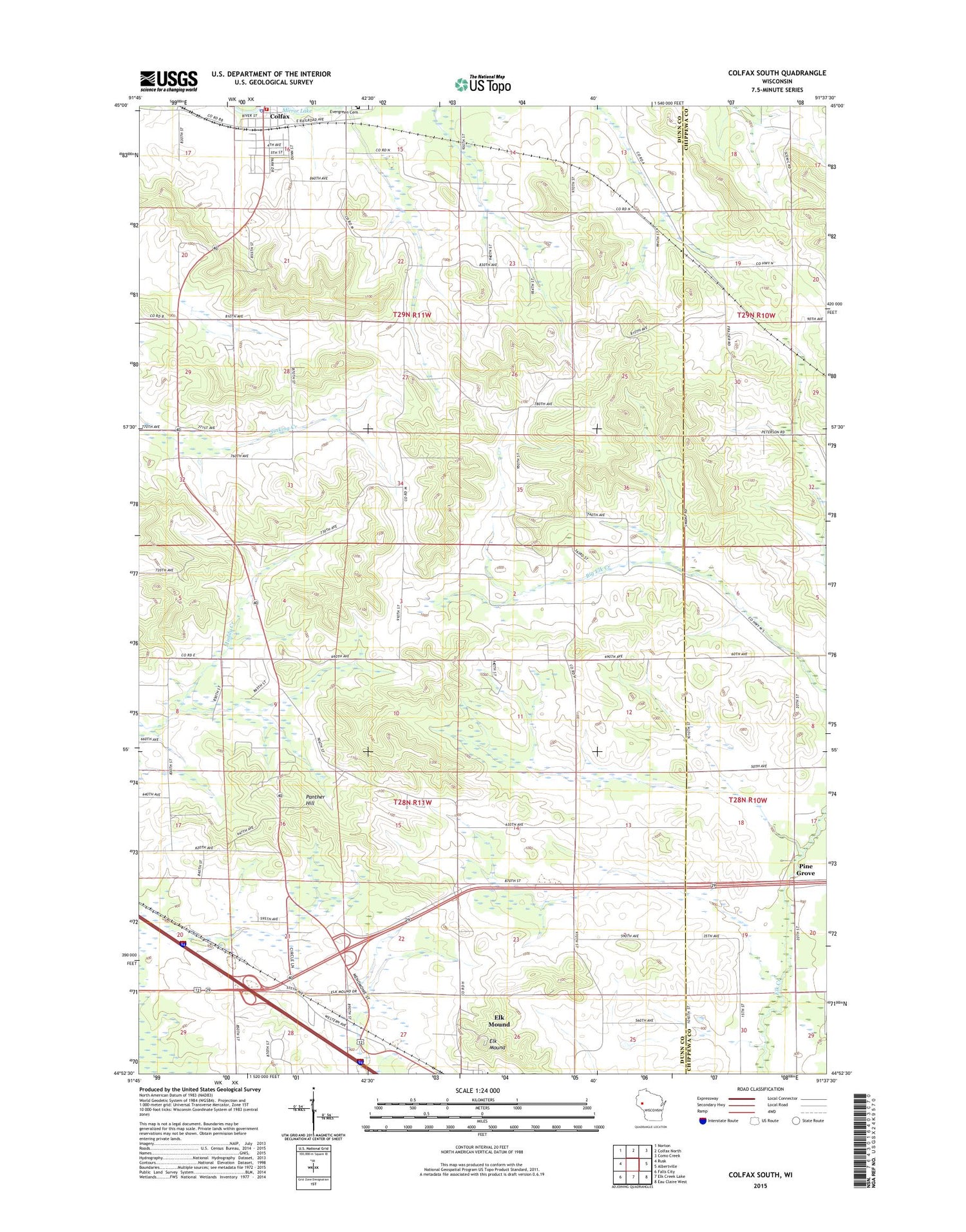
2018 topographic map quadrangle Colfax South in the state of Wisconsin. Scale: 1:24000. Based on the newly updated USGS 7.5' US Topo map series, this map is in the following counties: Dunn, Chippewa. The map contains contour data, water features, and other items you are used to seeing on USGS maps, but also has updated roads and other features. This is the next generation of topographic maps. Printed on high-quality waterproof paper with UV fade-resistant inks.
Quads adjacent to this one:
West: Rusk
Northwest: Norton
North: Colfax North
Northeast: Como Creek
East: Albertville
Southeast: Eau Claire West
South: Elk Creek Lake
Southwest: Falls City
Contains the following named places: Barum Church, Bear Valley School, Big Elk Creek Church, Colfax, Colfax 2WP1143 Dam, Colfax Community Fire Department, Colfax Police Department, Colfax Post Office, Colfax Rescue Squad, Elk Mound, Elk Mound Middle School, Elk Mound Scenic County Park, Frazier School, Hillside School, Oak Hill School, Oak Knoll School, Panther Hill, Pine Grove, Pleasant Valley School, Sinking Creek School, The Yankee Woods, Town of Colfax, Town of Elk Mound, Village of Colfax, WEUX-TV (Chippewa Falls), WQOW-TV (Eau Claire)


