MyTopo
Falls City Wisconsin US Topo Map
Couldn't load pickup availability
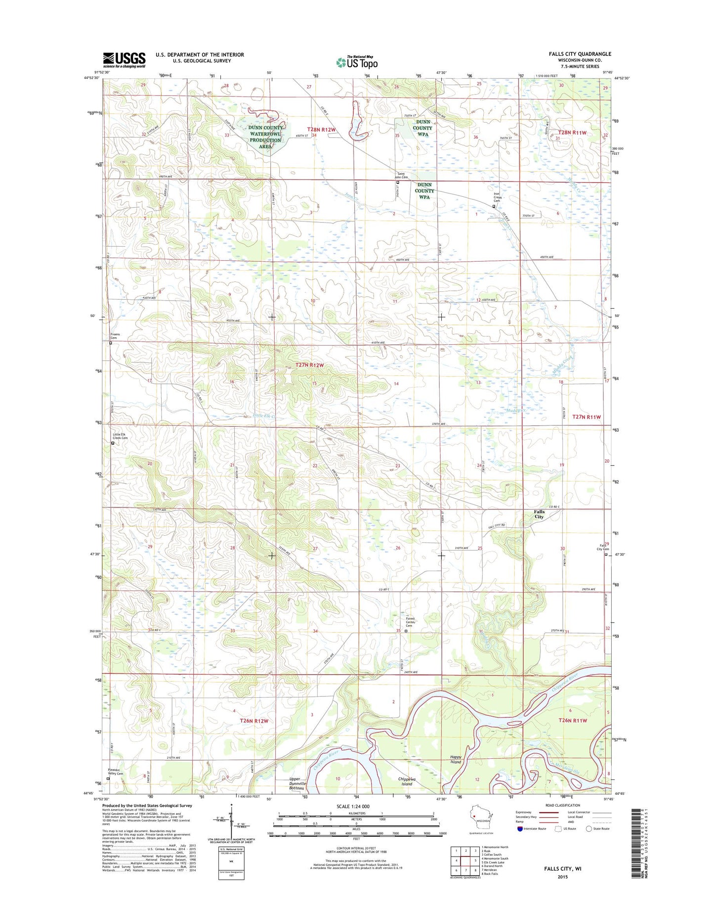
2022 topographic map quadrangle Falls City in the state of Wisconsin. Scale: 1:24000. Based on the newly updated USGS 7.5' US Topo map series, this map is in the following counties: Dunn. The map contains contour data, water features, and other items you are used to seeing on USGS maps, but also has updated roads and other features. This is the next generation of topographic maps. Printed on high-quality waterproof paper with UV fade-resistant inks.
Quads adjacent to this one:
West: Menomonie South
Northwest: Menomonie North
North: Rusk
Northeast: Colfax South
East: Elk Creek Lake
Southeast: Rock Falls
South: Meridean
Southwest: Durand North
This map covers the same area as the classic USGS quad with code o44091g7.
Contains the following named places: 65 Reservoir, Bountivale School, Chippewa Island, Falls City, Falls City Cemetery, Falls City Dam, Forest Center Cemetery, Forest Center Church of the Nazarene, Forest Center School, Froens Cemetery, Happy Island, Iron Creek, Iron Creek Cemetery, Iron Creek School, Little Elk Creek Cemetery, Little Elk Creek Church, Little Elk Creek School, Louisville School, Muddy Creek, Pleasant Valley Cemetery, Saint Johns Lutheran Cemetery, Salem Church, Shady Lawn School, Spring Brook School, Sunny Knoll School, Valley View School, WMEQ-AM (Menomonie)