MyTopo
Columbus Wisconsin US Topo Map
Couldn't load pickup availability
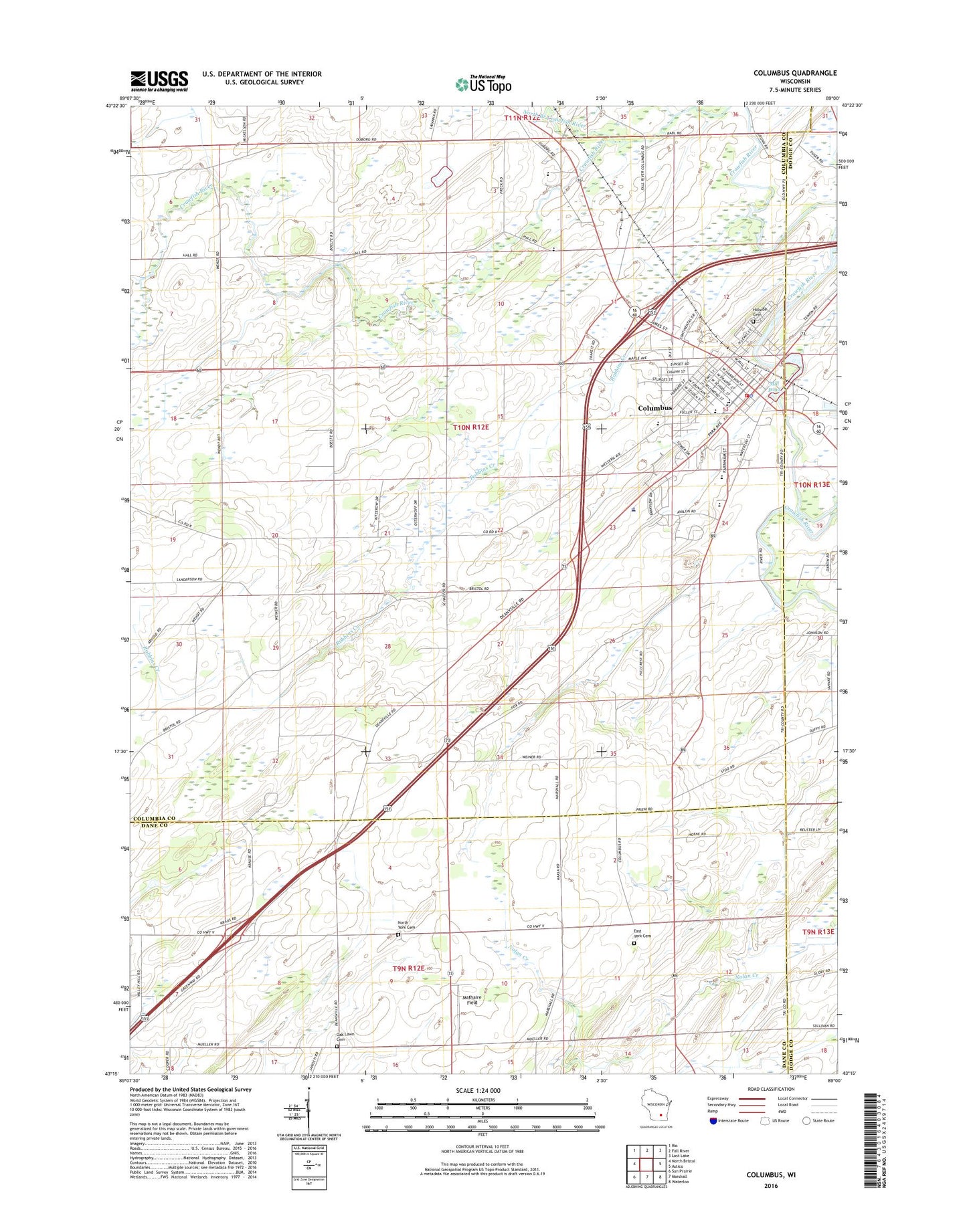
2018 topographic map quadrangle Columbus in the state of Wisconsin. Scale: 1:24000. Based on the newly updated USGS 7.5' US Topo map series, this map is in the following counties: Columbia, Dane, Dodge. The map contains contour data, water features, and other items you are used to seeing on USGS maps, but also has updated roads and other features. This is the next generation of topographic maps. Printed on high-quality waterproof paper with UV fade-resistant inks.
Quads adjacent to this one:
West: North Bristol
Northwest: Rio
North: Fall River
Northeast: Lost Lake
East: Astico
Southeast: Waterloo
South: Marshall
Southwest: Sun Prairie
Contains the following named places: City of Columbus, Clay Ridge School, Columbus, Columbus Community Hospital, Columbus Community Hospital Heliport, Columbus Elementary School, Columbus Fire Department, Columbus High School, Columbus Middle School, Columbus Mill Pond, Columbus Police Department, Columbus Post Office, Columbus Wastewater Treatment Plant, Early Childhood Family Education Center School, East York Cemetery, Feelyater School, Firemans Park, First Presbyterian Church, Hillside Cemetery, Mathaire Field, Mill Pond, New Testament Baptist Church, North Branch Crawfish River, North York Cemetery, Oak Lawn Cemetery, Oak Lawn School, Olivet Congregational United Church of Christ, Petersen Elementary School, Robbins Creek, Rotary Park, Saint Jerome School, Saint Jeromes Catholic Church, Town of Columbus, Udeys WP73 Dam, West Columbus School, Wisconsin Academy, Zion Evangelical Lutheran Church, Zion Lutheran Church, Zion Lutheran School, ZIP Code: 53925