MyTopo
Astico Wisconsin US Topo Map
Couldn't load pickup availability
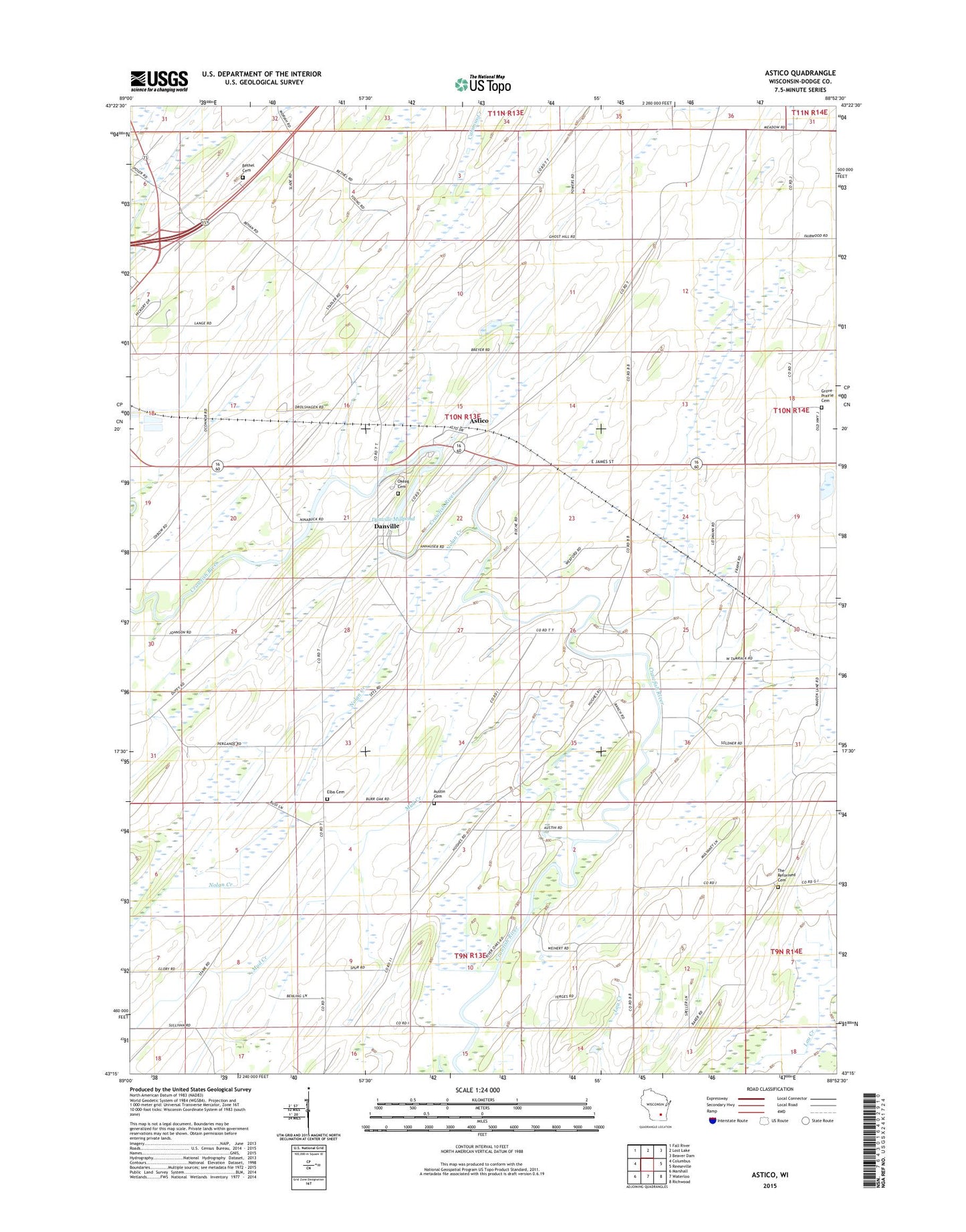
2022 topographic map quadrangle Astico in the state of Wisconsin. Scale: 1:24000. Based on the newly updated USGS 7.5' US Topo map series, this map is in the following counties: Dodge. The map contains contour data, water features, and other items you are used to seeing on USGS maps, but also has updated roads and other features. This is the next generation of topographic maps. Printed on high-quality waterproof paper with UV fade-resistant inks.
Quads adjacent to this one:
West: Columbus
Northwest: Fall River
North: Lost Lake
Northeast: Beaver Dam
East: Reeseville
Southeast: Richwood
South: Waterloo
Southwest: Marshall
This map covers the same area as the classic USGS quad with code o43088c8.
Contains the following named places: Altschwader Landing Strip, Astico, Astico County Park, Austin Cemetery, Benninger Farms, Bethel Cemetery, Country Gate Farm, Danville, Danville Dam, Danville Millpond 165, Elba Cemetery, Evangelical Reformed Cemetery, Franklin School, Gaffney School, Goebel School, Grove Prairie Cemetery, Grove Prairie School, Hartley School, Henken Farms, Homestead School, Maiden Lane School, Mud Creek, Nolan Creek, Okeag Cemetery, Pershing School, Pleasant Vale School, Saint Columbkille Church, Town of Elba, Trinity Church, Valley School, Wipple School, WYDI-TV (Fond du Lac)