MyTopo
Fall River Wisconsin US Topo Map
Couldn't load pickup availability
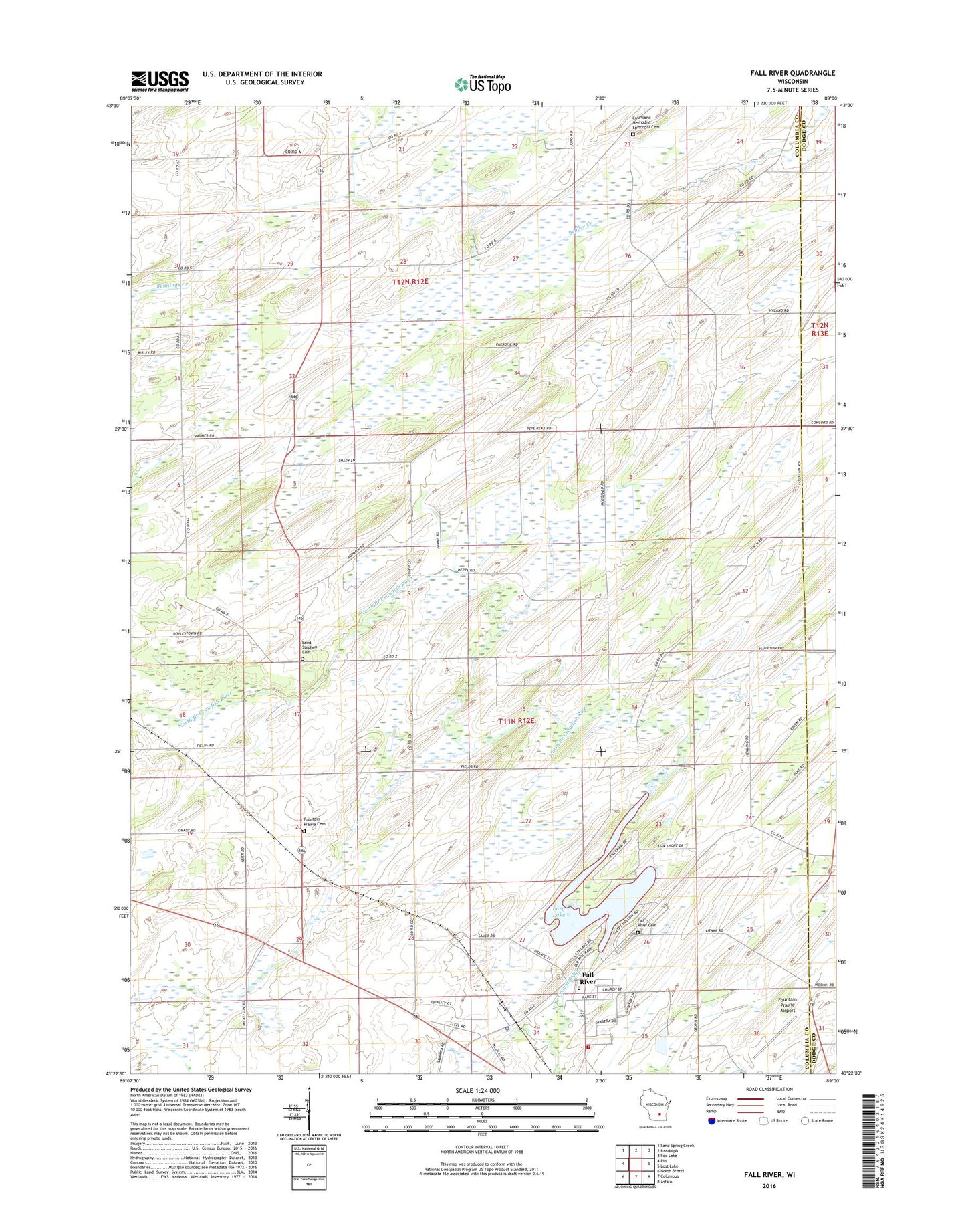
2022 topographic map quadrangle Fall River in the state of Wisconsin. Scale: 1:24000. Based on the newly updated USGS 7.5' US Topo map series, this map is in the following counties: Columbia, Dodge. The map contains contour data, water features, and other items you are used to seeing on USGS maps, but also has updated roads and other features. This is the next generation of topographic maps. Printed on high-quality waterproof paper with UV fade-resistant inks.
Quads adjacent to this one:
West: Rio
Northwest: Sand Spring Creek
North: Randolph
Northeast: Fox Lake
East: Lost Lake
Southeast: Astico
South: Columbus
Southwest: North Bristol
This map covers the same area as the classic USGS quad with code o43089d1.
Contains the following named places: Bennett School, Brace School, Courtland Bennett School, Courtland Church, Courtland Methodist Cemetery, England School, Englewood, Englewood School, Fall River, Fall River 2WP73 Dam, Fall River Cemetery, Fall River Elementary School, Fall River Middle / High School, Fall River Police Department, Fall River Post Office, Fall River Volunteer Fire Department, Fountain Prairie Airport, Fountain Prairie Cemetery, Lazy Lake, Lazy Lake 61, McKinley School, Paradise Marsh State Wildlife Area, Rust School, Saint Stephen Cemetery, Saint Stephen Church, Town of Fountain Prairie, Village of Fall River, ZIP Code: 53932