MyTopo
Urne Wisconsin US Topo Map
Couldn't load pickup availability
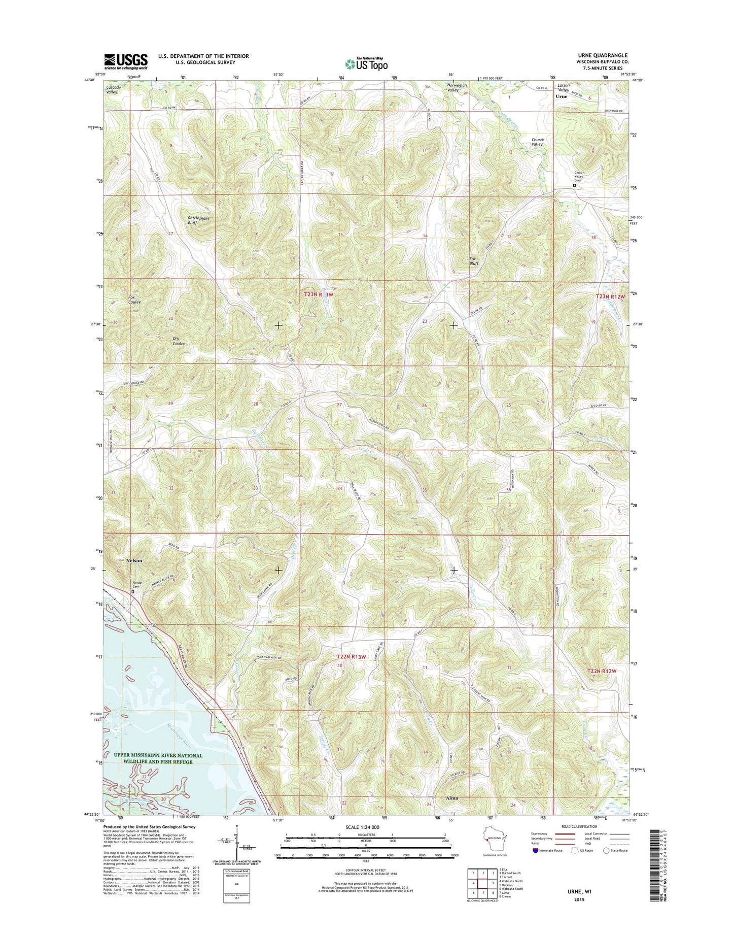
2022 topographic map quadrangle Urne in the state of Wisconsin. Scale: 1:24000. Based on the newly updated USGS 7.5' US Topo map series, this map is in the following counties: Buffalo. The map contains contour data, water features, and other items you are used to seeing on USGS maps, but also has updated roads and other features. This is the next generation of topographic maps. Printed on high-quality waterproof paper with UV fade-resistant inks.
Quads adjacent to this one:
West: Wabasha North
Northwest: Ella
North: Durand South
Northeast: Tarrant
East: Modena
Southeast: Cream
South: Alma
Southwest: Wabasha South
This map covers the same area as the classic USGS quad with code o44091d8.
Contains the following named places: 1.8 Reservoir, 54756, Big Lake, Cascade Chapel, Cascade Creek, Cascade School, Cascade Valley, Catfish Slough, Church Valley, Church Valley Cemetery, Deer Creek, Deer Creek School, Fox Bluff, Klopp Farm, Larson Valley, Lyster Church, Nelson Cemetery, North Branch Little Bear Creek, Norwegian Valley, Norwegian Valley School, Rattlesnake Bluff, South Nelson 1 D6519.1 Dam, Town of Nelson, Trout Creek School, Urne, Urne School