MyTopo
Crivitz Wisconsin US Topo Map
Couldn't load pickup availability
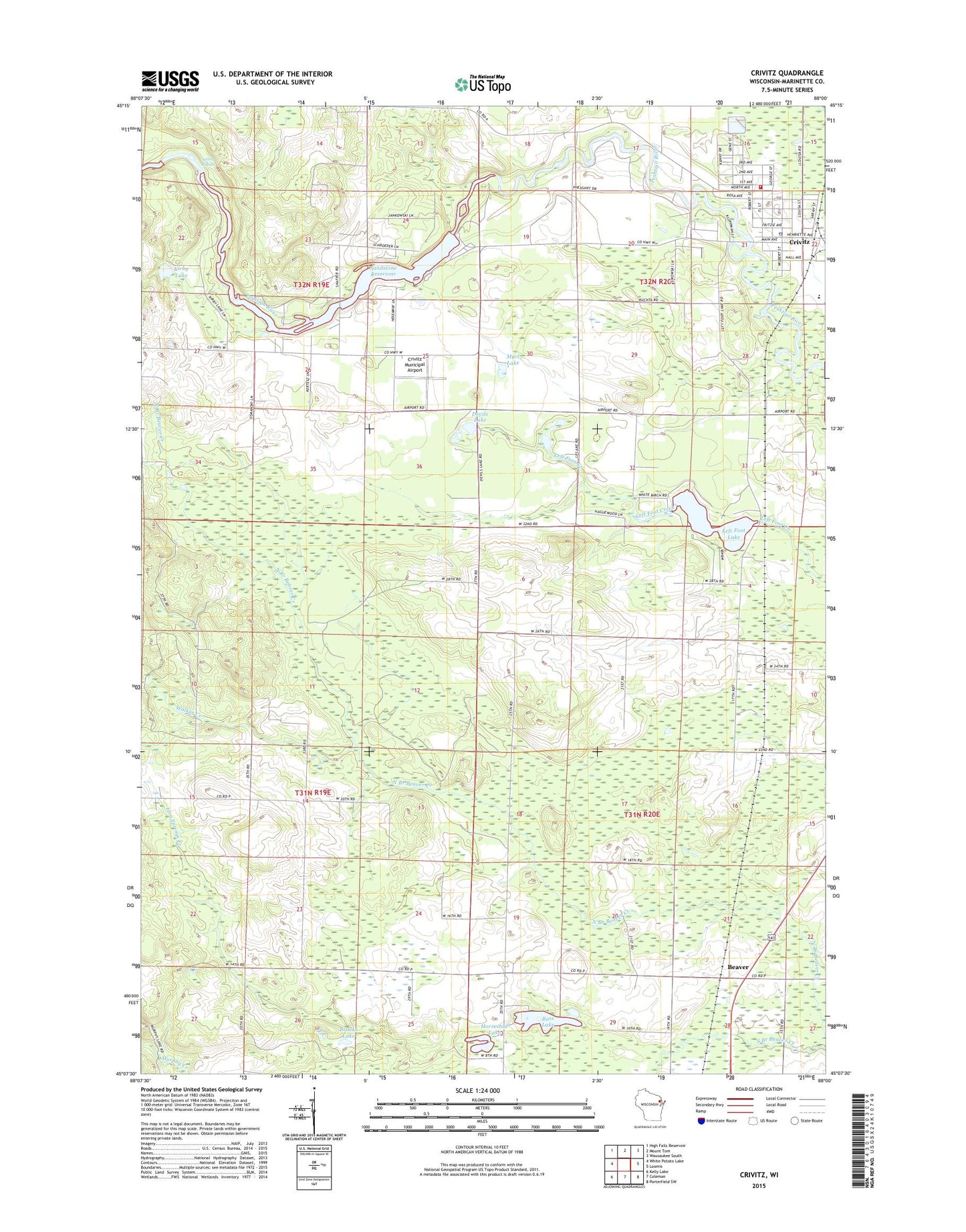
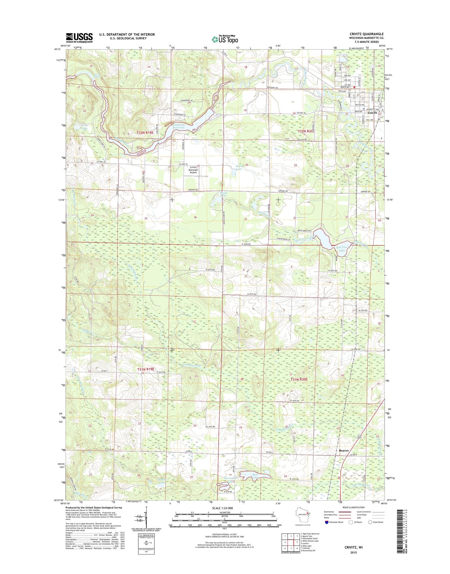
2018 topographic map quadrangle Crivitz in the state of Wisconsin. Scale: 1:24000. Based on the newly updated USGS 7.5' US Topo map series, this map is in the following counties: Marinette. The map contains contour data, water features, and other items you are used to seeing on USGS maps, but also has updated roads and other features. This is the next generation of topographic maps. Printed on high-quality waterproof paper with UV fade-resistant inks.
Quads adjacent to this one:
West: White Potato Lake
Northwest: High Falls Reservoir
North: Mount Tom
Northeast: Wausaukee South
East: Loomis
Southeast: Porterfield SW
South: Coleman
Southwest: Kelly Lake
Contains the following named places: Bass Lake, Beaver, Beaver Church, Beaver Creek State Public Hunting Grounds, Beaver Lookout Tower, Brooks Lake, Crivitz, Crivitz Elementary and Middle School, Crivitz High School, Crivitz Municipal Airport, Crivitz Police Department, Crivitz Post Office, Crivitz Rescue Squad, Crivitz Volunteer Fire Department, Devils Lake, Flower Nook School, Horseshoe Lake, Iron Springs Creek, Kirby Hill School, Kirby Lake, Left Foot Lake, Mar - Oco Sanitary Landfill, Marl Lake, Oak Ridge School, Sandstone Dam, Sandstone Flowage, Sandstone Rapids WP214 Dam, Sandstone Reservoir 675, Spring Rapids, Town of Beaver, Village of Crivitz, Walker Creek, Weber School, Woodrow Wilson School, ZIP Code: 54114