MyTopo
Coleman Wisconsin US Topo Map
Couldn't load pickup availability
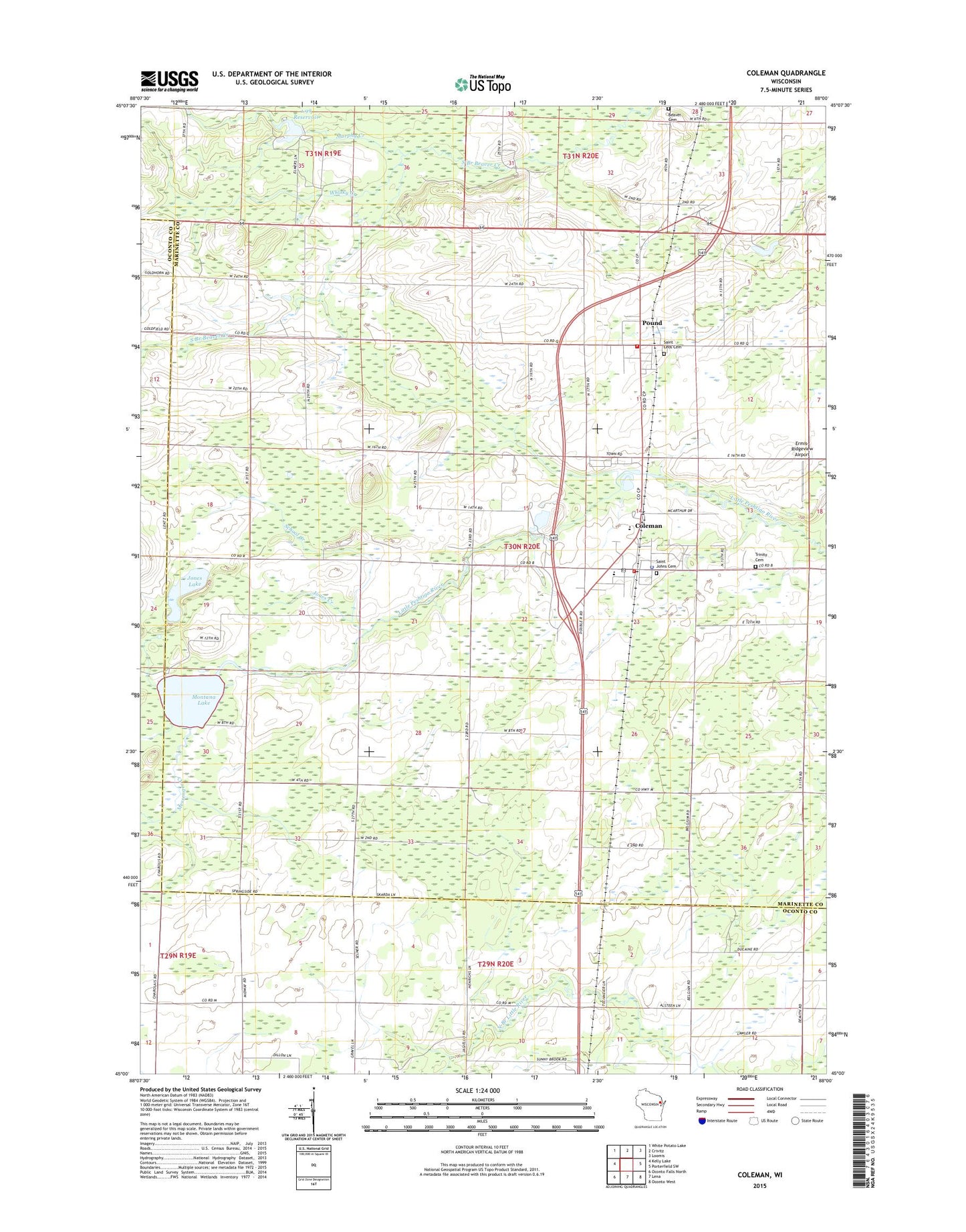
2022 topographic map quadrangle Coleman in the state of Wisconsin. Scale: 1:24000. Based on the newly updated USGS 7.5' US Topo map series, this map is in the following counties: Marinette, Oconto. The map contains contour data, water features, and other items you are used to seeing on USGS maps, but also has updated roads and other features. This is the next generation of topographic maps. Printed on high-quality waterproof paper with UV fade-resistant inks.
Quads adjacent to this one:
West: Kelly Lake
Northwest: White Potato Lake
North: Crivitz
Northeast: Loomis
East: Porterfield SW
Southeast: Oconto West
South: Lena
Southwest: Oconto Falls North
This map covers the same area as the classic USGS quad with code o45088a1.
Contains the following named places: 1.99 Reservoir, 54112, Beaver Cemetery, Brult School, Coleman, Coleman Area Rescue Squad, Coleman Fire Department, Coleman High School, Coleman Middle School, Coleman Police Department, Coleman Post Office, Ermis-Ridgeview Airport, Faith Christian School, Jones Creek, Jones Lake, Lena Road School, Lincoln School, Low Valley School, McDonald Creek, Messenger Creek, Montana Lake, Murphy Creek, Murphy Creek 3WR223 Dam, Pound, Pound Pit, Pound Post Office, Pound Volunteer Fire Department, Saint Johns Cemetery, Saint Leos Cemetery, School Creek, Section Eight Church, Section Eight School, Sunny Brook School, Trinity Evangelical Lutheran Church Cemetery, Victory School, Village of Coleman, Village of Pound, Weber School, Whisky Creek, Wilson School