MyTopo
Kelly Lake Wisconsin US Topo Map
Couldn't load pickup availability
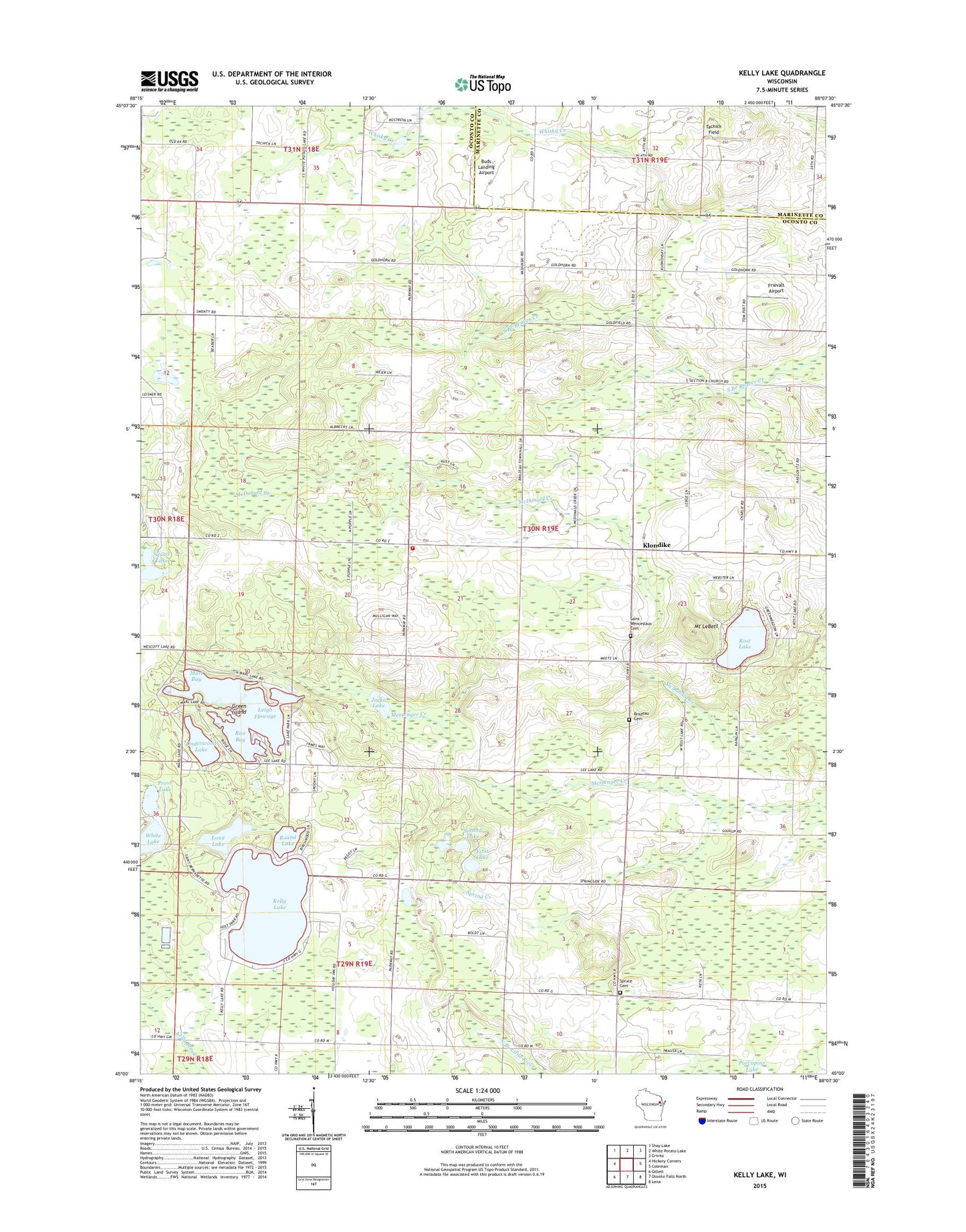
2023 topographic map quadrangle Kelly Lake in the state of Wisconsin. Scale: 1:24000. Based on the newly updated USGS 7.5' US Topo map series, this map is in the following counties: Oconto, Marinette. The map contains contour data, water features, and other items you are used to seeing on USGS maps, but also has updated roads and other features. This is the next generation of topographic maps. Printed on high-quality waterproof paper with UV fade-resistant inks.
Quads adjacent to this one:
West: Hickory Corners
Northwest: Shay Lake
North: White Potato Lake
Northeast: Crivitz
East: Coleman
Southeast: Lena
South: Oconto Falls North
Southwest: Gillett
This map covers the same area as the classic USGS quad with code o45088a2.
Contains the following named places: Bagley East Side School, Brazeau Cemetery, Brazeau Townhall, Brazeau Township Fire Department, Buds Landing, Central School, First Lake, Frievalt Airport, Funk Field, Goldfield School, Goldhorn School, Green Island, Holt Park, Jocko Lake, Kelly Lake, Kelly Lake School, Kelly Lake Waterways 2WP 168 Dam, Klondike, Leigh Flowage, Leigh Flowage 10, Long Lake, Marl Bay, Messenger Creek School, Mount LeBett, Pecor Lake, Rice Bay, Rost Lake, Round Lake, Saint Wenceslaus Cemetery, Second Lake, Spring Creek, Spruce Cemetery, Spruce School, Spruce Townhall, Squaw Lake, Tachick Field, Town of Brazeau, Underwood Lake, West Klondike School, White Lake, ZIP Code: 54161