MyTopo
Poskin Wisconsin US Topo Map
Couldn't load pickup availability
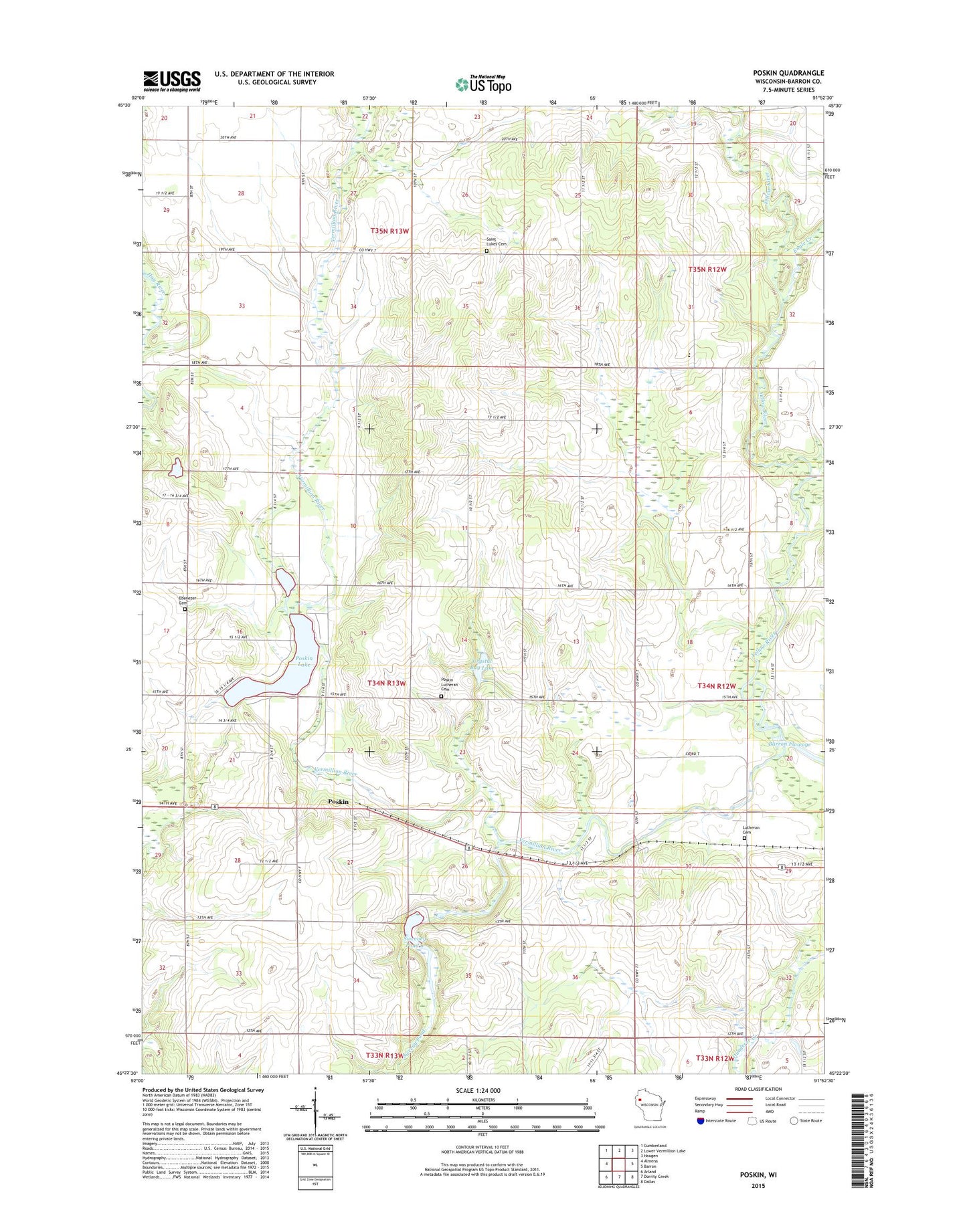
2022 topographic map quadrangle Poskin in the state of Wisconsin. Scale: 1:24000. Based on the newly updated USGS 7.5' US Topo map series, this map is in the following counties: Barron. The map contains contour data, water features, and other items you are used to seeing on USGS maps, but also has updated roads and other features. This is the next generation of topographic maps. Printed on high-quality waterproof paper with UV fade-resistant inks.
Quads adjacent to this one:
West: Almena
Northwest: Cumberland
North: Lower Vermillion Lake
Northeast: Haugen
East: Barron
Southeast: Dallas
South: Dorrity Creek
Southwest: Arland
This map covers the same area as the classic USGS quad with code o45091d8.
Contains the following named places: Berg Farms, Collingwood School, Coolidge School, Crist Miller School, Crystal Bay Lake, Ebenezer Cemetery, Ebenezer Church, Engle Creek, Field School, First Lutheran Cemetery, Garfield School, La Follette School, Paul Revere Community Center, Pine Grove School, Poskin, Poskin Church, Poskin Lake, Poskin Lutheran Cemetery, Revere School, Saint Lukes Cemetery, Saint Lukes Church, Silver Sky Farm, Sweeney Pond 6, Sweeny Pond, Sweeny Pond Creek 2WP1824 Dam, Town of Clinton, Vermillion River, Yellow River School, Yellow River State Public Fishery Area, ZIP Code: 54812