MyTopo
Deer Park Wisconsin US Topo Map
Couldn't load pickup availability
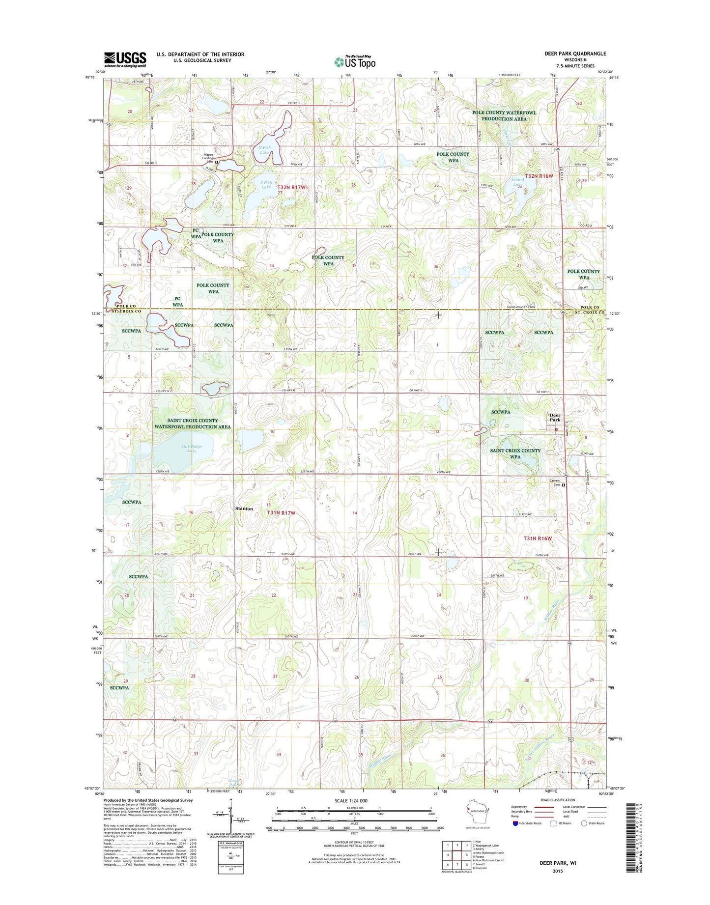
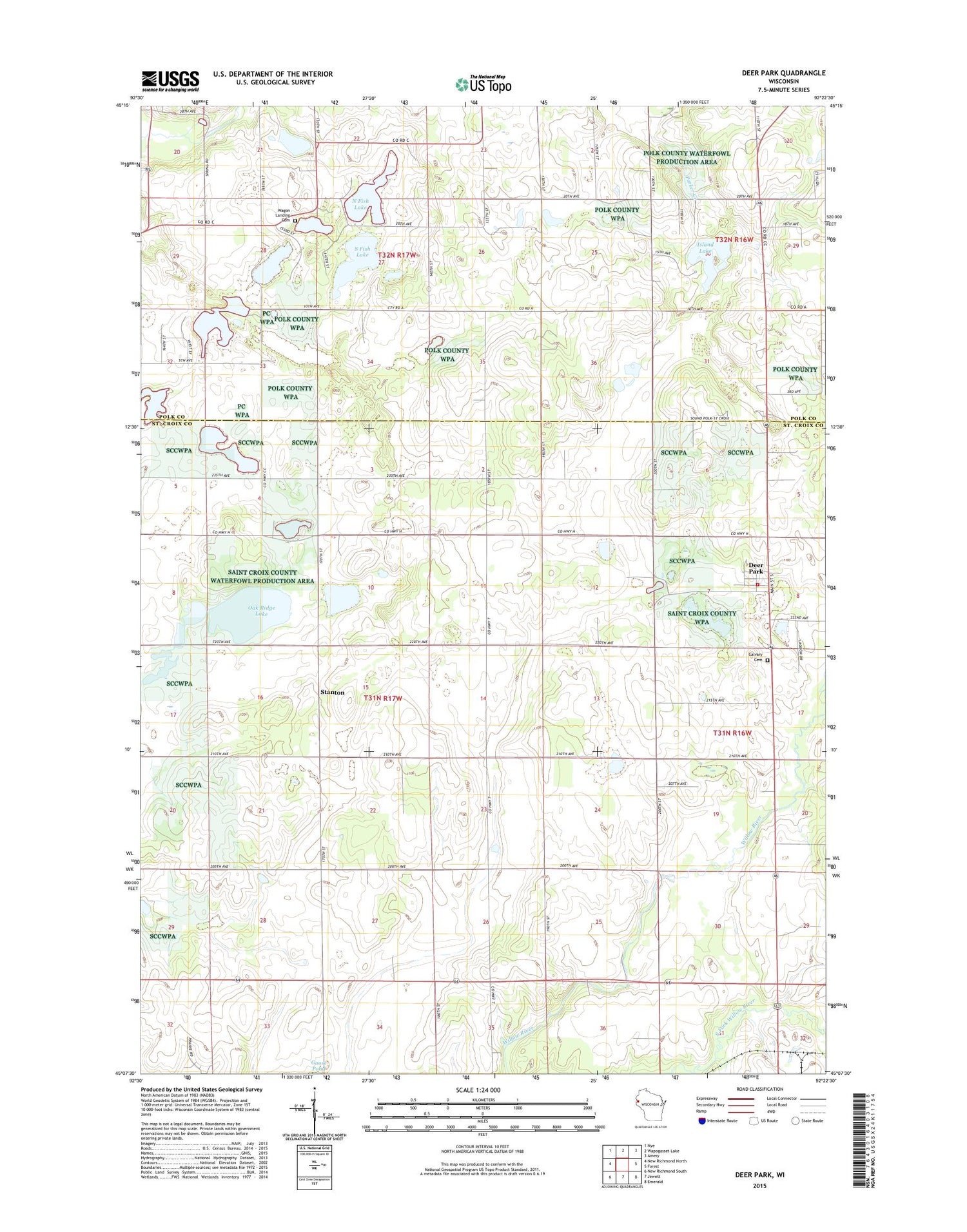
2018 topographic map quadrangle Deer Park in the state of Wisconsin. Scale: 1:24000. Based on the newly updated USGS 7.5' US Topo map series, this map is in the following counties: St. Croix, Polk. The map contains contour data, water features, and other items you are used to seeing on USGS maps, but also has updated roads and other features. This is the next generation of topographic maps. Printed on high-quality waterproof paper with UV fade-resistant inks.
Quads adjacent to this one:
West: New Richmond North
Northwest: Nye
North: Wapogasset Lake
Northeast: Amery
East: Forest
Southeast: Emerald
South: Jewett
Southwest: New Richmond South
Contains the following named places: Alden Townhall, Bierbrauer Lake, Calvary Cemetery, Cylon Church, Deer Park, Deer Park Area Fire Department, Deer Park Post Office, East Emanuel Church, Grandview School, Island Lake, Lakeside School, Lowland School, Meadowdale School, North Fish Lake, Northview School, Oak Ridge Lake, Polk County Waterfowl Production Area, Saint Bridget Church, Saint Croix County Waterfowl Production Area, Skunk Lake, South Fish Lake, Stanton, Town of Stanton, Village of Deer Park, Wagon Landing Cemetery, Wagon Landing School, Wagon Landing Springs State Public Fishing Area