MyTopo
Forest Wisconsin US Topo Map
Couldn't load pickup availability
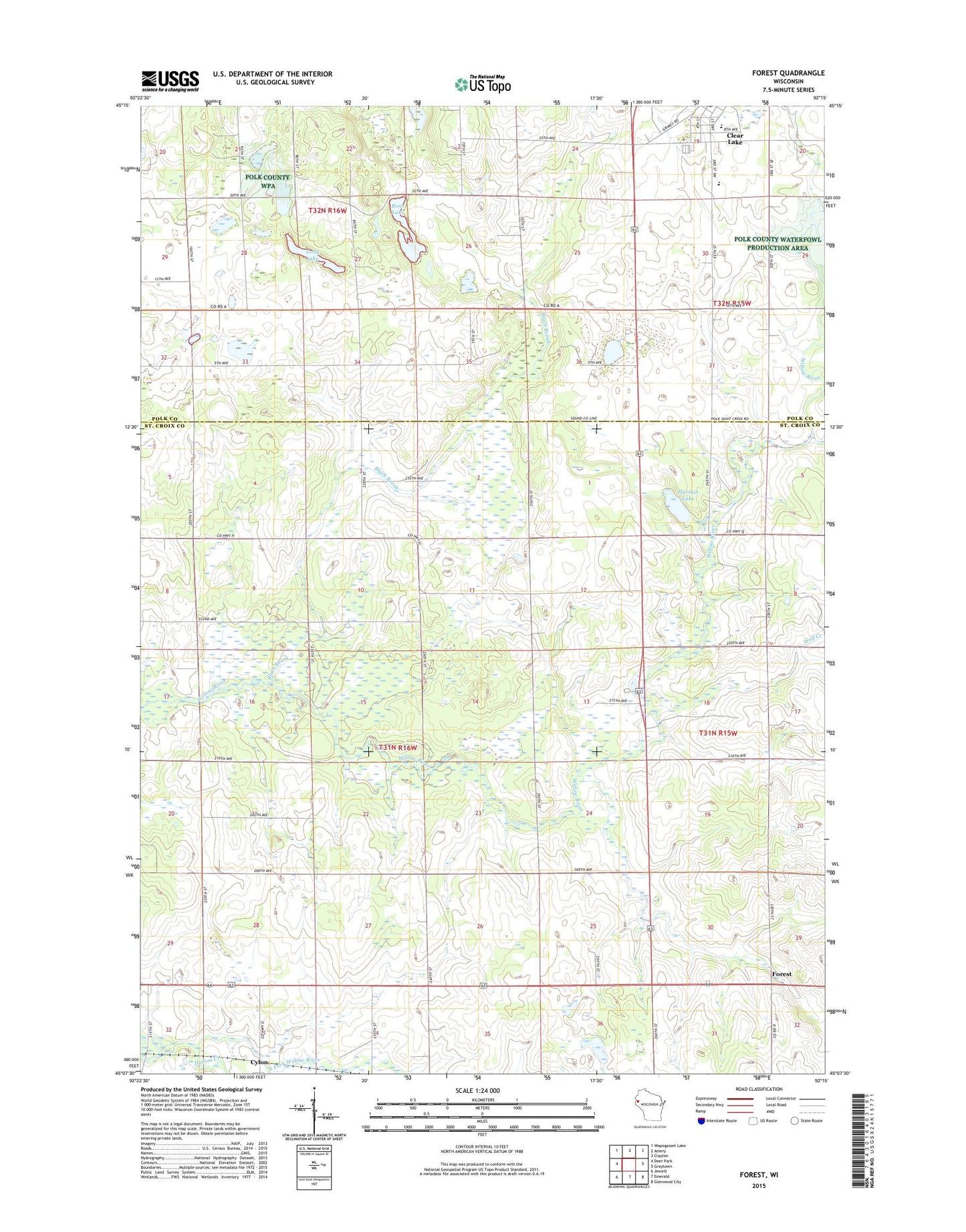
2022 topographic map quadrangle Forest in the state of Wisconsin. Scale: 1:24000. Based on the newly updated USGS 7.5' US Topo map series, this map is in the following counties: St. Croix, Polk. The map contains contour data, water features, and other items you are used to seeing on USGS maps, but also has updated roads and other features. This is the next generation of topographic maps. Printed on high-quality waterproof paper with UV fade-resistant inks.
Quads adjacent to this one:
West: Deer Park
Northwest: Wapogasset Lake
North: Amery
Northeast: Clayton
East: Graytown
Southeast: Glenwood City
South: Emerald
Southwest: Jewett
This map covers the same area as the classic USGS quad with code o45092b3.
Contains the following named places: Black Brook, Black Brook Townhall, Bone Lake, Clear Lake Junior - Senior High School, Clear Lake Junior High School, Cylon School, Cylon State Public Hunting Grounds, Diamond K Farm, Don Dosch Wildlife Flowage Dam, Edgewood School, Forest, Gaylord A Nelson Education Center, Green Creek School, Harmin Lake, High Landing School, Hutton Creek, Jack Green Creek, Kuhn Farm, Liberty School, Long Lake, Oakland School, Town of Cylon, Village of Clear Lake, Wolf Creek, ZIP Code: 54007