MyTopo
Emerald Wisconsin US Topo Map
Couldn't load pickup availability
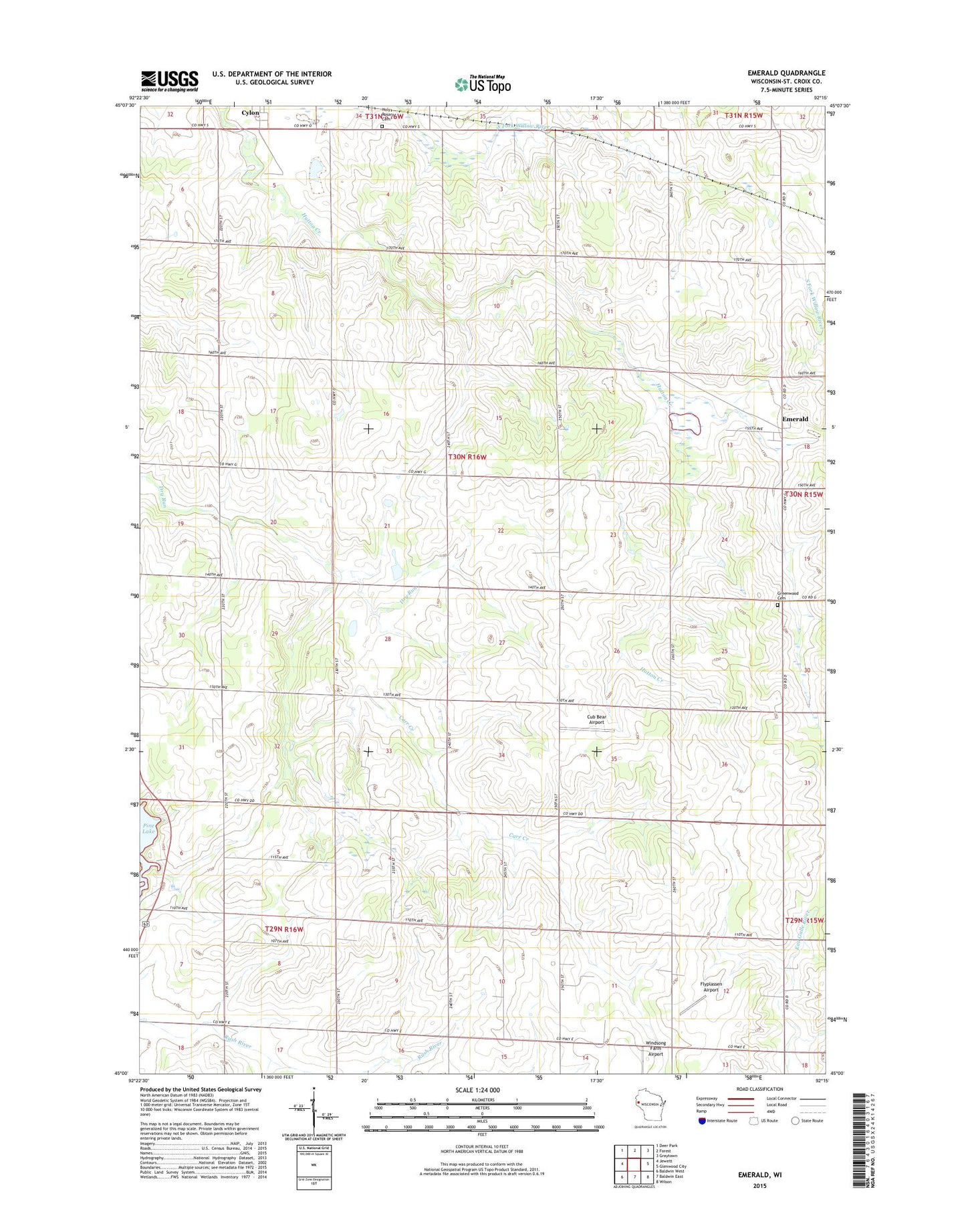
2022 topographic map quadrangle Emerald in the state of Wisconsin. Scale: 1:24000. Based on the newly updated USGS 7.5' US Topo map series, this map is in the following counties: St. Croix. The map contains contour data, water features, and other items you are used to seeing on USGS maps, but also has updated roads and other features. This is the next generation of topographic maps. Printed on high-quality waterproof paper with UV fade-resistant inks.
Quads adjacent to this one:
West: Jewett
Northwest: Deer Park
North: Forest
Northeast: Graytown
East: Glenwood City
Southeast: Wilson
South: Baldwin East
Southwest: Baldwin West
This map covers the same area as the classic USGS quad with code o45092a3.
Contains the following named places: Alex Acres, Baldwin Dairy, Bazille Hobbyland Farms, Berg Farms, Boehmer Farms, Carr Creek, Carr Creek School, Clarks Crossing School, Cloverleaf School, Cub Bear Airport, Cylon, East Pine Lake School, Eliason Farms, Emerald, Emerald Census Designated Place, Emerald Station, Emerald Townhall, Greenwood Cemetery, Happy Valley School, Holy Rosary Cemetery, Holy Rosary Church, Honyard School, Hutton Creek School, Jessop Farm, Kanten Field Airport, Kiekhofer Dairy, Kingdom Hall, Oakdale School, Omann Farms, Peskar Dairy, Thrifty Oak School, Town of Emerald, Triple C Farms, Windsong Farm Airport