MyTopo
Amery Wisconsin US Topo Map
Couldn't load pickup availability
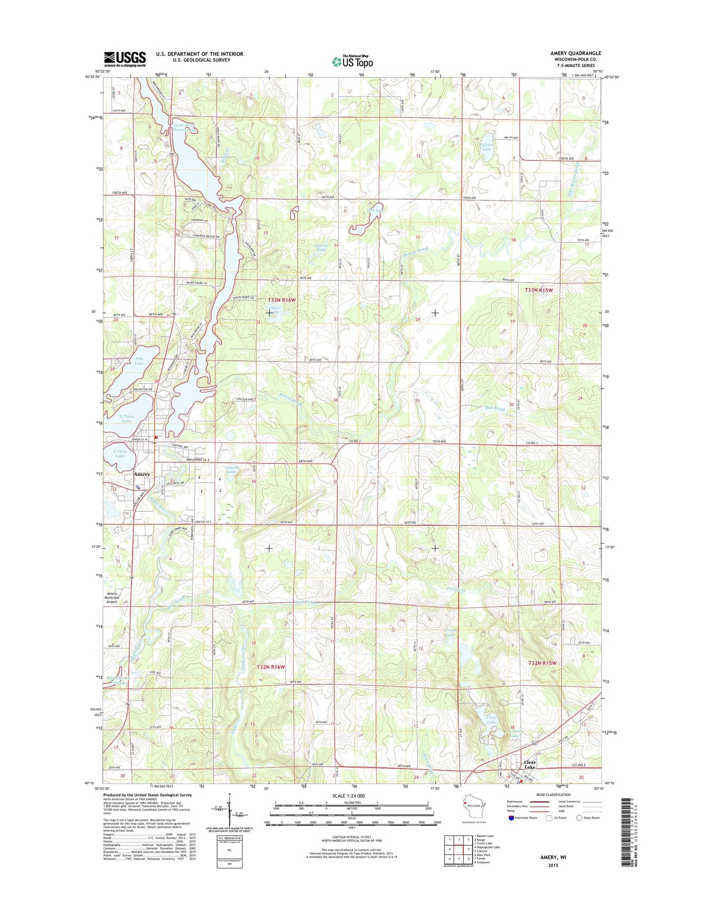
2022 topographic map quadrangle Amery in the state of Wisconsin. Scale: 1:24000. Based on the newly updated USGS 7.5' US Topo map series, this map is in the following counties: Polk. The map contains contour data, water features, and other items you are used to seeing on USGS maps, but also has updated roads and other features. This is the next generation of topographic maps. Printed on high-quality waterproof paper with UV fade-resistant inks.
Quads adjacent to this one:
West: Wapogasset Lake
Northwest: Balsam Lake
North: Range
Northeast: Turtle Lake
East: Clayton
Southeast: Graytown
South: Forest
Southwest: Deer Park
This map covers the same area as the classic USGS quad with code o45092c3.
Contains the following named places: Amery, Amery 3WR1627 Dam, Amery Area Emergency Medical Services, Amery Fire Department, Amery High School, Amery Intermediate School, Amery Middle School, Amery Municipal Airport, Amery Police Department, Amery Post Office, Amery Regional Medical Center, Apple River Church, Apple River Flowage 134, Beaver Brook, Beaver Brook School, Bethany Church, Bull Brook, Burns Creek, City of Amery, Clayton Townhall, Clear Creek Police Department, Clear Lake, Clear Lake Ambulance Service, Clear Lake Fire Department, Clear Lake Post Office, Clear Lake Village Park, East Lincoln Church, East Lincoln School, Flannigan School, French Creek, French Lake, Gorres Lake, Ice House Lake, Jim Lake, Joel School, Lien Elementary School, Lincoln Lake, Lincoln School, North Branch Beaver Brook, North Twin Lake, Oak View School, Omer Lake, Palmer Lake, Pike Lake, Snake Creek, Snake Creek State Public Fishing Area, Snake Lake, South Branch Beaver Brook, South Twin Lake, Town of Black Brook, Town of Lincoln, West Clayton School, WXCE-AM (Amery)