MyTopo
Dewey Marsh Wisconsin US Topo Map
Couldn't load pickup availability
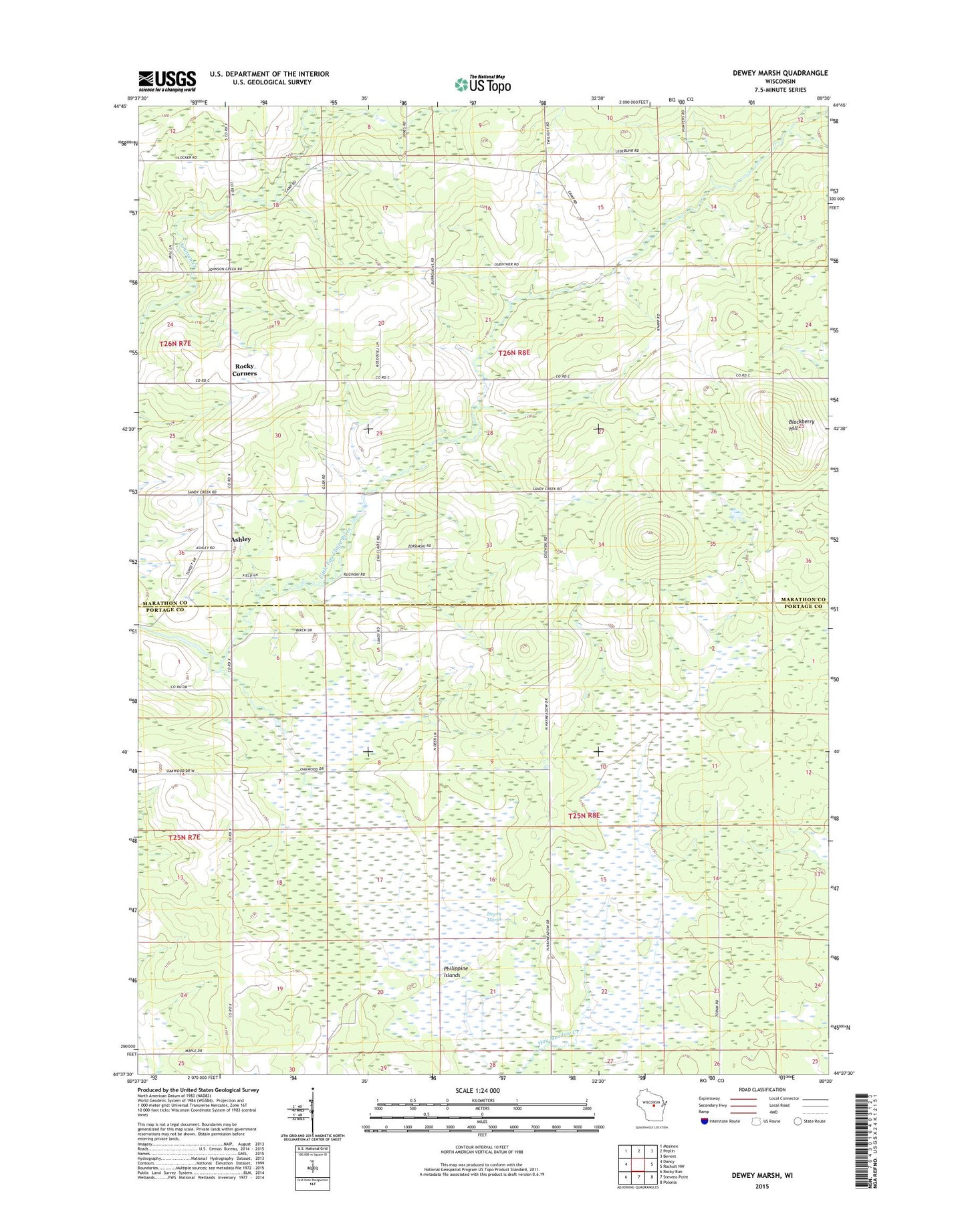
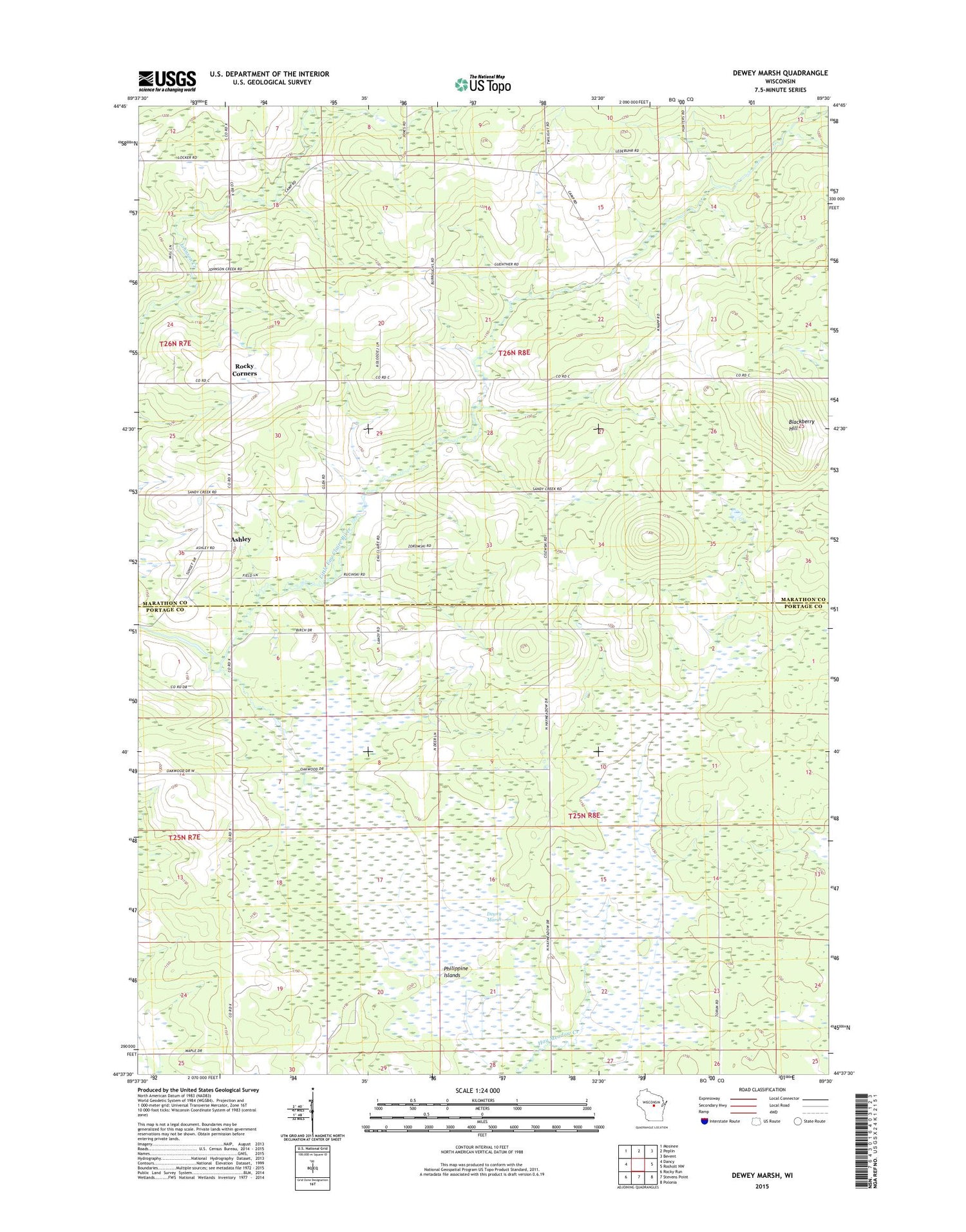
2018 topographic map quadrangle Dewey Marsh in the state of Wisconsin. Scale: 1:24000. Based on the newly updated USGS 7.5' US Topo map series, this map is in the following counties: Marathon, Portage. The map contains contour data, water features, and other items you are used to seeing on USGS maps, but also has updated roads and other features. This is the next generation of topographic maps. Printed on high-quality waterproof paper with UV fade-resistant inks.
Quads adjacent to this one:
West: Dancy
Northwest: Mosinee
North: Peplin
Northeast: Bevent
East: Rosholt NW
Southeast: Polonia
South: Stevens Point
Southwest: Rocky Run
Contains the following named places: Ashley, Blackberry Hill, Cisewski Farms, Cole School, Dewey Marsh, Dewey Marsh State Natural Area, Guenther School, Hajec Farm, Jet D Ranch, Kolodziez Farm, Lake Du Bay Berry Farms, Lassa Dairy Farms, Little Eau Claire School, Philippine Islands, Quarry Lookout Tower, Rockland School, Rocky Corners, Ryan School, Town of Dewey, Town of Guenther