MyTopo
Polonia Wisconsin US Topo Map
Couldn't load pickup availability
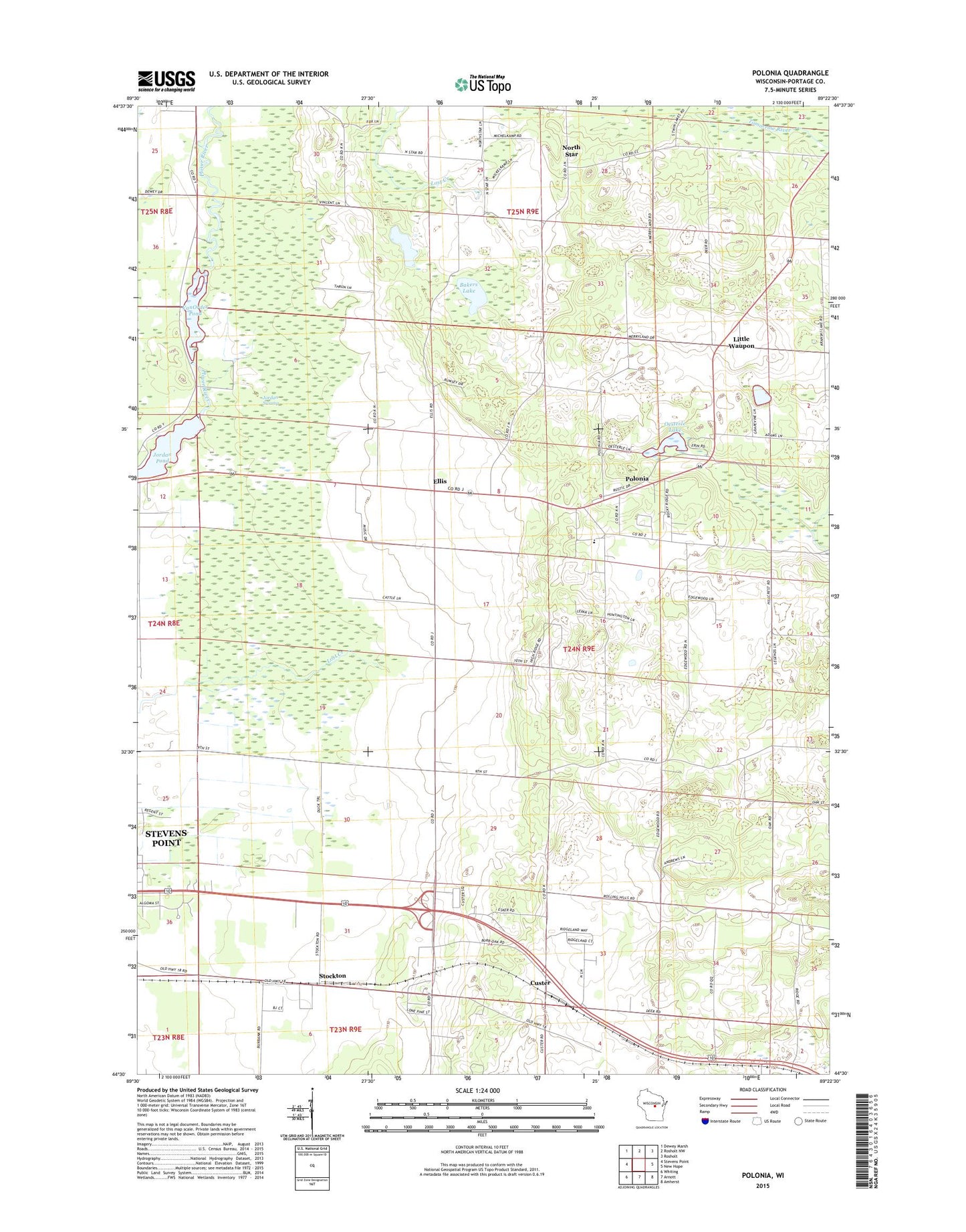
2022 topographic map quadrangle Polonia in the state of Wisconsin. Scale: 1:24000. Based on the newly updated USGS 7.5' US Topo map series, this map is in the following counties: Portage. The map contains contour data, water features, and other items you are used to seeing on USGS maps, but also has updated roads and other features. This is the next generation of topographic maps. Printed on high-quality waterproof paper with UV fade-resistant inks.
Quads adjacent to this one:
West: Stevens Point
Northwest: Dewey Marsh
North: Rosholt NW
Northeast: Rosholt
East: New Hope
Southeast: Amherst
South: Arnott
Southwest: Whiting
This map covers the same area as the classic USGS quad with code o44089e4.
Contains the following named places: Bakers Lake, Casey's Orchard, Custer, Custer Post Office, Edison School, Ellis, Heffron School, Jordan Pond, Jordan Swamp, Little Waupon, MacGlacklin School, Madison School, Mengel Sand and Gravel Pit, North Star, Oesterle Lake, Polonia, Polonia Census Designated Place, Sacred Heart Elementary School, Saint Martin Church, Saint Marys Church, Stockton, Stockton School, Town of Sharon, Van Order 1907C157 Dam, VanOrder Pond, ZIP Code: 54423