
MyTopo
Dodge Wisconsin US Topo Map
Couldn't load pickup availability
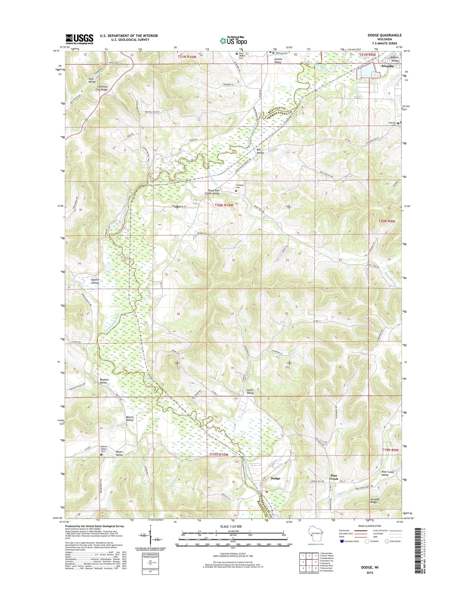
2018 topographic map quadrangle Dodge in the state of Wisconsin. Scale: 1:24000. Based on the newly updated USGS 7.5' US Topo map series, this map is in the following counties: Trempealeau, Buffalo. The map contains contour data, water features, and other items you are used to seeing on USGS maps, but also has updated roads and other features. This is the next generation of topographic maps. Printed on high-quality waterproof paper with UV fade-resistant inks.
Quads adjacent to this one:
West: Fountain City
Northwest: Waumandee
North: Swinns Valley
Northeast: Independence
East: Tamarack
Southeast: Trempealeau
South: Winona East
Southwest: Winona West
Contains the following named places: Bill Valley, Bohri, Bohris Valley, Bohris Valley Cemetery, Bohris Valley School, Buehler Valley, Calvary Cemetery, Cortland, Cortland Cemetery, Cortland School, Dodge, Dodge Census Designated Place, Dodge Fire Department, Dodge Post Office, Dodge School, Doelle School, Doelle Valley, Dooney Siding, Feltes Quarry, Glencoe Cemetery, Heuer Valley, Keller Creek, Latch Valley, Latch Valley School, Meyers School, Meyers Valley, Oak Grove School, Our Ladys Catholic Church, Pine Creek, Pine Creek School, Riley Creek, Sacred Heart Parochial School, Saint Joseph Cemetery, Schmitt Creek, Swinns Valley, Town of Dodge, Trempealeau River Meadow State Natural Area, Trout Run Creek, Trout Run Creek Valley, Wicka Dam, ZIP Codes: 54612, 54625


