MyTopo
Tamarack Wisconsin US Topo Map
Couldn't load pickup availability
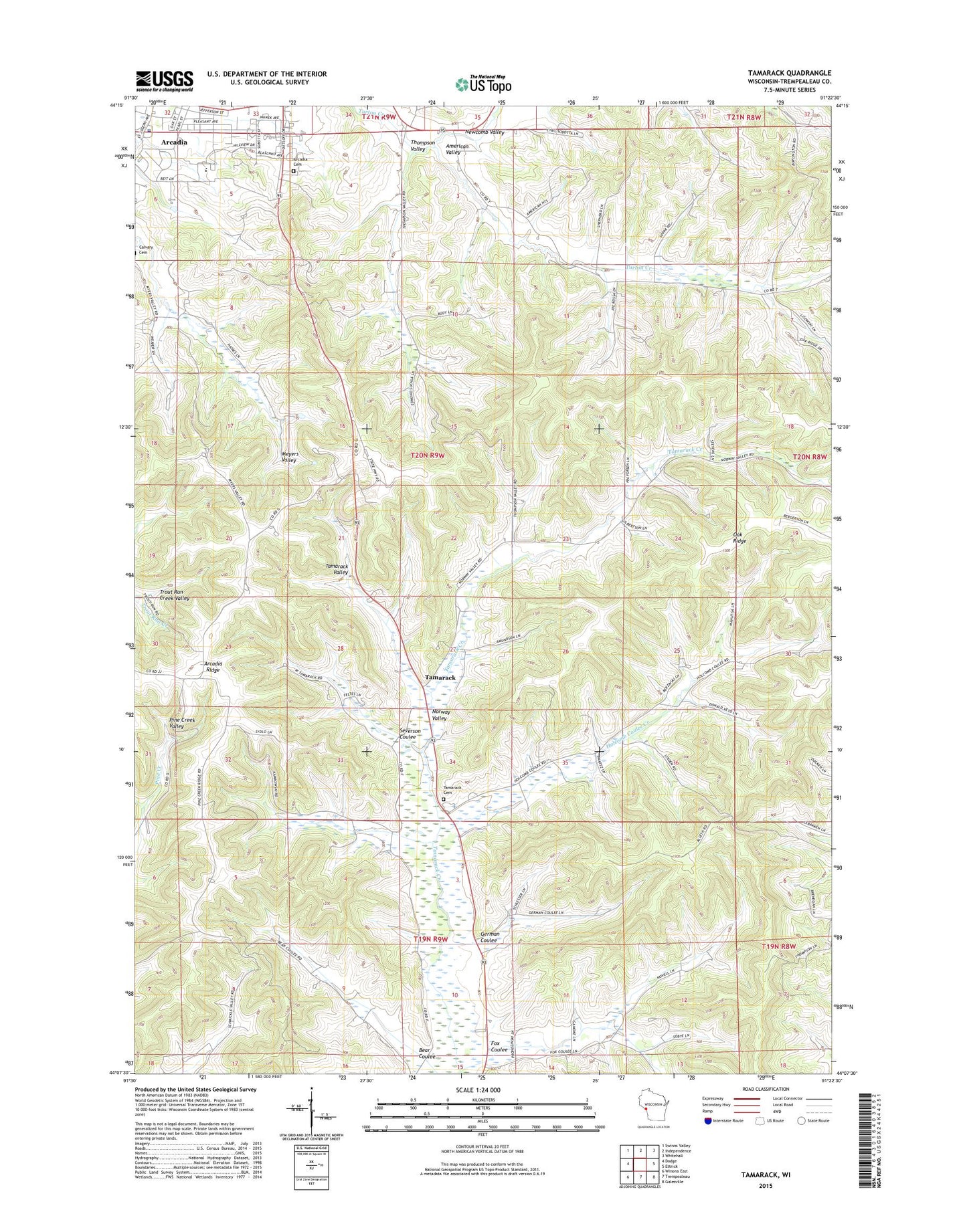
2022 topographic map quadrangle Tamarack in the state of Wisconsin. Scale: 1:24000. Based on the newly updated USGS 7.5' US Topo map series, this map is in the following counties: Trempealeau. The map contains contour data, water features, and other items you are used to seeing on USGS maps, but also has updated roads and other features. This is the next generation of topographic maps. Printed on high-quality waterproof paper with UV fade-resistant inks.
Quads adjacent to this one:
West: Dodge
Northwest: Swinns Valley
North: Independence
Northeast: Whitehall
East: Ettrick
Southeast: Galesville
South: Trempealeau
Southwest: Winona East
This map covers the same area as the classic USGS quad with code o44091b4.
Contains the following named places: 0.22 Reservoir, American Valley, American Valley School, Arcadia Ambulance Service, Arcadia Cemetery, Arcadia High School, Arcadia Police Department, Arcadia Post Office, Arcadia Ridge, Arcadia Ridge School, Bear Coulee, City of Arcadia, Fox Coulee, Franciscan Healthcare Arcadia - Mayo Clinic Health System, German Coulee, German Goulee School, Holcomb Coulee Creek, Holcomb School, Holy Family Catholic School, Kolstad School, Newcomb Valley, Norway Valley, Norway Valley School, Oak Ridge, Penny School, Saint Stanislaus Catholic Church, Schultz G9976 Dam, Severson Coulee, Tamarack, Tamarack Cemetery, Tamarack Church, Tamarack Creek Bog State Natural Area, Tamarack Creek State Wildlife Area, Thompson Valley, Town of Arcadia, White School