MyTopo
Independence Wisconsin US Topo Map
Couldn't load pickup availability
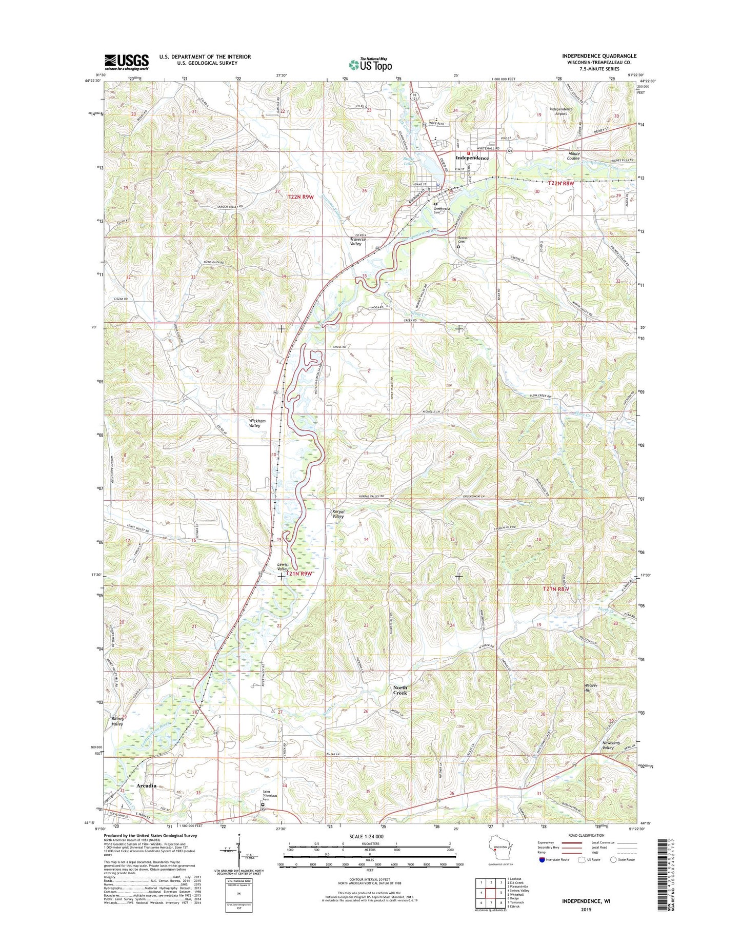
2022 topographic map quadrangle Independence in the state of Wisconsin. Scale: 1:24000. Based on the newly updated USGS 7.5' US Topo map series, this map is in the following counties: Trempealeau. The map contains contour data, water features, and other items you are used to seeing on USGS maps, but also has updated roads and other features. This is the next generation of topographic maps. Printed on high-quality waterproof paper with UV fade-resistant inks.
Quads adjacent to this one:
West: Swinns Valley
Northwest: Lookout
North: Elk Creek
Northeast: Pleasantville
East: Whitehall
Southeast: Ettrick
South: Tamarack
Southwest: Dodge
This map covers the same area as the classic USGS quad with code o44091c4.
Contains the following named places: Arcadia Country Club, Arcadia Elementary School, Arcadia Landing Strip, Bethel Cemetery, Bugle Lake, City of Independence, Dewey Corners, Elk Creek, Greenwood Cemetery, Independence, Independence Airport, Independence Dam, Independence Elementary School, Independence High School, Independence Police Department, Independence Post Office, Independence Volunteer Fire Department, Island Park, Joe Pietrek Junior County Park, Kniffen Creek, Korpal Valley, Korpal Valley School, Lewis Valley, Lewis Valley School, Lower Plum Creek School, Maule Coulee, New City, New City School, North Creek, North Creek School, Oakdale School, Plum Creek, Rainey Valley, Rainey Valley School, Saint Stanislaus Cemetery, Saints Peter and Paul Catholic School, Sunny Slope School, Traverse Valley, Traverse Valley Creek, Weaver Hill, Wickham School, Wickham Valley, Williamsburg, Williamsburg School, Wojcik School