MyTopo
Egg Harbor Wisconsin US Topo Map
Couldn't load pickup availability
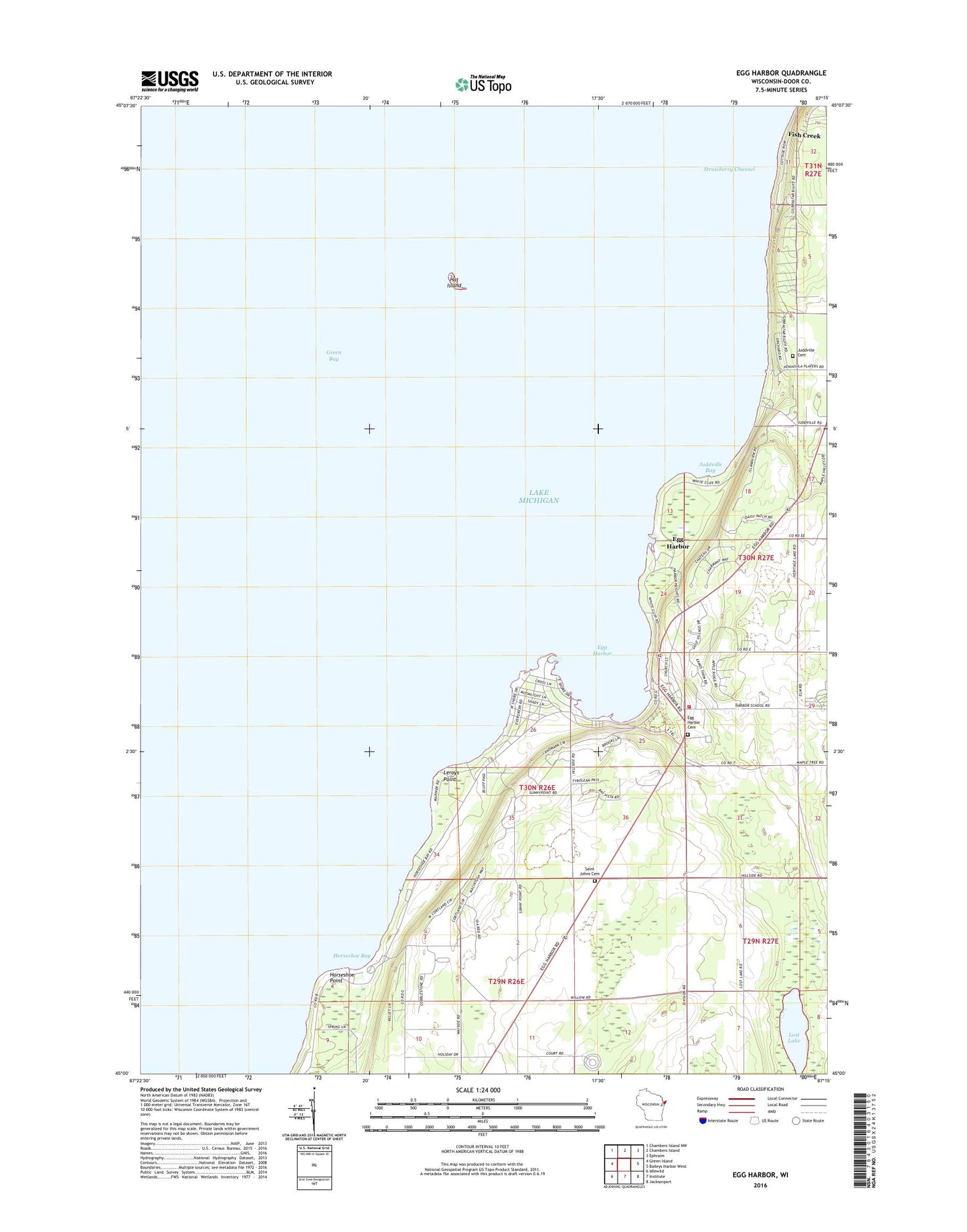
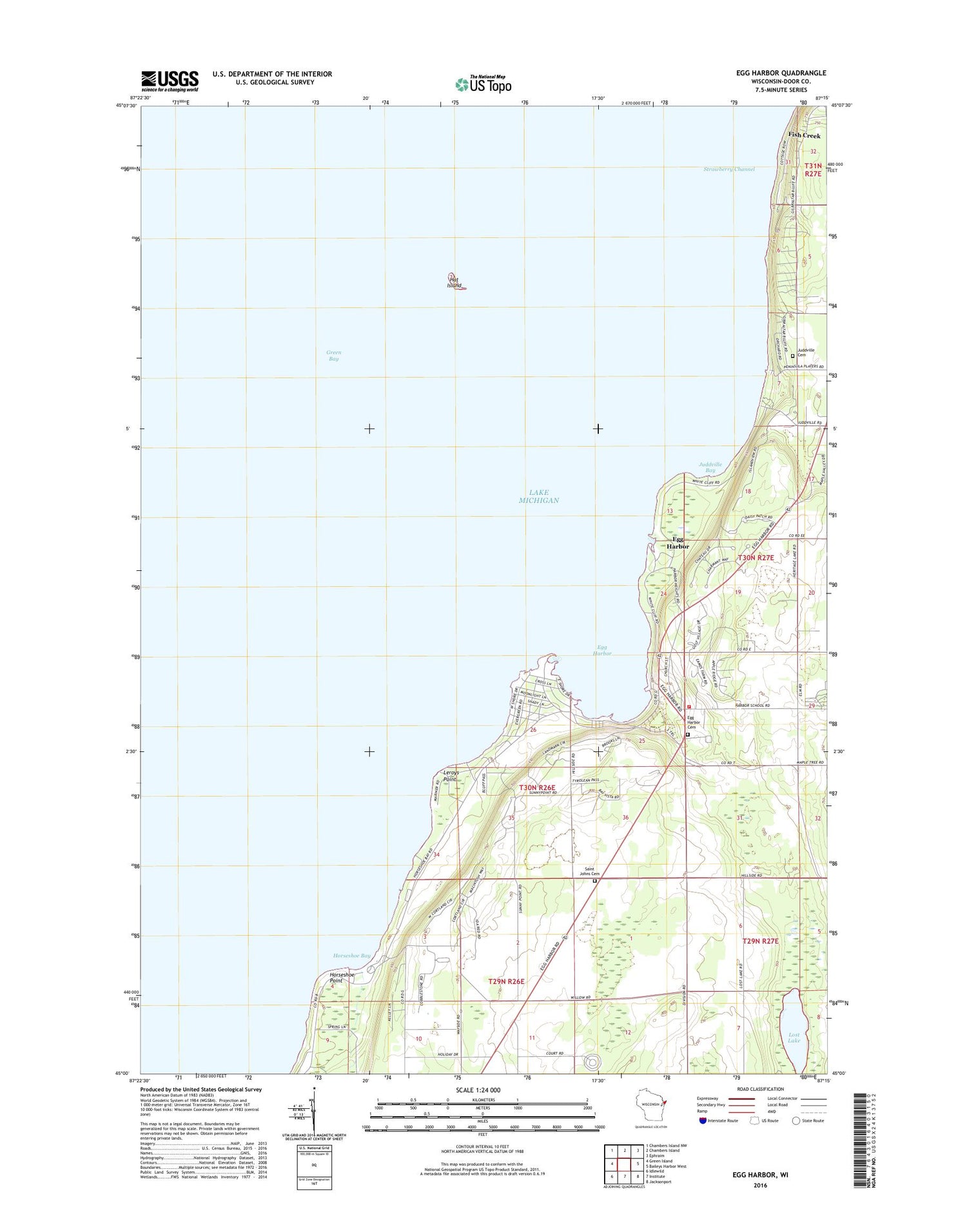
2018 topographic map quadrangle Egg Harbor in the state of Wisconsin. Scale: 1:24000. Based on the newly updated USGS 7.5' US Topo map series, this map is in the following counties: Door. The map contains contour data, water features, and other items you are used to seeing on USGS maps, but also has updated roads and other features. This is the next generation of topographic maps. Printed on high-quality waterproof paper with UV fade-resistant inks.
Quads adjacent to this one:
West: Green Island
Northwest: Chambers Island NW
North: Chambers Island
Northeast: Ephraim
East: Baileys Harbor West
Southeast: Jacksonport
South: Institute
Southwest: Idlewild
Contains the following named places: Alpine Country Club, Door County Library Egg Harbor Branch, Egg Harbor, Egg Harbor Cemetery, Egg Harbor Fire Department Station 1, Egg Harbor Post Office, Egg Harbor Wastewater Treatment Plant, Evangelical Church, Hat Island, Hillcrest Orchard, Horseshoe Bay, Horseshoe Point, Juddville Bay, Juddville Cemetery, Leroys Point, Lost Lake, Murphy County Park, Orchards Golf Course, Saint John the Baptist Cemetery, School Number One, Sunny Point School, Sunnypoint Gardens, Tanck Family Dairy, Town of Egg Harbor, Upper Lost Lake, Village of Egg Harbor, White Cliff Fen And Forest State Natural Area, ZIP Code: 54209