MyTopo
Institute Wisconsin US Topo Map
Couldn't load pickup availability
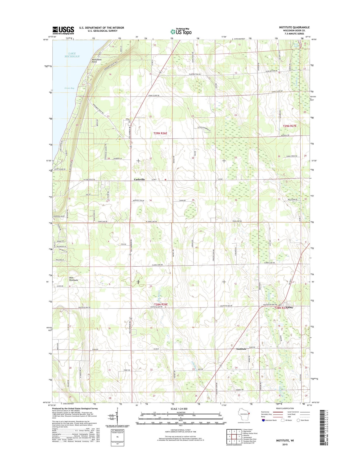
2022 topographic map quadrangle Institute in the state of Wisconsin. Scale: 1:24000. Based on the newly updated USGS 7.5' US Topo map series, this map is in the following counties: Door. The map contains contour data, water features, and other items you are used to seeing on USGS maps, but also has updated roads and other features. This is the next generation of topographic maps. Printed on high-quality waterproof paper with UV fade-resistant inks.
Quads adjacent to this one:
West: Idlewild
Northwest: Green Island
North: Egg Harbor
Northeast: Baileys Harbor West
East: Jacksonport
Southeast: Jacksonport SW
South: Sturgeon Bay East
Southwest: Sturgeon Bay West
This map covers the same area as the classic USGS quad with code o44087h3.
Contains the following named places: Carlsville, Cedar Breeze Farm, Cherrydale Farm, Cherryland Dairy Farm, Choice Orchards, Country View Farms, Door Peninsula, Egg Harbor Fire Department Station 2, Fellner Orchards, Giesel Dairy Farm, Homestead Farm, Institute, Keller Farm, Kuehn Acres Farm, Low Valley Farm, Meikle Farms, Monument Point, Monument Shoal, Pepperdine Golf Course, S and B Farm, Saint Johns Church, Saint Peter and Paul School, Schopf Hillside Dairy, Sevastopol Elementary School, Sevastopol High School, Sevastopol Junior High School, Sevastopol Preschool, Sevastopol School, Sevastpool School, Smejkal Farm, State Agricultural Experimental Station, Sunny Slope Farms, Sunny Slope Runway Airport, Valmy, Walker Road Quarry, WDOR-FM (Sturgeon Bay), WFNL-FM (Sturgeon Bay), WHET-FM (Sturgeon Bay), WPFF-FM (Sturgeon Bay), WRAH-TV (Sturgeon Bay)