MyTopo
Ephraim Wisconsin US Topo Map
Couldn't load pickup availability
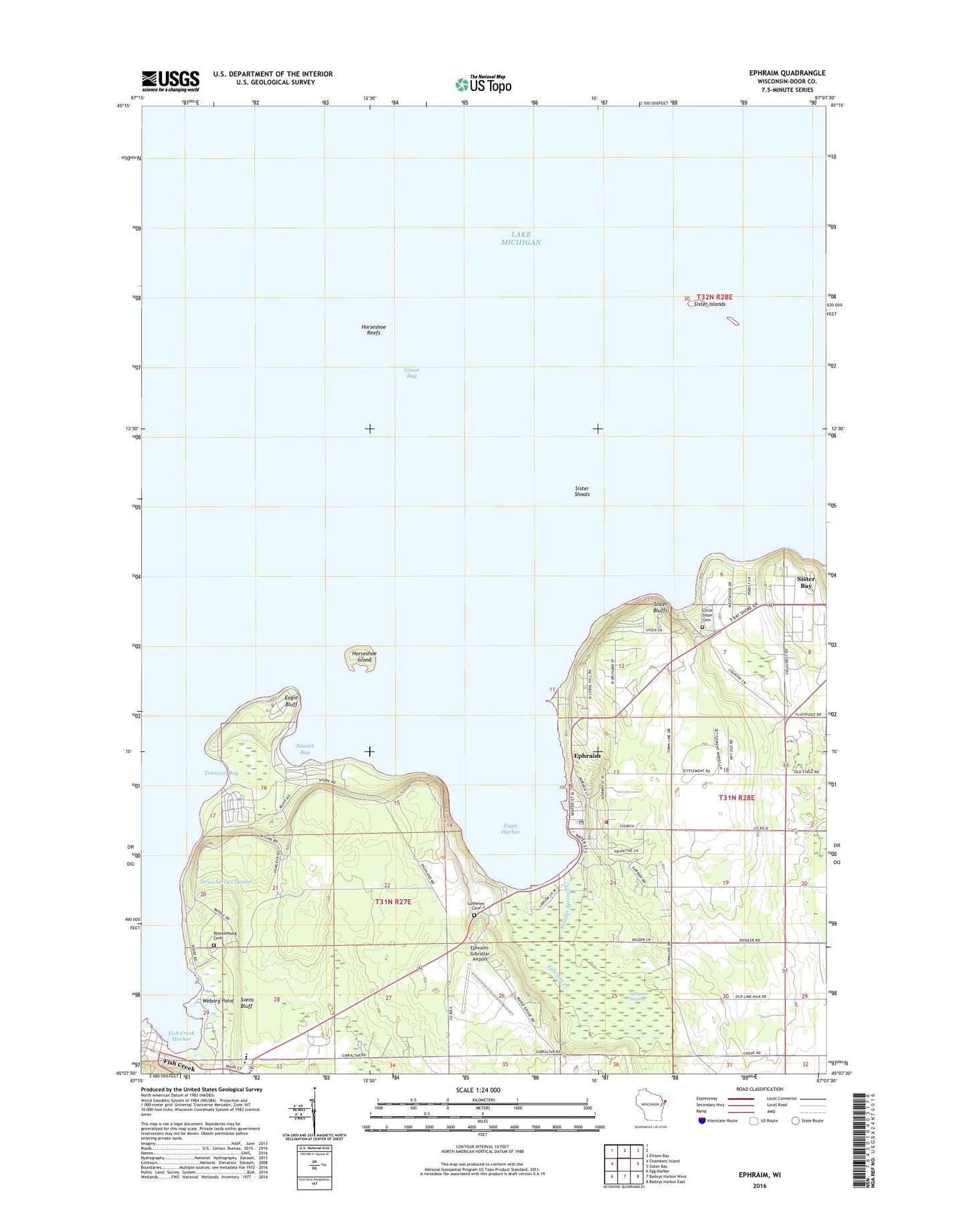
2022 topographic map quadrangle Ephraim in the state of Wisconsin. Scale: 1:24000. Based on the newly updated USGS 7.5' US Topo map series, this map is in the following counties: Door. The map contains contour data, water features, and other items you are used to seeing on USGS maps, but also has updated roads and other features. This is the next generation of topographic maps. Printed on high-quality waterproof paper with UV fade-resistant inks.
Quads adjacent to this one:
West: Chambers Island
Northeast: Ellison Bay
East: Sister Bay
Southeast: Baileys Harbor East
South: Baileys Harbor West
Southwest: Egg Harbor
This map covers the same area as the classic USGS quad with code o45087b2.
Contains the following named places: Bay Ridge Golf Club, Bethany Lutheran Cemetery, Blossomberg Cemetery, Door County Library Ephraim Branch, Door County Library Fish Creek Branch, Eagle Bluff, Eagle Bluff Light, Eagle Harbor, Ephraim, Ephraim Creek, Ephraim Fire Department, Ephraim Post Office, Ephraim Swamp, Ephraim Wastewater Treatment Plant, Ephraim Yacht Harbor Incorporated, Ephraim-Gibraltar Airport, Fish Creek, Fish Creek Harbor, Fish Creek Post Office, Gibraltar Elementary School, Gibraltar Secondary School, Hidden Springs Creek, Horseshoe Island, Horseshoe Reefs, Little Sister Cemetery, Nicolet Bay, Peninsula Park Beech Forest State Natural Area, Peninsula Park White Cedar Forest State Natural Area, Peninsula State Park, Penninsula Golf Club, Pioneer School, Settlement School, Sister Bluffs, Sister Islands, Sister Islands State Natural Area, Sister Shoals, Skyway Drive-In, Svens Bluff, Tennison Bay, Village of Ephraim, Village of Sister Bay, Weborg Point, ZIP Code: 54211