MyTopo
Jacksonport Wisconsin US Topo Map
Couldn't load pickup availability
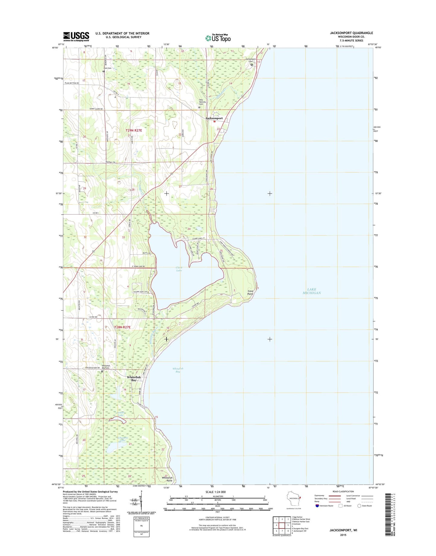
2022 topographic map quadrangle Jacksonport in the state of Wisconsin. Scale: 1:24000. Based on the newly updated USGS 7.5' US Topo map series, this map is in the following counties: Door. The map contains contour data, water features, and other items you are used to seeing on USGS maps, but also has updated roads and other features. This is the next generation of topographic maps. Printed on high-quality waterproof paper with UV fade-resistant inks.
Quads adjacent to this one:
West: Institute
Northwest: Egg Harbor
North: Baileys Harbor West
Northeast: Baileys Harbor East
South: Jacksonport SW
Southwest: Sturgeon Bay East
This map covers the same area as the classic USGS quad with code o44087h2.
Contains the following named places: Arbter Lake, Butler Pond, Cave Point, Cave Point County Park, Clark Lake, Farview School, Hibbard Creek, Holy Nativity Cemetery, Holy Nativity Church, Jacksonport, Jacksonport Fire Department, Lakeview Cemetery, Logan Creek, Quiteside Acres, Schauer Park, Schwartz Lake, Sevastopol Township Park, Whitefish Bay, Whitefish Bay Cemetery, Whitefish Bay Creek, Whitefish Bay Farm, Whitefish Dunes State Natural Area, Whitefish Point, Zion Church, Zion Lutheran Cemetery, Zion Lutheran School