MyTopo
Baileys Harbor West Wisconsin US Topo Map
Couldn't load pickup availability
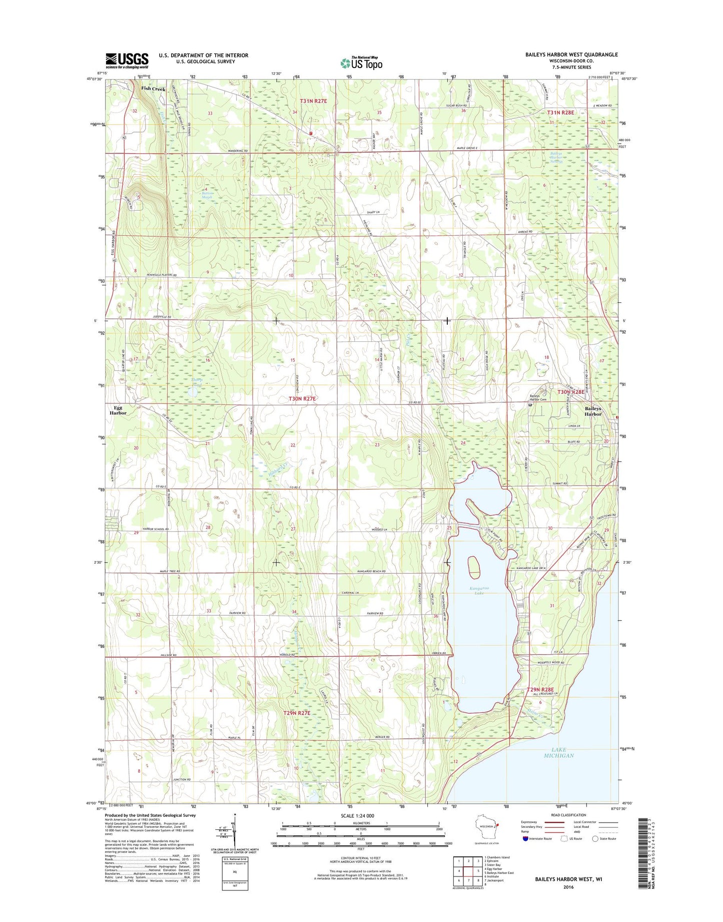
2022 topographic map quadrangle Baileys Harbor West in the state of Wisconsin. Scale: 1:24000. Based on the newly updated USGS 7.5' US Topo map series, this map is in the following counties: Door. The map contains contour data, water features, and other items you are used to seeing on USGS maps, but also has updated roads and other features. This is the next generation of topographic maps. Printed on high-quality waterproof paper with UV fade-resistant inks.
Quads adjacent to this one:
West: Egg Harbor
Northwest: Chambers Island
North: Ephraim
Northeast: Sister Bay
East: Baileys Harbor East
South: Jacksonport
Southwest: Institute
This map covers the same area as the classic USGS quad with code o45087a2.
Contains the following named places: Baileys Harbor Census Designated Place, Baileys Harbor Fire Department, Baileys Harbor Swamp, Baileys Harbor Town Cemetery, Bley Farms, Boynton Chapel, Button Marsh, Door County Quarries, Gibraltar Fire and Rescue Department, Gray Air Dairy Farm, Haberli Farms, Heins Creek, Jarman Quarry, Kangaroo Lake, Kangaroo Lake State Natural Area, Lighting Strikes Orchard, Lyle-Harter-Matter County Park, Maxwelton Country Club, Meridian County Park, Peil Creek, Peninsula Center, Saint Mary's of the Lake Cemetery, Saint Paul's Lutheran Church, Sky Harbor Landing Strip, Thorp Pond, Thorp Pond State Natural Area, Zion Church, ZIP Codes: 54202, 54212