MyTopo
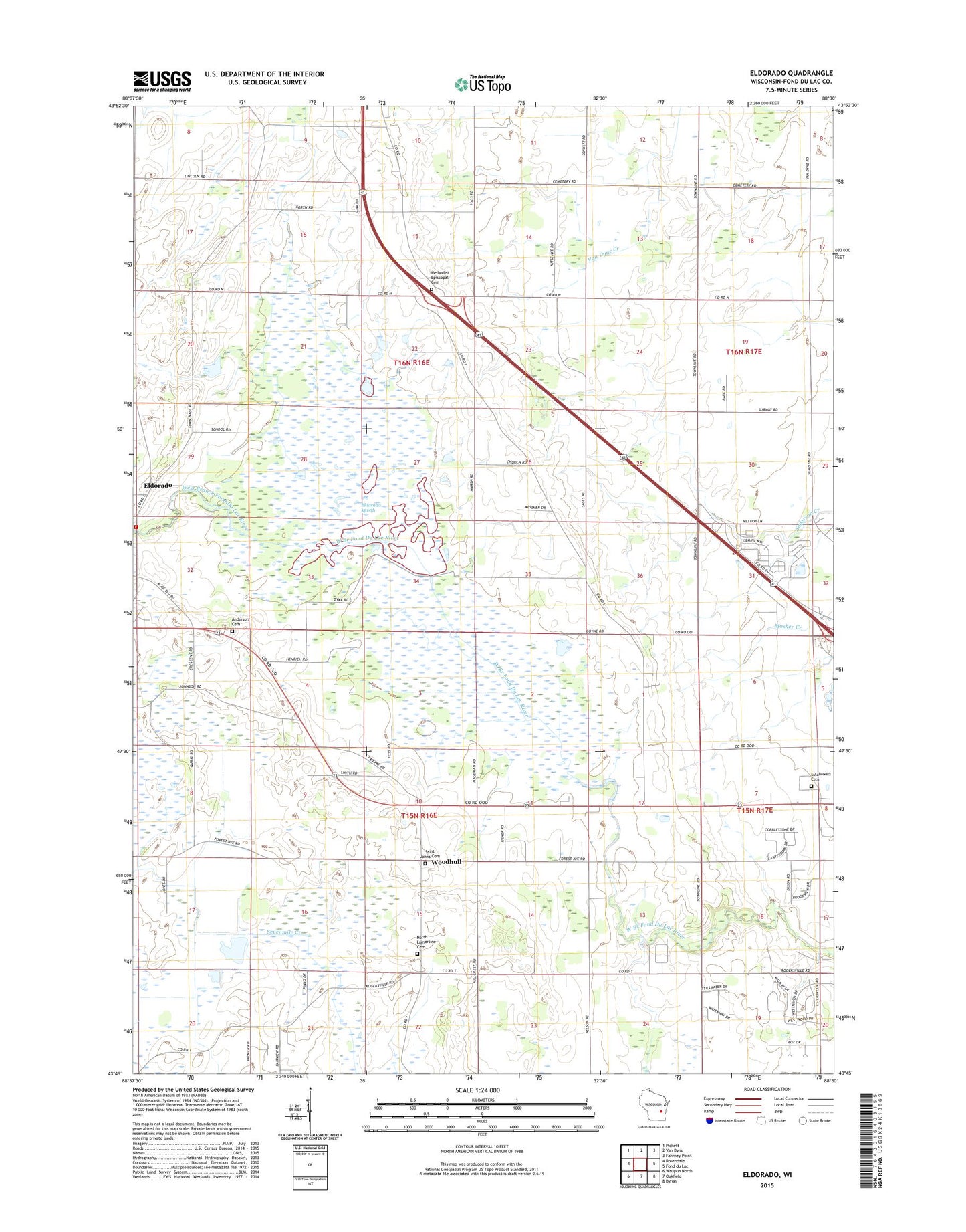
Eldorado Wisconsin US Topo Map
Couldn't load pickup availability
2018 topographic map quadrangle Eldorado in the state of Wisconsin. Scale: 1:24000. Based on the newly updated USGS 7.5' US Topo map series, this map is in the following counties: Fond du Lac. The map contains contour data, water features, and other items you are used to seeing on USGS maps, but also has updated roads and other features. This is the next generation of topographic maps. Printed on high-quality waterproof paper with UV fade-resistant inks.
Quads adjacent to this one:
West: Rosendale
Northwest: Pickett
North: Van Dyne
Northeast: Fahrney Point
East: Fond du Lac
Southeast: Byron
South: Oakfield
Southwest: Waupun North
Contains the following named places: Anderson Cemetery, Ash Grove School, B D Leith School, Boxelder Line School, Century Farms, Clark School, Crescent School, Eldorado, Eldorado Marsh, Eldorado Post Office, Eldorado State Public Hunting Grounds, Eldorado Volunteer Fire Department, Elmwood School, Estabrooks Cemetery, Franklin School, Gallitz Farms, High Ridge School, James Otis School, Longfellow School, Maple Grove School, Methodist Episcopal Cemetery, North Lamartine Cemetery, Our Risen Savior Catholic Church Cemetery, Pine Drive Dairy, Randolph School, Ridge Road School, Saint Johns Church, Saint Pauls Church, Saint Pauls School, Salem Church, Town Hall School, Town of Eldorado, Town of Fond du Lac, Town of Lamartine, West Terrace Farm, Woodhull, Woodhull Station, ZIP Codes: 54932, 54979