MyTopo
Byron Wisconsin US Topo Map
Couldn't load pickup availability
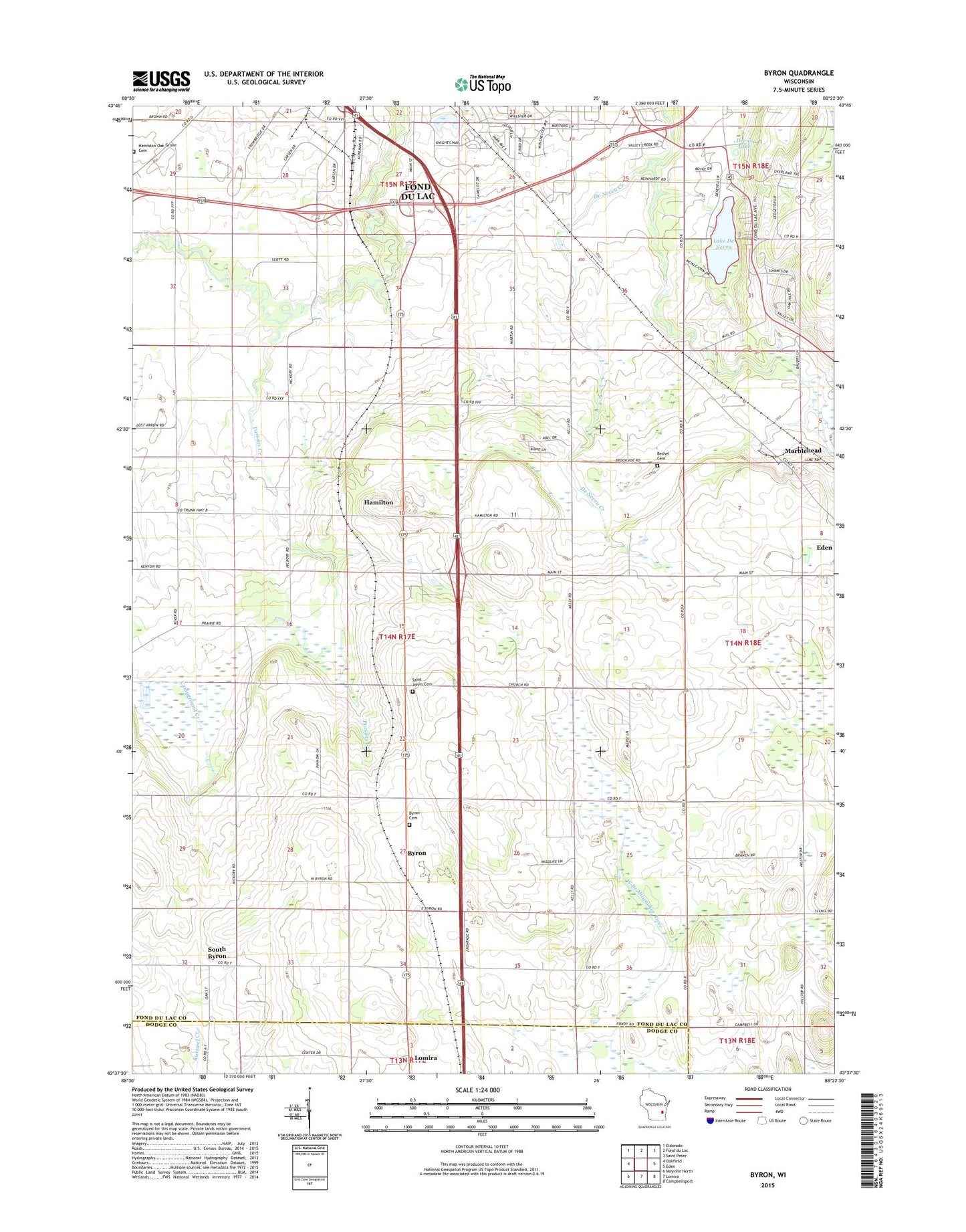
2022 topographic map quadrangle Byron in the state of Wisconsin. Scale: 1:24000. Based on the newly updated USGS 7.5' US Topo map series, this map is in the following counties: Fond du Lac, Dodge. The map contains contour data, water features, and other items you are used to seeing on USGS maps, but also has updated roads and other features. This is the next generation of topographic maps. Printed on high-quality waterproof paper with UV fade-resistant inks.
Quads adjacent to this one:
West: Oakfield
Northwest: Eldorado
North: Fond du Lac
Northeast: Saint Peter
East: Eden
Southeast: Campbellsport
South: Lomira
Southwest: Mayville North
This map covers the same area as the classic USGS quad with code o43088f4.
Contains the following named places: Abel Dairy Farms, Anderson School, Baier Landing Strip, Bee Bow Acres, Bethel Cemetery, Bethel Church, Brookside School, Byron, Byron Cemetery, Camp Byron, Camp Ground School, Cottonwood Creek Farms, Crailoo Dairy Farm, Deldale Farm, Devils Lake, Eden Quarry, Fond du Lac Quarry, Grandview School, Guellcrest Farm, Hamilton, Harrison School, Homiston School, Jefferson School, K View Farm, Lake De Neveu, Marblehead, Marshall School, Oak Grove Cemetery, Oak View Farms, Parsons Creek, Rolling Meadows Golf Course, Saint John Catholic Cemetery, Saint Johns Church, Saint Johns School, Schmitz Family Farm, South Byron, Town of Byron, Vir - Clar Farm, Willow Lawn School, Zinkes Farms