MyTopo
Nichols Wisconsin US Topo Map
Couldn't load pickup availability
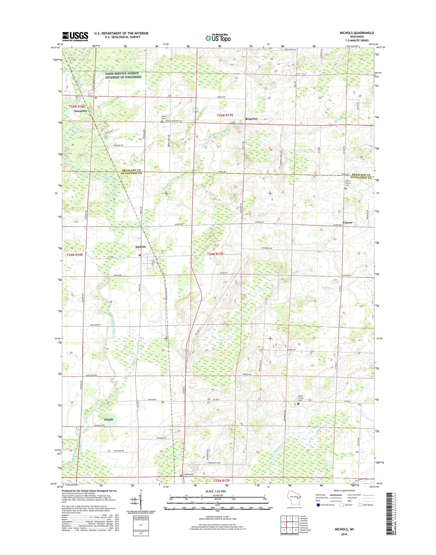
2022 topographic map quadrangle Nichols in the state of Wisconsin. Scale: 1:24000. Based on the newly updated USGS 7.5' US Topo map series, this map is in the following counties: Outagamie, Shawano. The map contains contour data, water features, and other items you are used to seeing on USGS maps, but also has updated roads and other features. This is the next generation of topographic maps. Printed on high-quality waterproof paper with UV fade-resistant inks.
Quads adjacent to this one:
West: Leeman
Northwest: Lunds
North: Bonduel
Northeast: Zachow
East: Seymour
Southeast: Freedom
South: Black Creek
Southwest: Shiocton
This map covers the same area as the classic USGS quad with code o44088e4.
Contains the following named places: Briarton, Cicero, Emmanuel Church, Herman Creek, Immanuel Lutheran Cemetery, Mink Creek, Navarino, Navarino Census Designated Place, Navarino Lessor Fire Department, Nichols, Nichols Post Office, Nichols Rural Fire Department, Nichols Wastewater Treatment Facility, North Cicero Cemetery, Saint Johns Church, South Cicero Cemetery, Spring Brook School, Sunny Nook School, Sunny Valley School, Toad Creek, Town of Cicero, Union Cemetery, United Brethren Church, Village of Nichols