
MyTopo
Gillett Wisconsin US Topo Map
Couldn't load pickup availability
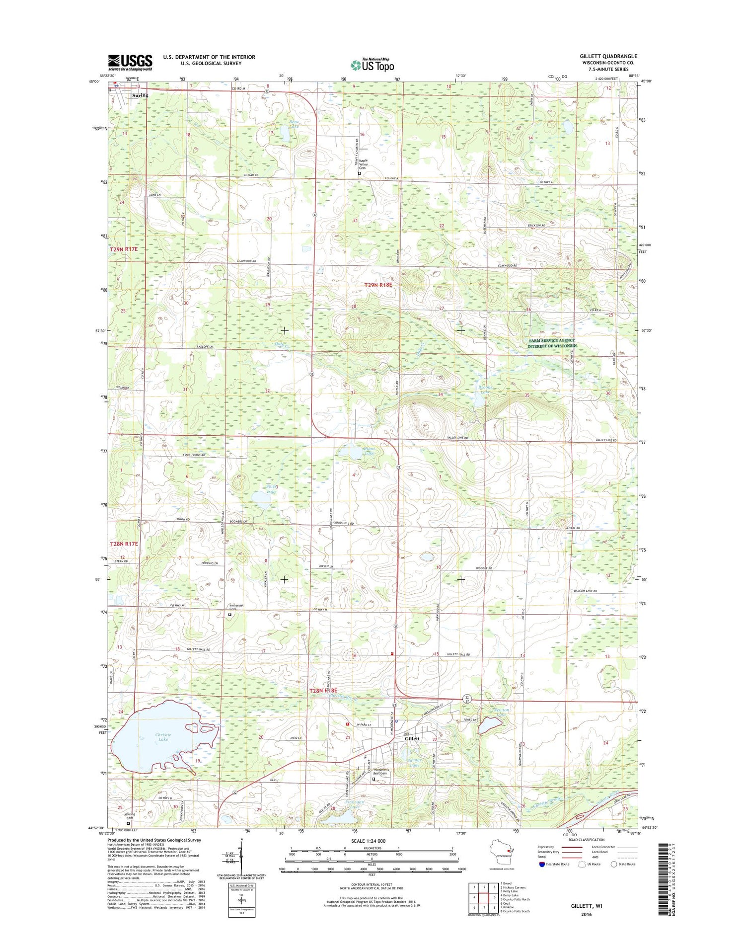
2018 topographic map quadrangle Gillett in the state of Wisconsin. Scale: 1:24000. Based on the newly updated USGS 7.5' US Topo map series, this map is in the following counties: Oconto. The map contains contour data, water features, and other items you are used to seeing on USGS maps, but also has updated roads and other features. This is the next generation of topographic maps. Printed on high-quality waterproof paper with UV fade-resistant inks.
Quads adjacent to this one:
West: Berry Lake
Northwest: Breed
North: Hickory Corners
Northeast: Kelly Lake
East: Oconto Falls North
Southeast: Oconto Falls South
South: Krakow
Southwest: Cecil
Contains the following named places: Apple Orchard School, Benz Lake, Brooks Lake, Christie Brook, Christie Lake, City of Gillett, Claywood School, Clover Nook School, Finnegan Lake, Four Town School, Gillett, Gillett Area Ambulance Service, Gillett Church, Gillett Elementary School, Gillett High School, Gillett Middle School, Gillett Police Department, Gillett Post Office, Gillett Township Volunteer Fire Department, Gillett Volunteer Fire Department, Gillett Wastewater Plant, Hickory Church, Immanuel Evangelical Lutheran Cemetery, Immanuel Lutheran Church, Immanuel School, Klaus Lake, Maple Valley Cemetery, Maple Valley Orchard and Nursery, Mosling Lutheran Cemetery, Newton Lake, Savage Lake, Spice Lake, Spring Hill School, Suring, Suring Area Public Library, Suring Police Department, Suring Post Office, Town of Gillett, Town of Maple Valley, Trinity Church, Valley Line School, Wanderer's Rest Cemetery, ZIP Code: 54124


