MyTopo
Cecil Wisconsin US Topo Map
Couldn't load pickup availability
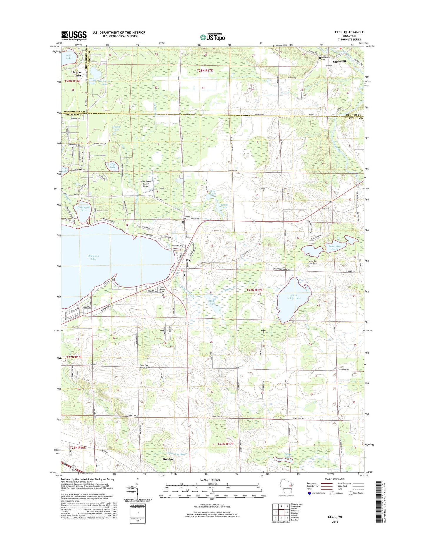
2022 topographic map quadrangle Cecil in the state of Wisconsin. Scale: 1:24000. Based on the newly updated USGS 7.5' US Topo map series, this map is in the following counties: Shawano, Oconto, Menominee. The map contains contour data, water features, and other items you are used to seeing on USGS maps, but also has updated roads and other features. This is the next generation of topographic maps. Printed on high-quality waterproof paper with UV fade-resistant inks.
Quads adjacent to this one:
West: Shawano
Northwest: Legend Lake
North: Berry Lake
Northeast: Gillett
East: Krakow
Southeast: Zachow
South: Bonduel
Southwest: Lunds
This map covers the same area as the classic USGS quad with code o44088g4.
Contains the following named places: Arrowhead Lake, Bahr Lake, Bass Lake, Cecil, Cecil - Washington Fire Department, Cecil Post Office, Deer Haven Ranch Airport, Duchess Creek, Korth Lake, Lakeview Cemetery, Lily Lake, Loon Creek, Milk-N-More Farms, Mud Lake, Pautz Lake, Pensaukee Lakes, Pickerel Creek, Saint Martin Catholic Cemetery, Saint Paul Lutheran Cemetery, Saint Pauls Church, Shawano Lake State Fishery Area, Spring Lake, Town of Washington, Tracy Corners, Underhill Cemetery, Underhill Fire Department, Village of Cecil, Warington Lake, Washington Lake, White Clay Lake, White Clay Lake Cemetery, White Clay Lake Church, Wolf River Lutheran High School, ZIP Code: 54111