MyTopo
Harris Lake Wisconsin US Topo Map
Couldn't load pickup availability
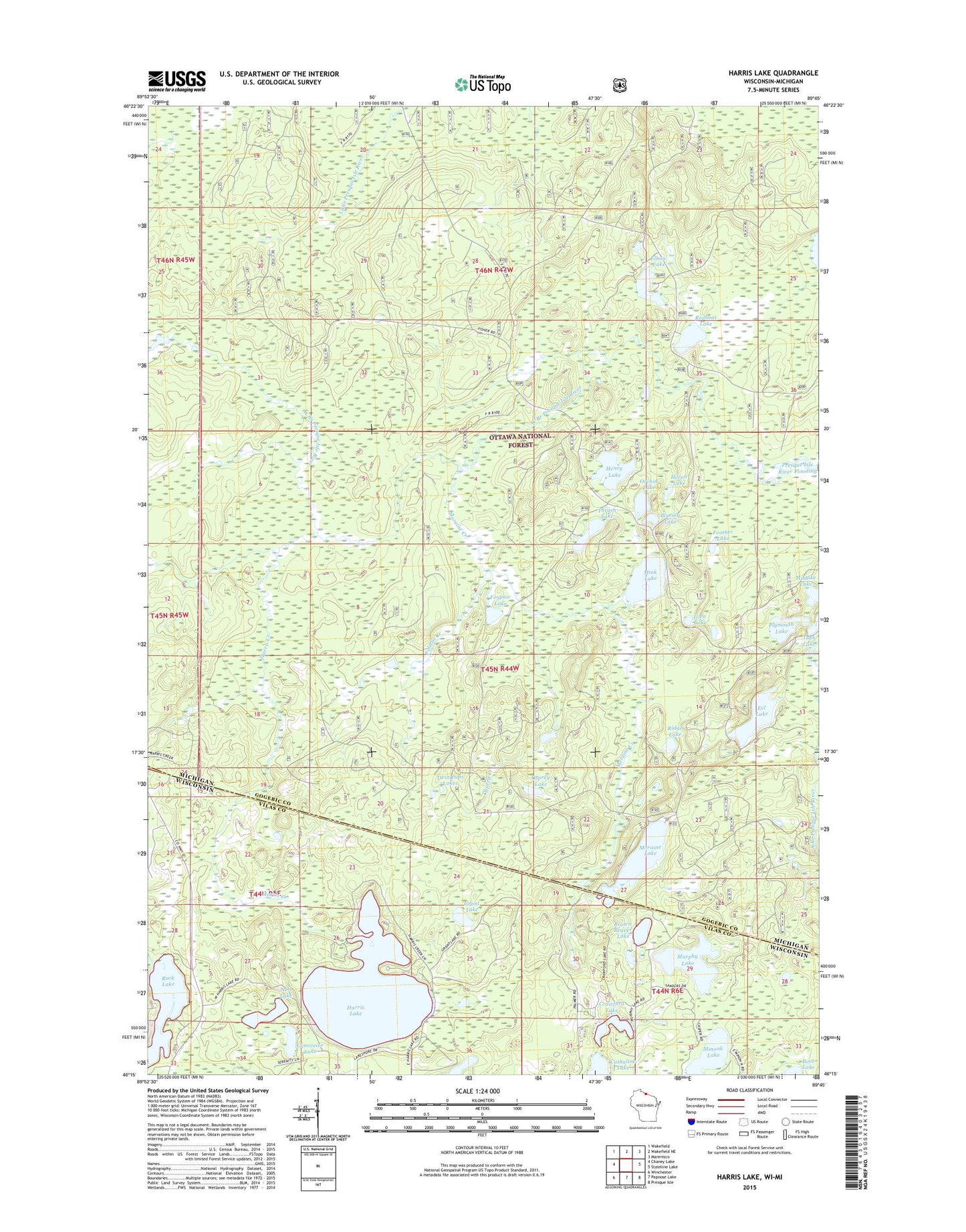
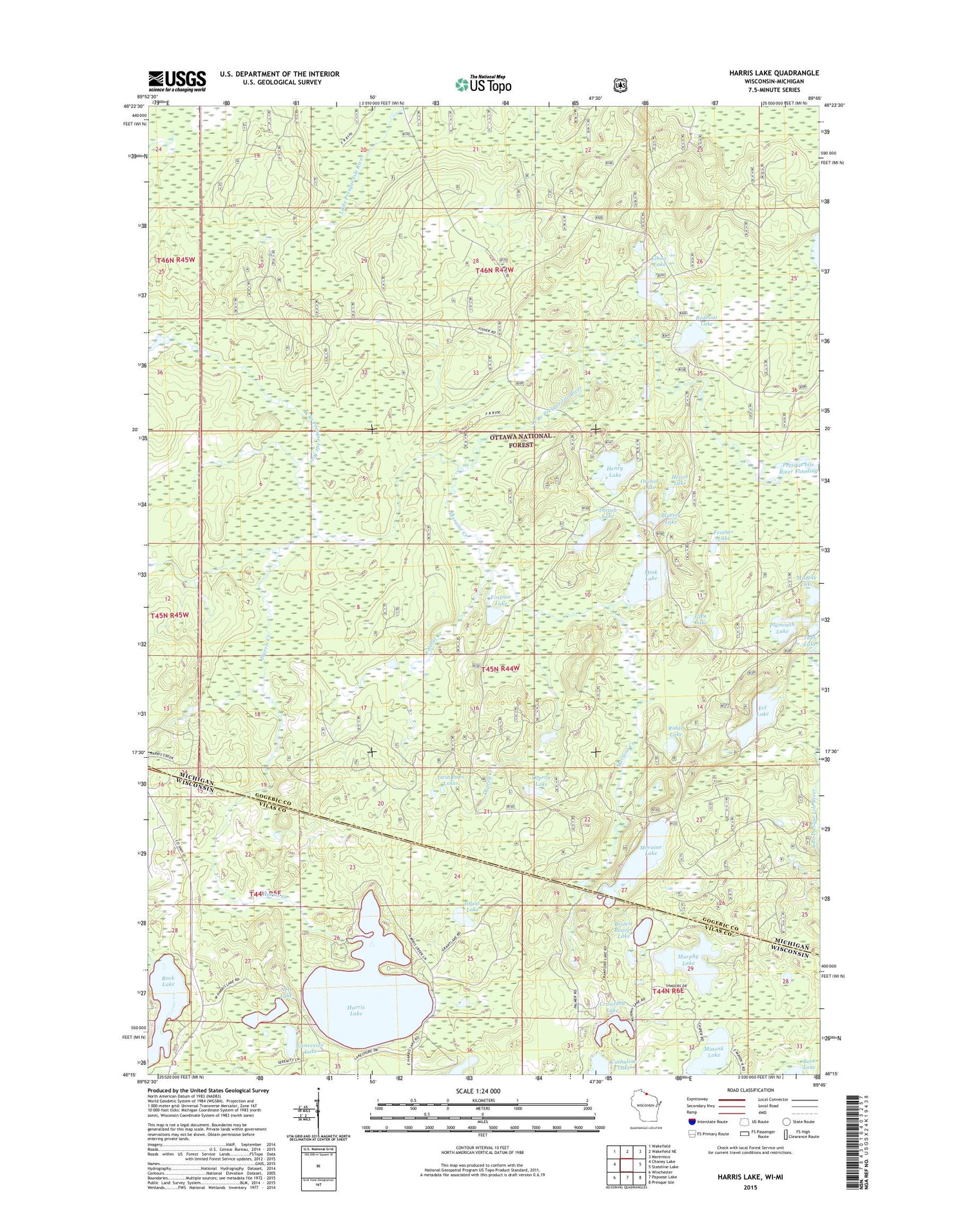
2018 topographic map quadrangle Harris Lake in the states of Wisconsin, Michigan. Scale: 1:24000. Based on the newly updated USGS 7.5' US Topo map series, this map is in the following counties: Vilas, Gogebic. The map contains contour data, water features, and other items you are used to seeing on USGS maps, but also has updated roads and other features. This is the next generation of topographic maps. Printed on high-quality waterproof paper with UV fade-resistant inks.
Quads adjacent to this one:
West: Chaney Lake
Northwest: Wakefield
North: Wakefield NE
Northeast: Marenisco
East: Stateline Lake
Southeast: Presque Isle
South: Papoose Lake
Southwest: Winchester
Contains the following named places: Anne Lake, Bluejay Lake, Brown Beaver Lake, Cathaline Lake, Crawford Lake, Eel Lake, Elbow Lake, Feather Lake, Foxpaw Lake, Geneveive Lake, Glen Lake, Grant Lake, Harris Creek, Harris Lake, Henry Lake, Henry Lake Campground, Heron Lake, Mink Lake, Mishike Lake, Moraine Creek, Moraine Lake, Murphy Lake, Nell Lake, Orchid Lake, Osprey Creek, Osprey Lake, Plymouth Lake, Polecat Creek, Redboat Lake, Ridge Lake, Rock Lake, Thrush Lake, Twin Pups Lakes