MyTopo
Chaney Lake Michigan US Topo Map
Couldn't load pickup availability
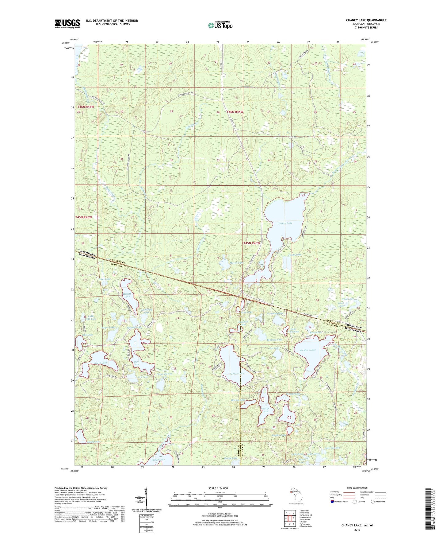
2023 topographic map quadrangle Chaney Lake in the states of Michigan, Wisconsin. Scale: 1:24000. Based on the newly updated USGS 7.5' US Topo map series, this map is in the following counties: Gogebic, Iron, Vilas. The map contains contour data, water features, and other items you are used to seeing on USGS maps, but also has updated roads and other features. This is the next generation of topographic maps. Printed on high-quality waterproof paper with UV fade-resistant inks.
Quads adjacent to this one:
West: Lake Evelyn
Northwest: Bessemer
North: Wakefield
Northeast: Wakefield NE
East: Harris Lake
Southeast: Papoose Lake
South: Winchester
Southwest: Mercer
Contains the following named places: Beatrice Lake, Bena Lake, Camp Twelve Lake, Chaney Lake, Christopher Creek, Constance Lake, Cranberry Lake, Dumbell Lake, Etna Lake, Findler Lake, Fox Lake, George Lake, Gretchen Lake, Hawk Lake, Hewitt Lake, Hill Lake, Hook Lake, Jeannie Lake, Joann Lake, Lake Franchian, Lake Helen, Lake Rose, Lake Yolanda, Little Oak Lake, Lynx Lake, Marell Lake, Marion Lake, Mary Lake, Mary Lake State Natural Area, McFadyen Dam, Mosinee Creek, Negro Lakes, No Mans Creek, No Mans Lake, Oak Lake, Otter Lake, Owl Lake, Pardee Creek, Pardee Lake, Spinnet Lake, Swamp Lake, Troste Lookout Tower, Trostel Lake, Virgin Lake, Woods Lake