MyTopo
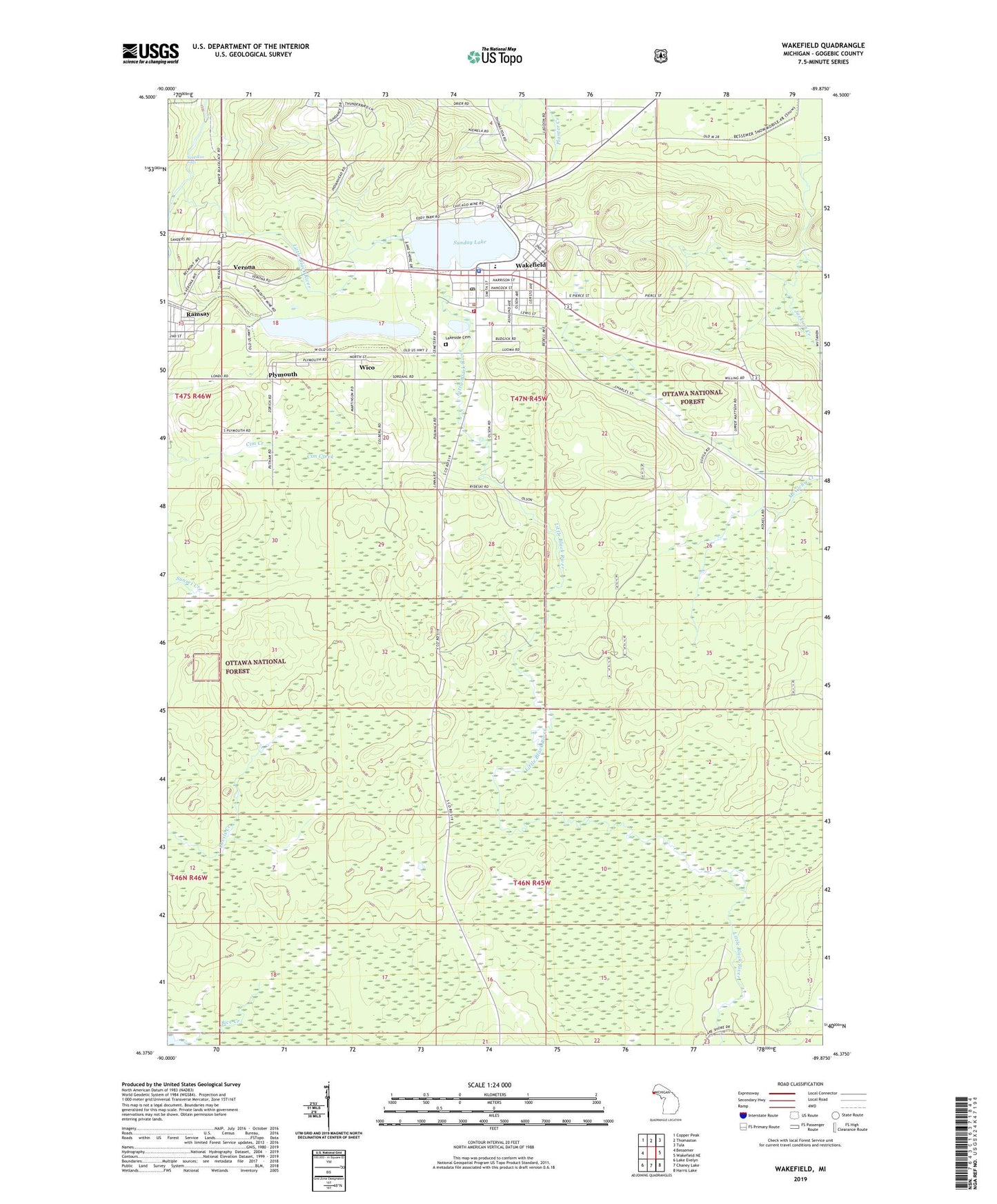
Wakefield Michigan US Topo Map
Couldn't load pickup availability
Also explore the Wakefield Forest Service Topo of this same quad for updated USFS data
2023 topographic map quadrangle Wakefield in the state of Michigan. Scale: 1:24000. Based on the newly updated USGS 7.5' US Topo map series, this map is in the following counties: Gogebic. The map contains contour data, water features, and other items you are used to seeing on USGS maps, but also has updated roads and other features. This is the next generation of topographic maps. Printed on high-quality waterproof paper with UV fade-resistant inks.
Quads adjacent to this one:
West: Bessemer
Northwest: Copper Peak
North: Thomaston
Northeast: Tula
East: Wakefield NE
Southeast: Harris Lake
South: Chaney Lake
Southwest: Lake Evelyn
This map covers the same area as the classic USGS quad with code o46089d8.
Contains the following named places: All Saints Lutheran Church, Alward Creek, Bice Creek, Calvary Baptist Church, Cim Creek, City of Wakefield, Eddy Park, Gogebic County Home, Grace Baptist Church, Grace Open Church, Immaculate Conception Church, Lakeside Cemetery, Little Black River, Michigan State Police District 8 Wakefield Post 86, Neepikon Falls, Plymouth, Plymouth Mine, Ramsay, Ramsay Census Designated Place, Ramsay Lookout Tower, Rocco Medical Clinic, Sunday Lake, Sunday Lake Mine, Township of Bessemer, Trout Creek Fire Hall, Verona, Verona Lookout Tower, Verona Post Office, Wakefield, Wakefield - Marenisco School, Wakefield City Library, Wakefield Police Department, Wakefield Post Office, Wakefield Station, Wakefield United Methodist Church, Wakefield Volunteer Fire Department, Wico, ZIP Codes: 49959, 49968