MyTopo
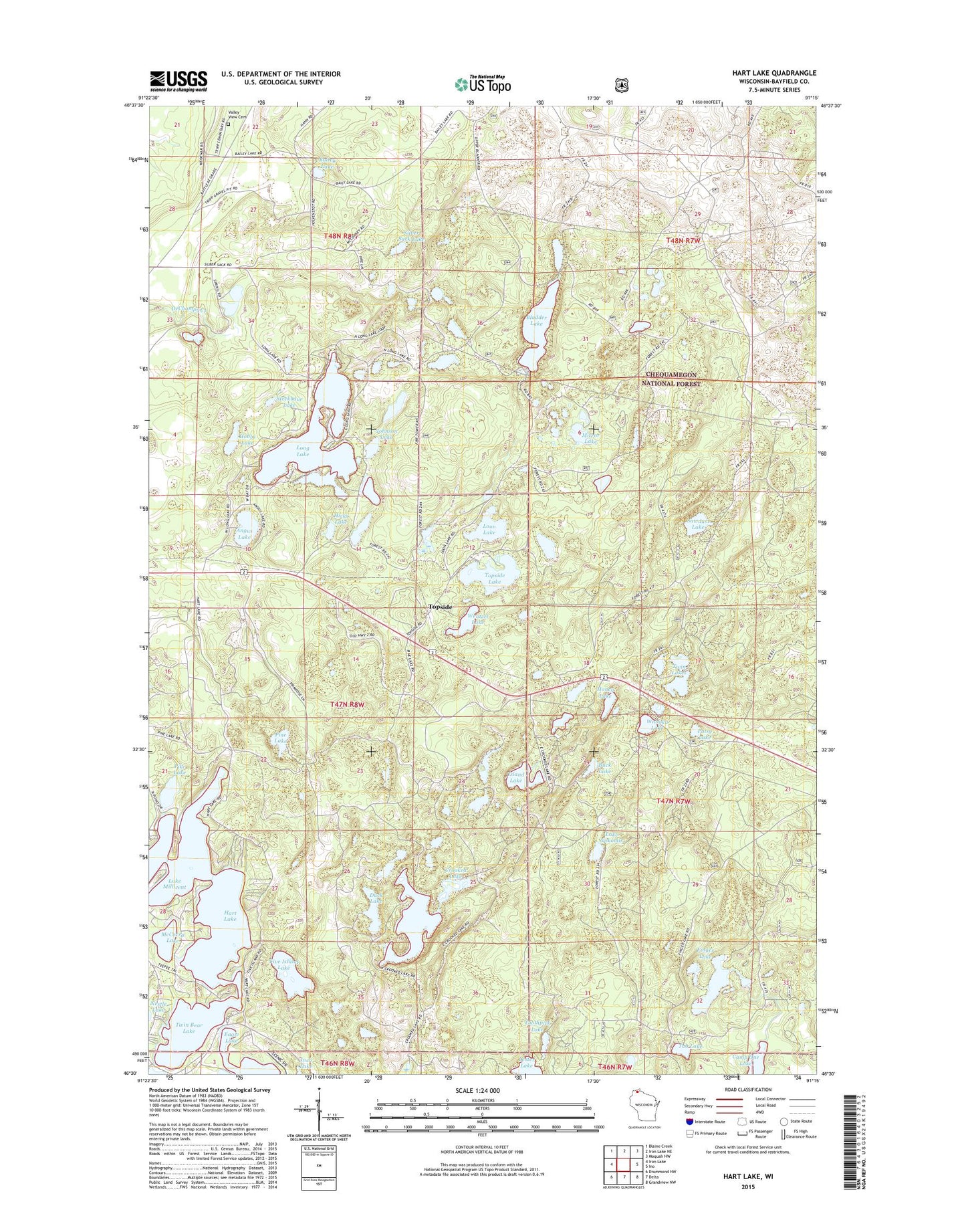
Hart Lake Wisconsin US Topo Map
Couldn't load pickup availability
Also explore the Hart Lake Forest Service Topo of this same quad for updated USFS data
2022 topographic map quadrangle Hart Lake in the state of Wisconsin. Scale: 1:24000. Based on the newly updated USGS 7.5' US Topo map series, this map is in the following counties: Bayfield. The map contains contour data, water features, and other items you are used to seeing on USGS maps, but also has updated roads and other features. This is the next generation of topographic maps. Printed on high-quality waterproof paper with UV fade-resistant inks.
Quads adjacent to this one:
West: Iron Lake
Northwest: Blaine Creek
North: Iron Lake NE
Northeast: Moquah NW
East: Ino
Southeast: Grandview NW
South: Delta
Southwest: Drummond NW
This map covers the same area as the classic USGS quad with code o46091e3.
Contains the following named places: Angus Lake, Bailey Lake, Bladder Lake, Buck Lake, Buskey Bay, Camp One Lake, Crooked Lake, Duck Lake, Finger Lake, Five Island Lake, Hart Lake, Hicks Lake, Hobbs Lake, Honey Lake, Iron River Lookout Tower, Island Lake, Johnson Lake, Lake Millicent, Lake Nokomis, Lester Lake, Long Lake, Loon Lake, McCarry Lake, Mirror Lake, Patsy Lake, Pike Lake, Pine Lake, Sawdust Lake, Silver Sack Lake, Steckbaur Lake, Toothpick Lake, Topside, Topside Lake, Town of Iron River, Tub Lake, Twin Bear Lake, Twin Lakes, Valley View Cemetery, Wanoka Lake, Wanoka Lake Recreation Site, Wentzel Lake