MyTopo
High Falls Reservoir Wisconsin US Topo Map
Couldn't load pickup availability
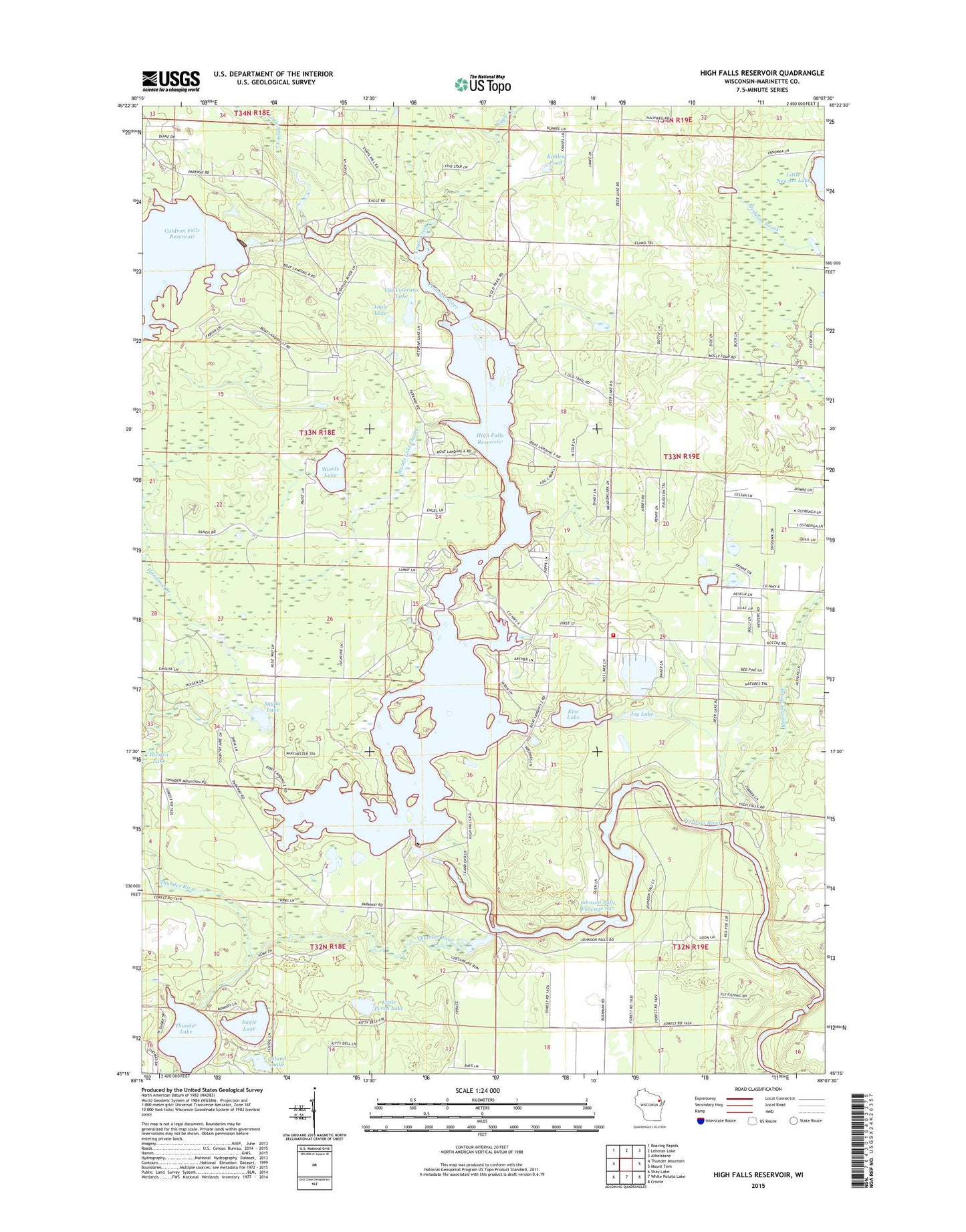
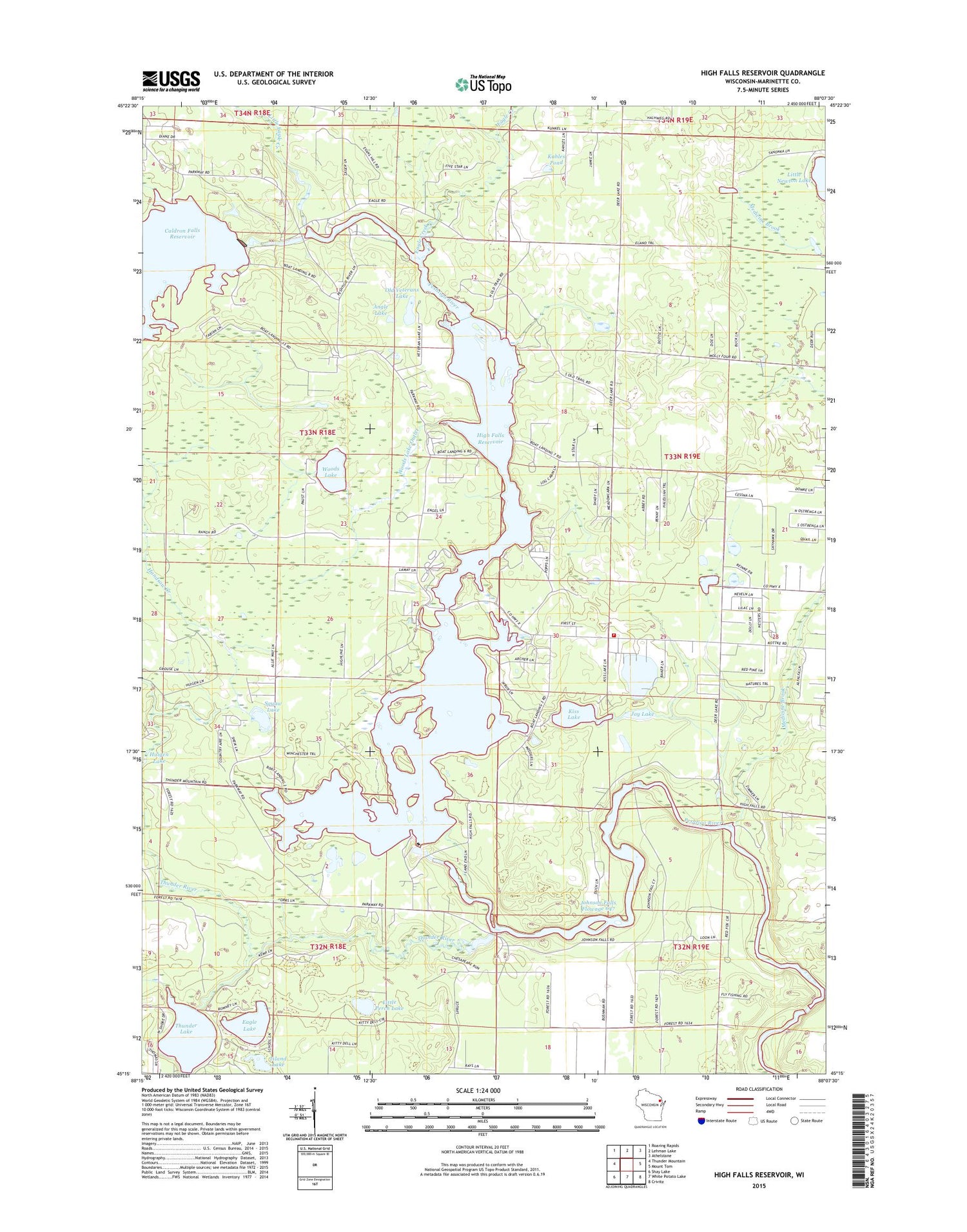
2018 topographic map quadrangle High Falls Reservoir in the state of Wisconsin. Scale: 1:24000. Based on the newly updated USGS 7.5' US Topo map series, this map is in the following counties: Marinette. The map contains contour data, water features, and other items you are used to seeing on USGS maps, but also has updated roads and other features. This is the next generation of topographic maps. Printed on high-quality waterproof paper with UV fade-resistant inks.
Quads adjacent to this one:
West: Thunder Mountain
Northwest: Roaring Rapids
North: Lehman Lake
Northeast: Athelstane
East: Mount Tom
Southeast: Crivitz
South: White Potato Lake
Southwest: Shay Lake
Contains the following named places: Angle Lake, Caldron Falls Dam, Caldron Falls Reservoir 496, Caldron Falls School, Caldron Falls WP186 Dam, Eagle Creek, Eagle Lake, Glen Lake Dam, High Falls 2WP928 Dam, High Falls Dam, High Falls Reservoir, High Falls School, Huigen Lake, Island Lake, Johnson Falls Dam, Johnson Falls Flowage 647, Johnson Falls WP 153 Dam, Joy Lake, Kahles Pond, Kiss Lake, Little Eagle Creek, Little Perch Lake, Medbrook Lake, Medicine Brook, Neveln Field Airport, Old Veteran Lake Park, Old Veterans Lake, Squaw Lake, Stephenson Volunteer Fire Department Town Hall Station, Thunder Lake, Thunder Lake Inlet, Thunder Lake Outlet, Thunder River, Town of Stephenson, Twin Bridge Park, Veterans Memorial Park, Woods Lake, Woods Lake Outlet