MyTopo
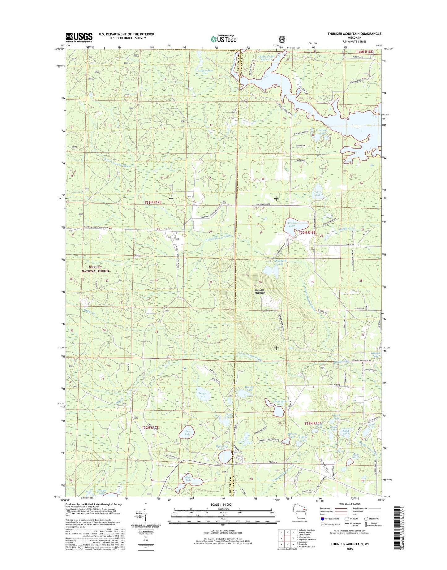
Thunder Mountain Wisconsin US Topo Map
Couldn't load pickup availability
Also explore the Thunder Mountain Forest Service Topo of this same quad for updated USFS data
2022 topographic map quadrangle Thunder Mountain in the state of Wisconsin. Scale: 1:24000. Based on the newly updated USGS 7.5' US Topo map series, this map is in the following counties: Oconto, Marinette. The map contains contour data, water features, and other items you are used to seeing on USGS maps, but also has updated roads and other features. This is the next generation of topographic maps. Printed on high-quality waterproof paper with UV fade-resistant inks.
Quads adjacent to this one:
West: Wheeler Lake
Northwest: McCaslin Mountain
North: Roaring Rapids
Northeast: Lehman Lake
East: High Falls Reservoir
Southeast: White Potato Lake
South: Shay Lake
Southwest: Mountain
This map covers the same area as the classic USGS quad with code o45088c3.
Contains the following named places: Balsam Lake, Borth Lake, Bottle Lake, Boundary Lake, Caldron Falls Reservoir, Camp Bird State Youth Recreational Center, Cedar Lake, Dell Lake, Flower Lake, Forbes Creek, Frieda Lake, Fryingpan Lake, Handsaw Creek, Hay Creek, Hazel Lake, Huber Lake, Kiss Lake, Lackawanna Lake, Ledge Lake, Mirror Lake, Mountain Lake, North Fork Thunder River, Rollins Lake, Sand Lake, South Fork Thunder River, The Spring, Thunder Mountain, Thunder Mountain Ranch, Thunder River State Rearing Station, Twin Bessies, Wonder Lake