MyTopo
Lehman Lake Wisconsin US Topo Map
Couldn't load pickup availability
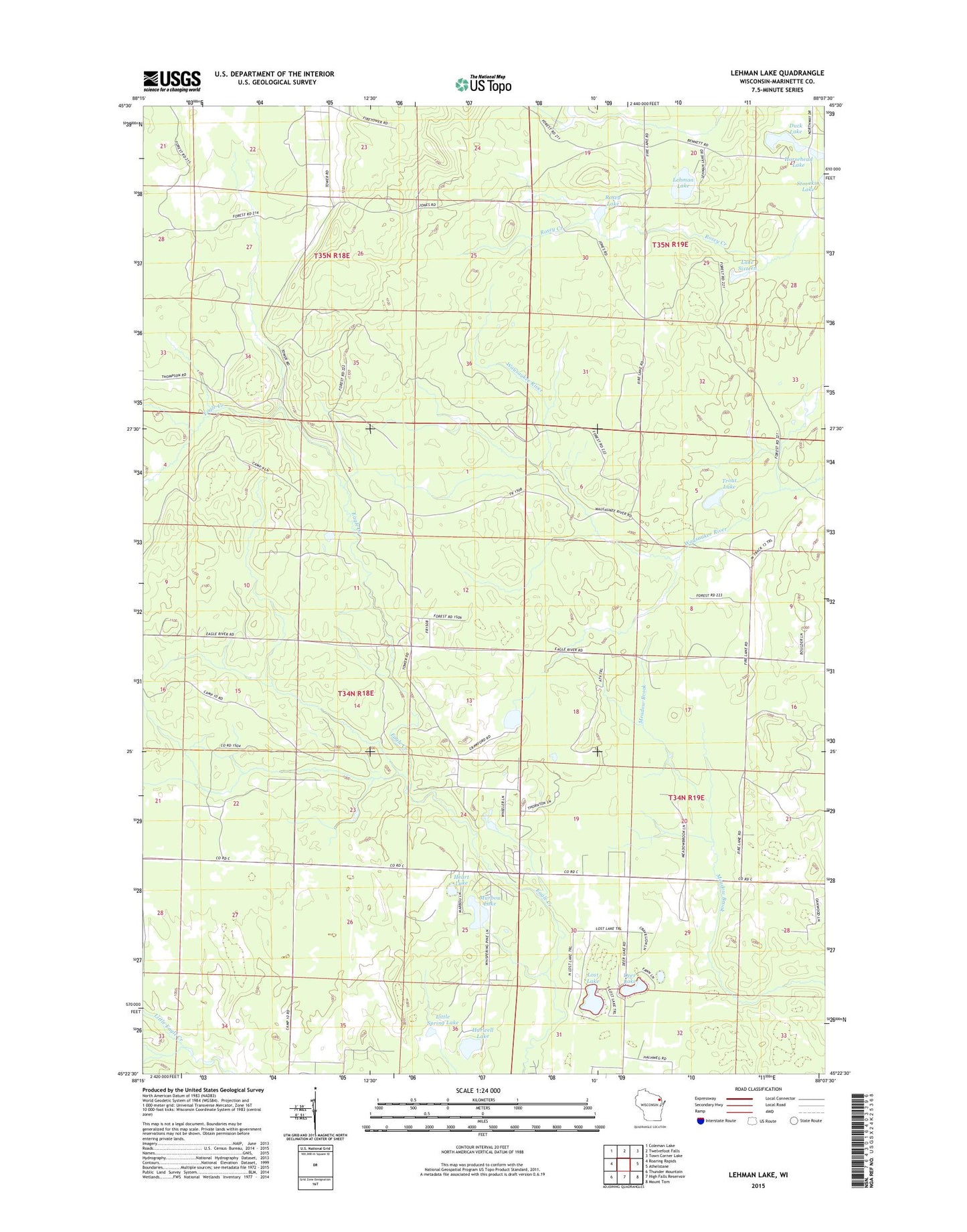
2022 topographic map quadrangle Lehman Lake in the state of Wisconsin. Scale: 1:24000. Based on the newly updated USGS 7.5' US Topo map series, this map is in the following counties: Marinette. The map contains contour data, water features, and other items you are used to seeing on USGS maps, but also has updated roads and other features. This is the next generation of topographic maps. Printed on high-quality waterproof paper with UV fade-resistant inks.
Quads adjacent to this one:
West: Roaring Rapids
Northwest: Coleman Lake
North: Twelvefoot Falls
Northeast: Town Corner Lake
East: Athelstane
Southeast: Mount Tom
South: High Falls Reservoir
Southwest: Thunder Mountain
This map covers the same area as the classic USGS quad with code o45088d2.
Contains the following named places: Deer Lake, Duck Lake, Eagle River School, Girard Junction Lookout Tower, Harwell Lake, Heart Lake, Horsehead Lake, Intervale School, Lake Sixteen, Lehman Lake, Little Spring Lake, Lost Lake, Murbou Lake, Rosey Lake, Spring Lake, Town of Athelstane, Trout Lake