MyTopo
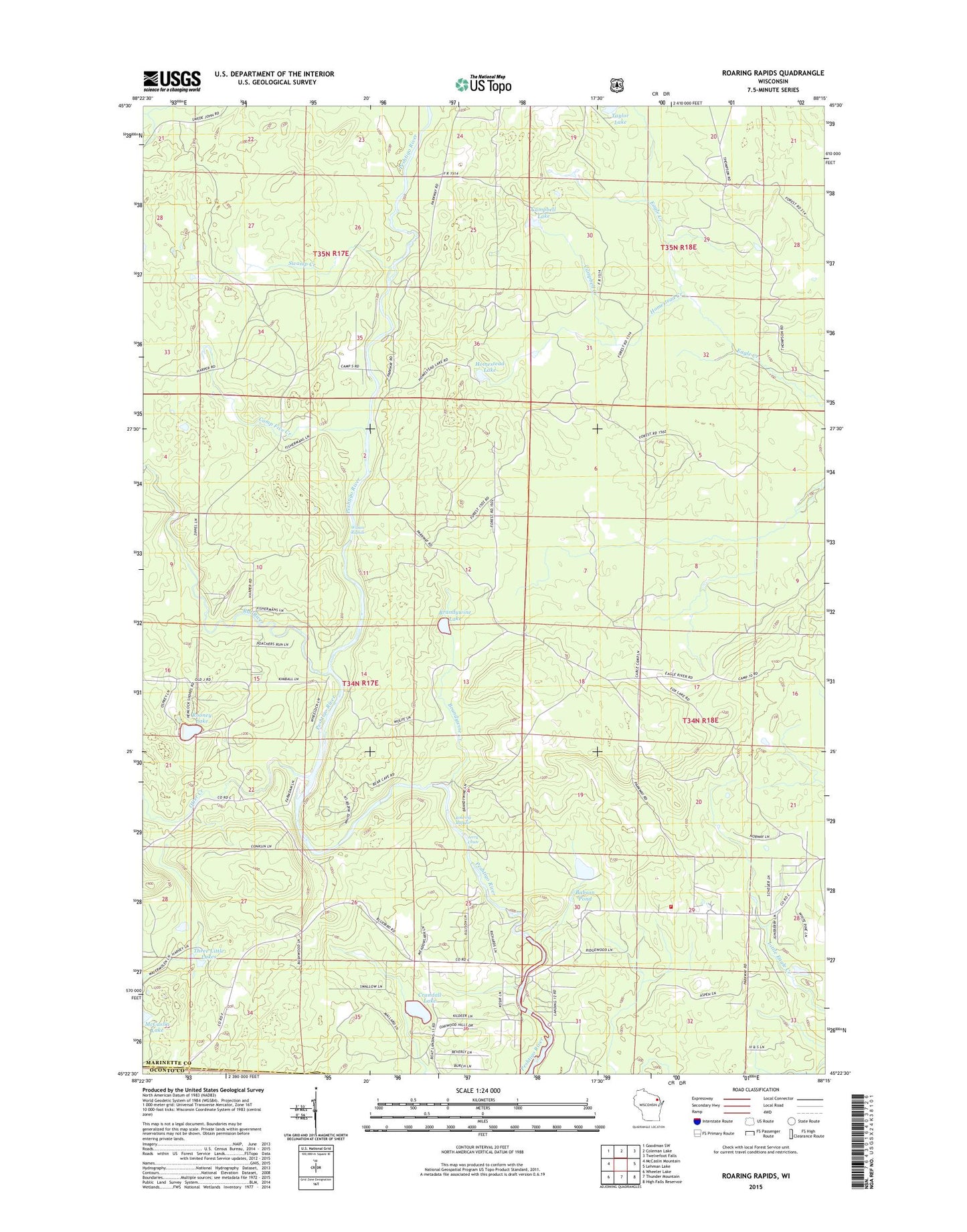
Roaring Rapids Wisconsin US Topo Map
Couldn't load pickup availability
Also explore the Roaring Rapids Forest Service Topo of this same quad for updated USFS data
2022 topographic map quadrangle Roaring Rapids in the state of Wisconsin. Scale: 1:24000. Based on the newly updated USGS 7.5' US Topo map series, this map is in the following counties: Marinette, Oconto. The map contains contour data, water features, and other items you are used to seeing on USGS maps, but also has updated roads and other features. This is the next generation of topographic maps. Printed on high-quality waterproof paper with UV fade-resistant inks.
Quads adjacent to this one:
West: McCaslin Mountain
Northwest: Goodman SW
North: Coleman Lake
Northeast: Twelvefoot Falls
East: Lehman Lake
Southeast: High Falls Reservoir
South: Thunder Mountain
Southwest: Wheeler Lake
This map covers the same area as the classic USGS quad with code o45088d3.
Contains the following named places: Babson Pond, Brandywine Creek, Brandywine Lake, Camp Five Creek, Campbell Creek, Campbell Lake, Crandall Lake, Homestead Creek, Homestead Lake, Hoyle and Johnson 3WR-1647 Dam, Jerry Chute, Marinette County Beech Forest State Natural Area, Mc Clintock County Park, Otter Creek, Rat River, Roaring Rapids, Rooney Lake, Saint Mary of the Cliff Church, Shady Nook School, Silver Cliff Fire Department, Swamp Creek, Taylor Lake, Three Little Lakes, Town of Silver Cliff, Wilson Rapids, ZIP Code: 54104